Magellan MapSend Topo User Manual - Page 3
Using MapSend
 |
UPC - 763357109726
View all Magellan MapSend Topo manuals
Add to My Manuals
Save this manual to your list of manuals |
Page 3 highlights
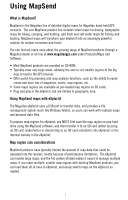
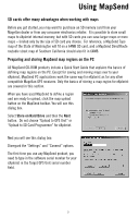
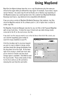
Using MapSend What is MapSend? MapSend is the Magellan line of detailed digital maps for Magellan hand-held GPS receivers. The core MapSend product line includes street maps for driving, topographic maps for hiking, camping, and hunting, and fresh and salt water maps for fishing and boating. MapSend maps will transform your eXplorist into an amazingly powerful solution for outdoor recreation and travel. You can find out much more about the growing range of MapSend products through a Magellan dealer or on-line at www.magellangps.com under Products/Maps and Software. • Most MapSend products are provided on CD-ROM. • Typically cover very large areas, allowing the user to cut smaller regions of the big map to load to the GPS receiver. • Offer useful trip planning and map analysis functions, such as the ability to easily create and store lots of waypoints, routes, map regions, etc. • Some maps regions are available as pre-loaded map regions on SD cards. • Plug and play in the eXplorist, but are limited in geographic area. Using MapSend maps with eXplorist The Magellan eXplorist uses a USB port to transfer data, and provides a file management system much like Windows folders, so users can work with multiple maps and personal data files. To prepare map regions for eXplorist, you MUST first save the map region on your hard drive using the MapSend software, and then transfer it to an SD card (either by using an SD card reader/writer or transferring to an SD card installed in the eXplorist) or the internal memory in the eXplorist. Map region size considerations MapSend products have typically limited the amount of map data that could be uploaded into the receiver, mostly because of performance limitations. The eXplorist can handle large maps, and the file system utilized makes it easier to manage multiple maps. If you make multiple, smaller map regions with existing MapSend products, you can load them all at once to eXplorist, and easily switch maps on the eXplorist as needed. 1
-
 1
1 -
 2
2 -
 3
3 -
 4
4 -
 5
5 -
 6
6 -
 7
7 -
 8
8
 |
 |
