Pioneer AVIC-9DVD Owner's Manual - Page 147
Copyright, Canada, Map Database, Detailed Areas, Limited Guidance Areas
 |
View all Pioneer AVIC-9DVD manuals
Add to My Manuals
Save this manual to your list of manuals |
Page 147 highlights
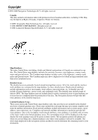
Appendix Copyright ©1993-2000 Navigation Technologies B. V. All rights reserved Canada: This data includes information taken with permission from Canadian authorities, including © Her Majesty the Queen in Right of Canada, © Queen's Printer for Ontario. © GDT, Geographic Data Technology, Inc. All rights reserved © 2001 DENSO CORPORATION, All rights reserved © 2001 Lernout & Hauspie Speech Products N. V. All rights reserved Map Database : The entire United States (excluding Alaska and Hawaii) and portions of Canada are contained in one disc. The United States map database includes the interstate freeways, state highways, country roads, major and general streets. The Canadian map database includes some of the highways, country roads, major and general streets. The Canadian map may show a higher level of detail in large populated areas than in less populated areas. Detailed Areas : The detailed areas are primarily located around metropolitan centers. All of the roads and the road network attributes are contained in the map database for these detailed areas. Road network attributes include information such as street names, street address, turn restrictions, etc. A detailed area will include all major highways, service roads, and residential roads. The detailed areas include points of interest (POI). The map database may not include data for newly constructed areas or map database corrections that are completed after the production of the disc. The Navigation System will provide full route guidance in the detailed map areas. Limited Guidance Areas : These areas exist in the United States map database only. Any area that is not included in the detailed area list is a limited guidance area. These areas include the road maps but may not contain complete road network attribute information. Road network attributes include information such as street names, street address, turn restrictions, etc. Complete road network attribute information is needed to provide full route guidance. Due to the incomplete road network attributes, route guidance is available only on some of the major roads in the limited guidance areas. The surrounding streets will be displayed on the map display but route guidance may not be given on these streets. The navigation system will inform you when you are travelling into a limited guidance area where route guidance will not be available. The street maps displayed on the navigation system can then be used to determine the remaining route to your destination. 145
-
 1
1 -
2
-
3
-
4
-
5
-
6
-
7
-
8
-
9
-
10
-
11
-
12
-
13
-
14
-
15
-
16
-
17
-
18
-
19
-
20
-
21
-
22
-
23
-
24
-
25
-
26
-
27
-
28
-
29
-
30
-
31
-
32
-
33
-
34
-
35
-
36
-
37
-
38
-
39
-
40
-
41
-
42
-
43
-
44
-
45
-
46
-
47
-
48
-
49
-
50
-
51
-
52
-
53
-
54
-
55
-
56
-
57
-
58
-
59
-
60
-
61
-
62
-
63
-
64
-
65
-
66
-
67
-
68
-
69
-
70
-
71
-
72
-
73
-
74
-
75
-
76
-
77
-
78
-
79
-
80
-
81
-
82
-
83
-
84
-
85
-
86
-
87
-
88
-
89
-
90
-
91
-
92
-
93
-
94
-
95
-
96
-
97
-
98
-
99
-
100
-
101
-
102
-
103
-
104
-
105
-
106
-
107
-
108
-
109
-
110
-
111
-
112
-
113
-
114
-
115
-
116
-
117
-
118
-
119
-
120
-
121
-
122
-
123
-
124
-
125
-
126
-
127
-
128
-
129
-
130
-
131
-
132
-
133
-
134
-
135
-
136
-
137
-
138
-
139
-
140
-
141
-
 142
142 -
 143
143 -
 144
144 -
 145
145 -
 146
146 -
 147
147 -
 148
148 -
 149
149 -
 150
150 -
 151
151 -
 152
152 -
153
-
154
-
155
-
156
-
157
-
158
-
159
-
160
 |
 |
