Garmin ECHOMAP Plus 42cv Owners Manual PDF - Page 19
Destinations, Waypoints
 |
View all Garmin ECHOMAP Plus 42cv manuals
Add to My Manuals
Save this manual to your list of manuals |
Page 19 highlights
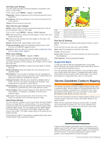
Question Answer Can the device create a path for me? If you have premium maps that support Auto Guidance and are in an area covered by Auto Guidance, navigate using Auto Guidance (Setting and Following an Auto Guidance Path, page 15). How do I change the Auto See (Auto Guidance, page 15). Guidance settings for my boat? Destinations You can select destinations using various charts and 3D chart views or using the lists. Searching for a Destination by Name You can search for saved waypoints, saved routes, saved tracks, and marine services destinations by name. 1 Select Nav Info > Search by Name. 2 Enter at least a portion of the name of your destination. 3 If necessary, select Done. The 50 nearest destinations that contain your search criteria appear. 4 Select the destination. Selecting a Destination Using the Navigation Chart From the Navigation chart, select a destination. Searching for a Marine Services Destination NOTE: This feature is available with premium charts, in some areas. The chartplotter contains information for thousands of destinations offering marine services. 1 Select Nav Info. 2 Select Offshore Services or Inland Services. 3 If necessary, select the marine service category. The chartplotter shows a list of the nearest locations and the distance and bearing to each. 4 Select a destination. You can select or to view additional information or to show the location on a chart. Setting and Following a Direct Course Using Go To WARNING When using Go To, a direct course and a corrected course may pass over land or shallow water. Use visual sightings, and steer to avoid land, shallow water, and other dangerous objects. You can set and follow a direct course from your current location to a selected destination. 1 Select a destination (Destinations, page 13). 2 Select Navigate To > Go To. A magenta line appears. In the center of the magenta line is a thinner purple line that represents the corrected course from your current location to the destination. The corrected course is dynamic, and it moves with your boat when you are off course. 3 Follow the magenta line, steering to avoid land, shallow water, and other obstacles. 4 If you are off course, follow the purple line (corrected course) to go to your destination, or steer back to the magenta line (direct course). You can also use the orange course-to-steer arrow, which shows a proposed turning radius to return your boat to the course. WARNING Review the path for obstacles before negotiating the turn. If the path is unsafe, reduce your boat speed and determine a safe path back to the course. Stopping Navigation From the Navigation chart or Fishing chart, select MENU > Stop Navigation. Waypoints Waypoints are locations you record and store in the device. Waypoints can mark where you are, where you are going, or where you have been. You can add details about the location, such as name, elevation, and depth. Marking Your Present Location as a Waypoint From any screen, select MARK. Creating a Waypoint at a Different Location 1 Select Nav Info > Waypoints > New Waypoint. 2 Select an option: • To create the waypoint by entering position coordinates, select Enter Coordinates, and enter the coordinates. • To create the waypoint using a chart, select Use Chart, select the location, and select SELECT. • To create the waypoint using a range (distance) and bearing, select Enter Range/Bearing, and enter the information. Marking an MOB Location Select MARK > Man Overboard. An international man overboard (MOB) symbol marks the active MOB point and the chartplotter sets a direct course back to the marked location. Projecting a Waypoint You can create a new waypoint by projecting the distance and bearing from a different location. This can be helpful when creating sail racing start and finish lines. 1 Select Nav Info > Waypoints > New Waypoint > Enter Range/Bearing. 2 if necessary, select a reference point on the chart. 3 Select Enter Range/Bearing. 4 Enter the distance, and select Done. 5 Enter the bearing, and select Done. 6 Select Position. Viewing a List of all Waypoints Select Nav Info > Waypoints. Editing a Saved Waypoint 1 Select Nav Info > Waypoints. 2 Select a waypoint. 3 Select Edit Waypoint. 4 Select an option: • To add a name, select Name, and enter a name. • To change the symbol, select Symbol. • To change the depth, select Depth. • To change the water temperature, select Water Temp.. • To change the comment, select Comment. • To move the position of the waypoint, select Move. Moving a Saved Waypoint 1 Select Nav Info > Waypoints. 2 Select a waypoint. Navigation with a Chartplotter 13
-
 1
1 -
2
-
3
-
4
-
5
-
6
-
7
-
8
-
9
-
10
-
11
-
12
-
13
-
 14
14 -
 15
15 -
 16
16 -
 17
17 -
 18
18 -
 19
19 -
 20
20 -
 21
21 -
 22
22 -
 23
23 -
 24
24 -
25
-
26
-
27
-
28
-
29
-
30
-
31
-
32
-
33
-
34
-
35
-
36
-
37
-
38
-
39
-
40
-
41
-
42
-
43
-
44
-
45
-
46
-
47
-
48
-
49
-
50
-
51
-
52
-
53
-
54
 |
 |
