Garmin aera 560 Pilot's Guide - Page 189
International Civil Aviation Organization, Grid Minimum Off-Route Altitude
 |
View all Garmin aera 560 manuals
Add to My Manuals
Save this manual to your list of manuals |
Page 189 highlights
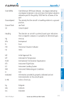
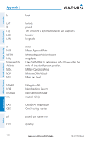
Grid MORA Groundspeed Ground Track GS Heading Hg hPa hr HSI Hz IAF IAT ICAO IFR ILS IMC in Indicated in HG kg kHz km 190-01117-02 Rev. A Appendix J Grid Minimum Off-Route Altitude; one degree latitude by one degree longitude in size and clears the highest elevation reference point in the grid by 1000 feet for all areas of the grid The velocity that the aircraft is travelling relative to a ground position. see Track Ground speed The direction an aircraft is pointed, based upon indications from a magnetic compass or a properly set directional gyro. mercury hectopascal hour Horizontal Situation Indicator Hertz Initial Approach Fix Indicated Air Temperature International Civil Aviation Organization Instrument Flight Rules Instrument Landing System Instrument Meteorological Conditions inch Information provided by properly calibrated and set instrumentation on the aircraft panel. inches of mercury kilogram kilohertz kilometer Garmin aera 500 Series Pilot's Guide 177 Index Appendices Flight Planning Hazard Avoidance Additional Features GPS Navigation Overview
-
 1
1 -
2
-
3
-
4
-
5
-
6
-
7
-
8
-
9
-
10
-
11
-
12
-
13
-
14
-
15
-
16
-
17
-
18
-
19
-
20
-
21
-
22
-
23
-
24
-
25
-
26
-
27
-
28
-
29
-
30
-
31
-
32
-
33
-
34
-
35
-
36
-
37
-
38
-
39
-
40
-
41
-
42
-
43
-
44
-
45
-
46
-
47
-
48
-
49
-
50
-
51
-
52
-
53
-
54
-
55
-
56
-
57
-
58
-
59
-
60
-
61
-
62
-
63
-
64
-
65
-
66
-
67
-
68
-
69
-
70
-
71
-
72
-
73
-
74
-
75
-
76
-
77
-
78
-
79
-
80
-
81
-
82
-
83
-
84
-
85
-
86
-
87
-
88
-
89
-
90
-
91
-
92
-
93
-
94
-
95
-
96
-
97
-
98
-
99
-
100
-
101
-
102
-
103
-
104
-
105
-
106
-
107
-
108
-
109
-
110
-
111
-
112
-
113
-
114
-
115
-
116
-
117
-
118
-
119
-
120
-
121
-
122
-
123
-
124
-
125
-
126
-
127
-
128
-
129
-
130
-
131
-
132
-
133
-
134
-
135
-
136
-
137
-
138
-
139
-
140
-
141
-
142
-
143
-
144
-
145
-
146
-
147
-
148
-
149
-
150
-
151
-
152
-
153
-
154
-
155
-
156
-
157
-
158
-
159
-
160
-
161
-
162
-
163
-
164
-
165
-
166
-
167
-
168
-
169
-
170
-
171
-
172
-
173
-
174
-
175
-
176
-
177
-
178
-
179
-
180
-
181
-
182
-
183
-
 184
184 -
 185
185 -
 186
186 -
 187
187 -
 188
188 -
 189
189 -
 190
190 -
 191
191 -
 192
192 -
 193
193 -
 194
194 -
195
-
196
-
197
-
198
-
199
-
200
-
201
-
202
 |
 |
