Lowrance HDS-12 Carbon Operators Manual EN - Page 168
Tropical statements, Adjusting color codes, Animating Sirius weather graphics, Weather alarms
 |
View all Lowrance HDS-12 Carbon manuals
Add to My Manuals
Save this manual to your list of manuals |
Page 168 highlights
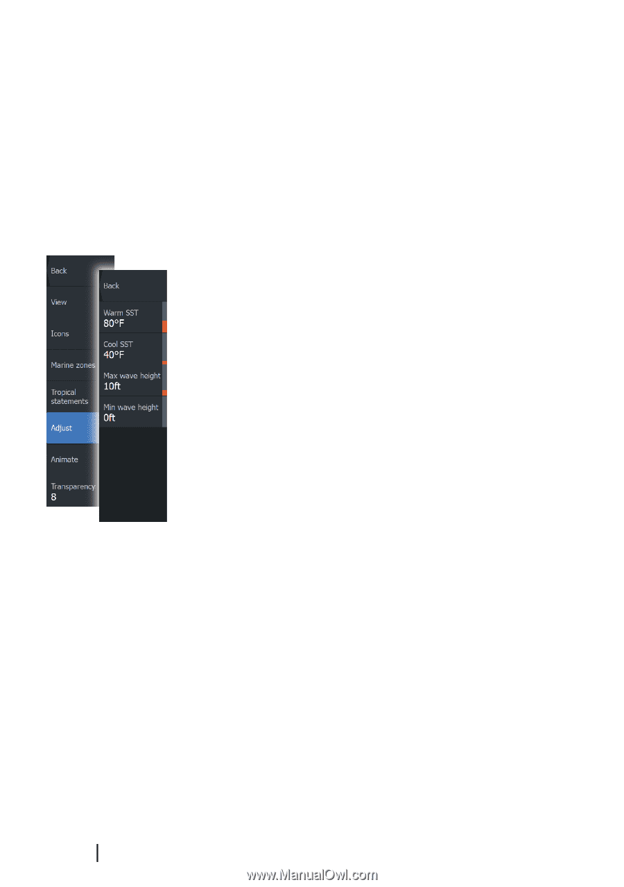
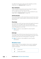
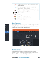
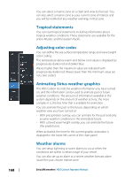
You can select a marine zone on a chart and view its forecast. You can also select a marine zone as your current zone of interest and you will be notified of any weather warnings in that zone. Tropical statements You can read tropical statements including information about tropical weather conditions. These statements are available for the entire Atlantic and the Eastern Pacific. Adjusting color codes You can define the sea surface temperature range and wave height color coding. The temperature above warm and below cool values is displayed as progressively darker red and darker blue. Waves higher than the maximum value are indicated with progressively darker red. Waves lower than the minimum value are not color coded. Animating Sirius weather graphics The HDS Carbon records the weather information you have turned on, and this information can be used to animate past or future weather conditions. The amount of information available in the system depends on the amount of weather activity; the more complex it is, the less time that is available for animation. You can animate the past or the future, depending on which weather view you have turned on: • With precipitation overlay, you can animate for the past and only assume weather conditions in the immediate future. • With colored wave height overlay, you can animate the future (the predictions). When activated, the time for the current graphic animation is displayed in the lower left corner of the chart panel. Weather alarms You can setup lightning or storm alarms to occur when the conditions are within a certain range of your vessel. You can also set up an alarm as a severe weather forecast alarm issued for your chosen marine zone. 168 SiriusXM weather | HDS Carbon Operator Manual
-
 1
1 -
2
-
3
-
4
-
5
-
6
-
7
-
8
-
9
-
10
-
11
-
12
-
13
-
14
-
15
-
16
-
17
-
18
-
19
-
20
-
21
-
22
-
23
-
24
-
25
-
26
-
27
-
28
-
29
-
30
-
31
-
32
-
33
-
34
-
35
-
36
-
37
-
38
-
39
-
40
-
41
-
42
-
43
-
44
-
45
-
46
-
47
-
48
-
49
-
50
-
51
-
52
-
53
-
54
-
55
-
56
-
57
-
58
-
59
-
60
-
61
-
62
-
63
-
64
-
65
-
66
-
67
-
68
-
69
-
70
-
71
-
72
-
73
-
74
-
75
-
76
-
77
-
78
-
79
-
80
-
81
-
82
-
83
-
84
-
85
-
86
-
87
-
88
-
89
-
90
-
91
-
92
-
93
-
94
-
95
-
96
-
97
-
98
-
99
-
100
-
101
-
102
-
103
-
104
-
105
-
106
-
107
-
108
-
109
-
110
-
111
-
112
-
113
-
114
-
115
-
116
-
117
-
118
-
119
-
120
-
121
-
122
-
123
-
124
-
125
-
126
-
127
-
128
-
129
-
130
-
131
-
132
-
133
-
134
-
135
-
136
-
137
-
138
-
139
-
140
-
141
-
142
-
143
-
144
-
145
-
146
-
147
-
148
-
149
-
150
-
151
-
152
-
153
-
154
-
155
-
156
-
157
-
158
-
159
-
160
-
161
-
162
-
 163
163 -
 164
164 -
 165
165 -
 166
166 -
 167
167 -
 168
168 -
 169
169 -
 170
170 -
 171
171 -
 172
172 -
 173
173 -
174
-
175
-
176
-
177
-
178
-
179
-
180
-
181
-
182
-
183
-
184
-
185
-
186
-
187
-
188
-
189
-
190
-
191
-
192
-
193
-
194
-
195
-
196
-
197
-
198
 |
 |