Magellan MapSend NW Alaska/Aleutians Quick Reference Guide - Page 6
Selecting Topo and/or POIs from Marked Regions, Uploading Regions to a GPS Receiver, Regions
 |
UPC - 763357113624
View all Magellan MapSend NW Alaska/Aleutians manuals
Add to My Manuals
Save this manual to your list of manuals |
Page 6 highlights
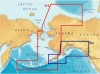
Selecting Topo and/or POIs from Marked Regions: - After selecting (marking) a region, you can select whether or not to upload the POI's and Topo map (if available). - Along with the check box for marking the region are the other boxes used to select Topo and POI's. (The "T" for Topographic is available only with the MapSend Topo of the United States software.) - Clicking on the "T" or "P" will turn the selection on or off. Greyed letters indicate that option is turned off and will not be uploaded. Uploading Regions to a GPS Receiver: - To upload regions from the Saved Regions List to your GPS receiver, you need to make sure your PC has been properly connected to the GPS receiver and the required communication options have been set. - Make sure the regions you want to be uploaded have been marked in the Saved Regions List and that the total amount of memory used will fit into the memory restrictions of your receiver. - From the Regions menu, choose Upload to GPS... - Follow the instructions in the dialog information box. - If the estimated total size of the regions you have marked is greater than available memory on the receiver, a corresponding warning appears. If so, then try to lessen the size of marked regions by editing the region rectangles and referring to the table's status box. - Estimated size of regions may differ from the final one, so the corresponding warning can appear after the regions have been converted. In this case, reduce the region size and try again. - When uploading regions, all current regions stored in your receiver will be deleted. - Refer to the User Manual on downloading waypoints, tracks and routes from the GPS receiver to your PC. - Be sure to note that the upload or download process may take a certain amount of time in order to complete the file transfer.
-
 1
1 -
 2
2 -
 3
3 -
 4
4 -
 5
5 -
 6
6 -
 7
7 -
 8
8
 |
 |
