Garmin Astro Astro and DC 30 Owner's Manual - Page 58
Units Setup, Heading Setup, Elevation Vert. Speed
 |
UPC - 753759063931
View all Garmin Astro manuals
Add to My Manuals
Save this manual to your list of manuals |
Page 58 highlights
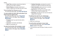
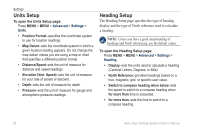
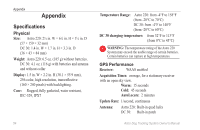
Settings Units Setup To open the Units Setup page: Press MENU > MENU > Advanced > Settings > Units. • Position Format-specifies the coordinate system to use for location readings. • Map Datum-sets the coordinate system in which a given location reading appears. Do not change the map datum unless you are using a map or chart that specifies a different position format. • Distance/Speed-sets the unit of measure for distance and speed readings. • Elevation (Vert. Speed)-sets the unit of measure for your rate of ascent or descent. • Depth-sets the unit of measure for depth. • Pressure-sets the unit of measure for gauge and atmospheric pressure readings. Heading Setup The Heading Setup page specifies the type of heading display and the type of North reference used to calculate a heading. Note: Unless you have a good understanding of headings and North referencing, use the default values. To open the Heading Setup page: Press MENU > MENU > Advanced > Settings > Heading. • Display-sets the units used to calculate a heading (Cardinal Letters, Degrees, or Mils). • North Reference-provides headings based on a true, magnetic, grid, or specific user value. • Switch to compass heading when below-sets the speed to switch to a compass heading when for more than time is exceeded. • for more than-sets the time to switch to a compass heading. 52 Astro Dog Tracking System Owner's Manual
-
 1
1 -
2
-
3
-
4
-
5
-
6
-
7
-
8
-
9
-
10
-
11
-
12
-
13
-
14
-
15
-
16
-
17
-
18
-
19
-
20
-
21
-
22
-
23
-
24
-
25
-
26
-
27
-
28
-
29
-
30
-
31
-
32
-
33
-
34
-
35
-
36
-
37
-
38
-
39
-
40
-
41
-
42
-
43
-
44
-
45
-
46
-
47
-
48
-
49
-
50
-
51
-
52
-
 53
53 -
 54
54 -
 55
55 -
 56
56 -
 57
57 -
 58
58 -
 59
59 -
 60
60 -
 61
61 -
 62
62 -
 63
63 -
64
-
65
-
66
-
67
-
68
-
69
-
70
-
71
-
72
-
73
-
74
-
75
-
76
 |
 |
