Garmin G500H G500H Cockpit Reference Guide - Page 25
Additional Features
 |
View all Garmin G500H manuals
Add to My Manuals
Save this manual to your list of manuals |
Page 25 highlights
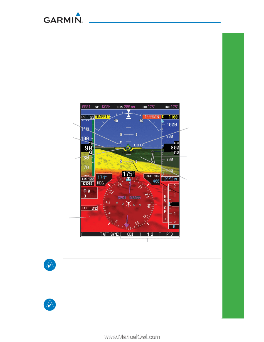
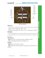
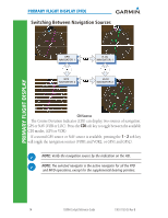
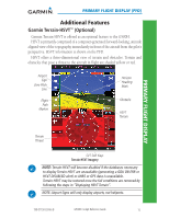
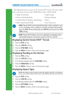
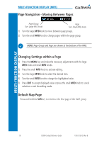
PRIMARY FLIGHT DISPLAY (PFD) Additional Features Garmin Terrain-HSVT™ (Optional) Garmin Terrain-HSVT is offered as an optional feature to the G500H. HSVT is primarily comprised of a computer-generated forward-looking, attitude aligned view of the topography immediately in front of the aircraft from the pilot's perspective. HSVT information is shown on the PFD. HSVT offers a three-dimensional view of terrain and obstacles. Terrain and obstacles that pose a threat to the aircraft in flight are shaded yellow or red. Airport Sign Zero-Pitch Line Flight Path Marker Horizon Heading Mark Obstacle HSVT Terrain PRIMARY FLIGHT DISPLAY Terrain Threat SVT Soft Keys Terrain-HSVT Imagery NOTE: Terrain-HSVT will become disabled if the databases necessary to display Terrain-HSVT are unavailable (generating a GDU DB ERR or HSVT DISABLED alert) or AHRS or GPS data is unavailable. Terrain-HSVT may be restored once the fail conditions are removed by following the steps in "Displaying HSVT Terrain". NOTE: Airport Signs will only display airports, not heliports. 190-01150-03 Rev B G500H Cockpit Reference Guide 15
-
 1
1 -
2
-
3
-
4
-
5
-
6
-
7
-
8
-
9
-
10
-
11
-
12
-
13
-
14
-
15
-
16
-
17
-
18
-
19
-
 20
20 -
 21
21 -
 22
22 -
 23
23 -
 24
24 -
 25
25 -
 26
26 -
 27
27 -
 28
28 -
 29
29 -
 30
30 -
31
-
32
-
33
-
34
-
35
-
36
-
37
-
38
-
39
-
40
-
41
-
42
-
43
-
44
-
45
-
46
-
47
-
48
-
49
-
50
-
51
-
52
-
53
-
54
-
55
-
56
-
57
-
58
-
59
-
60
-
61
-
62
-
63
-
64
-
65
-
66
-
67
-
68
-
69
-
70
 |
 |