Garmin GPS III Plus Owner's Manual - Page 43
straight ahead, you're heading directly to it. Each data field may be con d - windows 7 configuration
 |
UPC - 753759015817
View all Garmin GPS III Plus manuals
Add to My Manuals
Save this manual to your list of manuals |
Page 43 highlights
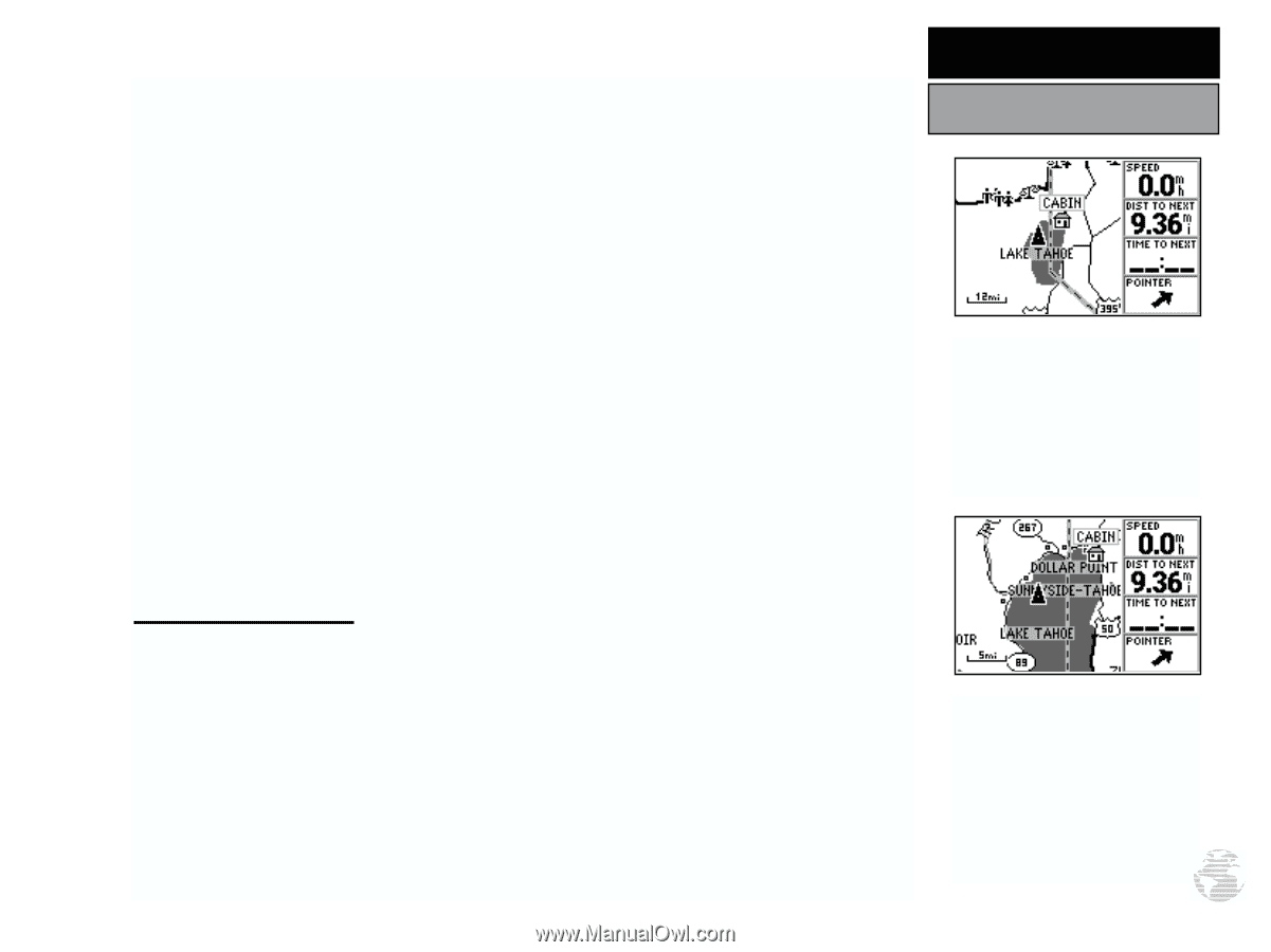
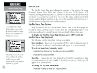
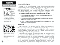
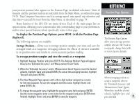
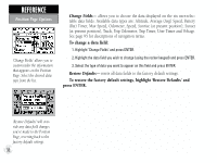
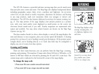
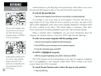
The GPS III+ features a powerful real-time moving map that can do much more than just plot your course and route. The Map Page also displays background detail, including geographic names, lakes, rivers, coastlines and highways. An on-screen cursor lets you pan ahead to nearby waypoints, determine the distance and bearing to any map position, mark new waypoints while you navigate or retrieve exit information. The GPS III+ also features dedicated zoom keys for instant zooming (see pg. 2). The map portion of the page displays your present position as a pointer icon, with your track and/or route displayed as small points on the screen (an electronic bread crumb trail, if you will). Nearby waypoints are represented with names and symbols. You may select which features are shown via the Map Page Options (see pg. 36). The data window beside (or above when display is vertical) the map displays the time and distance to next waypoint, plus your current speed (all defaults). A bearing pointer lets you know if you're heading toward your destination. (If the pointer points straight ahead, you're heading directly to it.) Each data field may be configured to display any one of twenty-four data options. Zooming and Panning There are three main functions you can perform from the Map Page: zooming, panning, and pointing. The map has 24 map scales (from 120 feet to 500 miles, or 30 meters to 800 km) which are selected by pressing the IN and OUT zoom keys. The current map scale is indicated in the bottom left corner of the map display. To change the map scale: 1. Press zoom IN to see a smaller area with more detail. 2. Press zoom OUT to see a larger area with less detail. REFERENCE Map Page The Map Page displays a digital map, including lakes, rivers, highways, highway exits and towns. Zoom IN to see more detail for a smaller area. Zoom OUT to see a larger area. 33
-
 1
1 -
2
-
3
-
4
-
5
-
6
-
7
-
8
-
9
-
10
-
11
-
12
-
13
-
14
-
15
-
16
-
17
-
18
-
19
-
20
-
21
-
22
-
23
-
24
-
25
-
26
-
27
-
28
-
29
-
30
-
31
-
32
-
33
-
34
-
35
-
36
-
37
-
 38
38 -
 39
39 -
 40
40 -
 41
41 -
 42
42 -
 43
43 -
 44
44 -
 45
45 -
 46
46 -
 47
47 -
 48
48 -
49
-
50
-
51
-
52
-
53
-
54
-
55
-
56
-
57
-
58
-
59
-
60
-
61
-
62
-
63
-
64
-
65
-
66
-
67
-
68
-
69
-
70
-
71
-
72
-
73
-
74
-
75
-
76
-
77
-
78
-
79
-
80
-
81
-
82
-
83
-
84
-
85
-
86
-
87
-
88
-
89
-
90
-
91
-
92
-
93
-
94
-
95
-
96
-
97
-
98
-
99
-
100
-
101
-
102
-
103
-
104
-
105
-
106
-
107
-
108
-
109
-
110
-
111
-
112
-
113
-
114
 |
 |