Garmin GPSMAP 292 Owner's Manual - Page 44
No signal strength bars, To disable/enable WAAS capability
 |
View all Garmin GPSMAP 292 manuals
Add to My Manuals
Save this manual to your list of manuals |
Page 44 highlights
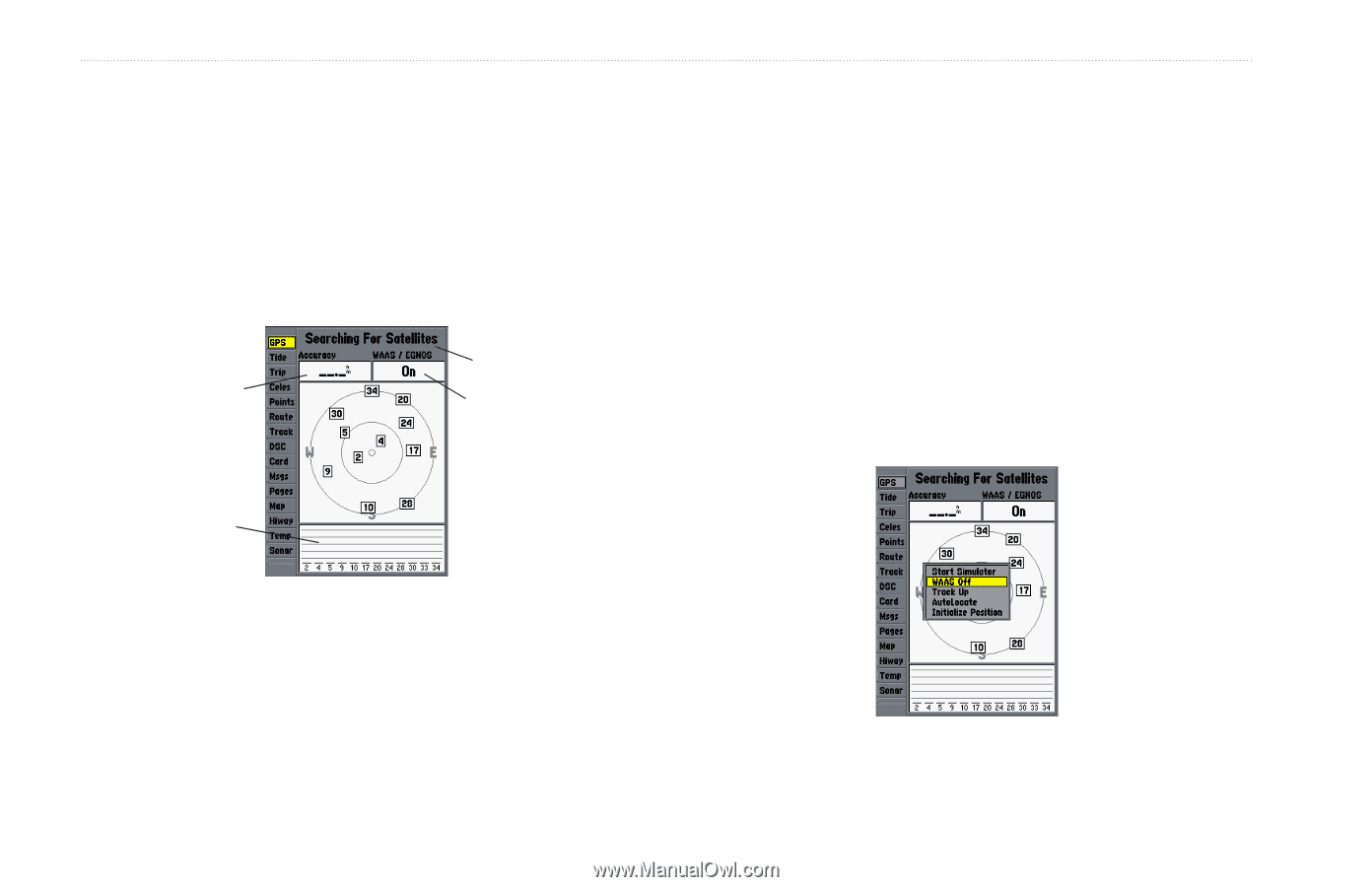
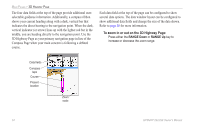
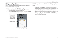
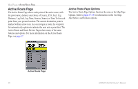
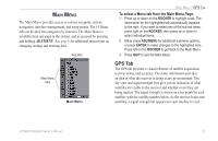
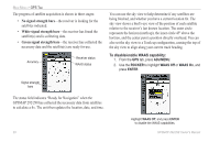
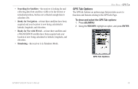
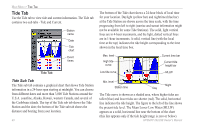
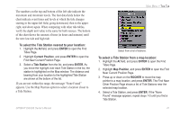
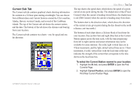
MAIN MENU > GPS TAB The progress of satellite acquisition is shown in three stages: • No signal strength bars-the receiver is looking for the satellites indicated. • White signal strength bars-the receiver has found the satellite(s) and is collecting data. • Green signal strength bars-the receiver has collected the necessary data and the satellite(s) are ready for use. Accuracy Receiver status WAAS status You can use the sky view to help determine if any satellites are being blocked, and whether you have a current location fix. The sky view shows a bird's-eye view of the position of each satellite relative to the receiver's last known location. The outer circle represents the horizon (north up), the inner circle 45º above the horizon, and the center point a position directly overhead. You can also set the sky view to a Track up configuration, causing the top of the sky view to align along your current track heading. To disable/enable WAAS capability: 1. From the GPS tab, press ADJ/MENU. 2. Use the ROCKER to highlight WAAS Off or WAAS On, and press ENTER. Signal strength bars The status field indicates "Ready for Navigation" when the GPSMAP 292/298 has collected the necessary data from satellites to calculate a fix. The unit then updates the location, date, and time. 38 Highlight WAAS Off, and press ENTER to disable the WAAS capabilities. GPSMAP 292/298 Owner's Manual
-
 1
1 -
2
-
3
-
4
-
5
-
6
-
7
-
8
-
9
-
10
-
11
-
12
-
13
-
14
-
15
-
16
-
17
-
18
-
19
-
20
-
21
-
22
-
23
-
24
-
25
-
26
-
27
-
28
-
29
-
30
-
31
-
32
-
33
-
34
-
35
-
36
-
37
-
38
-
 39
39 -
 40
40 -
 41
41 -
 42
42 -
 43
43 -
 44
44 -
 45
45 -
 46
46 -
 47
47 -
 48
48 -
 49
49 -
50
-
51
-
52
-
53
-
54
-
55
-
56
-
57
-
58
-
59
-
60
-
61
-
62
-
63
-
64
-
65
-
66
-
67
-
68
-
69
-
70
-
71
-
72
-
73
-
74
-
75
-
76
-
77
-
78
-
79
-
80
-
81
-
82
-
83
-
84
-
85
-
86
-
87
-
88
-
89
-
90
-
91
-
92
-
93
-
94
-
95
-
96
-
97
-
98
-
99
-
100
-
101
-
102
-
103
-
104
-
105
-
106
-
107
-
108
-
109
-
110
-
111
-
112
-
113
-
114
-
115
-
116
-
117
-
118
-
119
-
120
 |
 |