Garmin dezl OTR700 Owners Manual - Page 7
Enabling or Disabling Driver Alerts, Red Light and Speed Cameras, Finding a Location Using
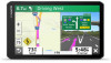 |
View all Garmin dezl OTR700 manuals
Add to My Manuals
Save this manual to your list of manuals |
Page 7 highlights
familiar area. The device plays an audible tone or message and displays information for each alert. You can enable or disable the audible tone for some types of driver alerts. Not all alerts are available in all areas. Schools: The device plays a tone and displays the speed limit (if available) for an upcoming school or school zone. Speed limit exceeded: The device plays a tone and displays a red border on the speed limit icon when you exceed the posted speed limit for the current road. Speed limit change: The device plays a tone and displays the upcoming speed limit so you can be prepared to adjust your speed. Wrong way on a one-way street: The device plays a message and displays a full-screen warning if you travel the wrong way on a one-way street. The edges of the screen appear red and an alert remains at the top of the screen until you leave the one-way street or correct your direction of travel. Railroad crossing: The device plays a tone to indicate an upcoming railroad crossing. Animal crossing: The device plays a tone to indicate an upcoming animal crossing area. Curves: The device plays a tone to indicate a curve in the road. Slower traffic: The device plays a tone to indicate slower traffic when you approach slower traffic at a higher speed. Your device must be receiving traffic information to use this feature (Traffic, page 13). Break planning: The device plays a tone and suggests upcoming rest stops after you have been driving for a long time. No trucks allowed: The device plays a tone when you approach a road where no trucks are allowed. Risk of grounding: The device plays a tone and displays a message when you approach a road where your vehicle could become grounded. Lateral wind: The device plays a tone and displays a message when you approach a road where there is risk of lateral wind. Narrow road: The device plays a tone and displays a message when you approach a road that may be too narrow for your vehicle. Steep hill: The device plays a tone and displays a message when you approach a steep hill. State and country borders: The device plays a tone and displays a message when you approach the border of a state or country. Enabling or Disabling Driver Alerts You can enable or disable several types of driver alerts. 1 Select Settings > Driver Assistance > Driver Alerts. 2 Select or clear the check box next to each alert. Red Light and Speed Cameras NOTICE Garmin is not responsible for the accuracy of or the consequences of using a red light or speed camera database. NOTE: This feature is not available for all regions or product models. Information about red light and speed camera locations is available in some areas for some product models. The device alerts you when you approach a reported speed or red light camera. • In some areas, your device can receive live red light and speed camera data while connected to a smartphone running the Garmin Drive app. • You can use the Garmin Express™ software (garmin.com /express) to update the camera database stored on your device. You should update your device frequently to receive the most up-to-date camera information. Finding and Saving Locations The maps loaded in your device contain locations, such as restaurants, hotels, auto services, and detailed street information. The Where To? menu helps you find your destination by providing several methods to browse, search, and save this information. • Enter search terms to quickly search all location information (Finding a Location Using the Search Bar, page 3). • Browse or search pre-loaded points of interest by category (Points of Interest, page 4). • Search for truck stops and services, including detailed TruckDown® directory information, where available (Finding Trucking Points of Interest, page 4). • Search and check into Foursquare® points of interest (Searching Foursquare Points of Interest, page 5). • Use search tools to find specific locations, such as addresses, intersections, or geographic coordinates (Search Tools, page 5). • Search near a different city or area (Changing the Search Area, page 4). • Save your favorite locations to find them quickly in the future (Saving Locations, page 6). • Return to recently found locations. Finding a Location Using the Search Bar You can use the search bar to search for locations by entering a category, brand name, address, or city name. 1 Select Where To?. 2 Select Search in the search bar. 3 Enter all or part of the search term. Suggested search terms appear below the search bar. 4 Select an option: • To search for a type of business, enter a category name (for example, "movie theaters"). • To search for a business name, enter all or part of the name. • To search for an address near you, enter the house number and street name. • To search for an address in another city, enter the house number, street name, city, and state. • To search for a city, enter the city and state. • To search for coordinates, enter latitude and longitude coordinates. 5 Select an option: • To search using a suggested search term, select the term. • To search using the text you entered, select . 6 If necessary, select a location. Finding an Address NOTE: The order of the steps may change depending on the map data loaded on your device. 1 Select Where To?. 2 If necessary, select to search near a different city or area. 3 Select Address. 4 Follow the on-screen instructions to enter address information. Finding and Saving Locations 3
-
 1
1 -
 2
2 -
 3
3 -
 4
4 -
 5
5 -
 6
6 -
 7
7 -
 8
8 -
 9
9 -
 10
10 -
 11
11 -
 12
12 -
13
-
14
-
15
-
16
-
17
-
18
-
19
-
20
-
21
-
22
-
23
-
24
-
25
-
26
-
27
-
28
-
29
-
30
 |
 |
