Magellan MapSend TOPO France Quick Reference Guide - Page 10
Inspecting POIs
 |
UPC - 763357114843
View all Magellan MapSend TOPO France manuals
Add to My Manuals
Save this manual to your list of manuals |
Page 10 highlights
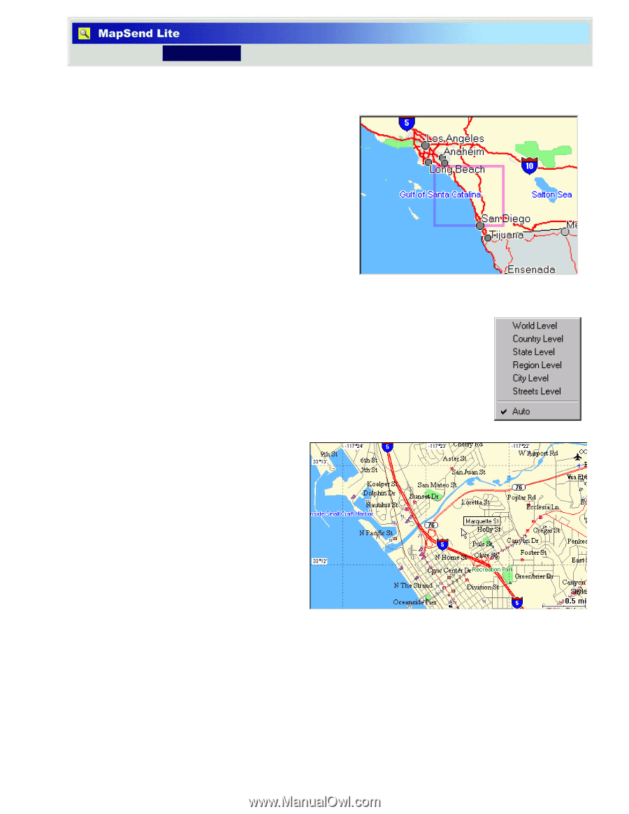
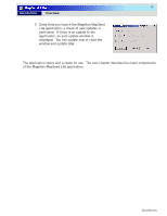
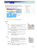
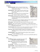
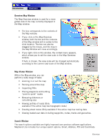
8 Introduction Overview Overview Map Window The Map Overview window is used for a more global view of the map currently displayed in the Map window. • The box corresponds to the contents of the Map window. • If you click on the Map Overview window, both the box and the contents of the Map window will re-center to the click location. The box can also be dragged by the mouse, and the map in the Map Window will move accordingly. • If you right-click on this window, the context menu appears, which allows you to set the view scale in the Map Overview window. If Auto is chosen, the view scale will be changed automatically according to the current view scale of the Map window. Map Viewer Window Within the Map window, you can perform a wide range of tasks: • Zooming in or out the map • Panning around the map • Inspecting POIs • Placing waypoints and building "point-to-point" routes • Measuring distances or calculating area • Viewing profiles of roads (Only available if the active map has topographic data.) • Creating street routes (Only available if the active map has routing data. • Viewing loaded user data including waypoints, routes, tracks and geocaches. Search Window The search options available are highly improved over previous software applications. MapSend Lite includes four unique search options: Smart, Address, POI and Coordinate. Overview
-
 1
1 -
2
-
3
-
4
-
 5
5 -
 6
6 -
 7
7 -
 8
8 -
 9
9 -
 10
10 -
 11
11 -
 12
12 -
 13
13 -
 14
14
 |
 |