Pioneer AVIC-W6500NEX Owners Manual - Page 21
How to read the map screen
 |
View all Pioneer AVIC-W6500NEX manuals
Add to My Manuals
Save this manual to your list of manuals |
Page 21 highlights
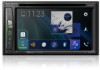
English How to read the map screen NOTE Depending on the conditions and settings, some items may not be displayed. * Shows the number and name of the street to be used (or next guidance point). * Shows the next guidance point (maneuver). The type of the event (turn, traffic circle, exiting freeway, etc.) is displayed (page 24). * Shows the distance to the next guidance point (maneuver). * Shows the maneuver after the next maneuver. Indicates the current location of your vehicle. The apex of the triangular mark indicates your orientation and the display moves automatically as you drive. NOTE When there is no GPS position, the triangular mark is transparent. It shows your last known position. Displays the data field. Shows the name of the street (or city) that your vehicle is traveling on (or in). * Indicates the current route. The route currently set is highlighted in color on the map. * Indicates the progress to the final destination. * The information appears only when a route is set. ▶AV information bar AV information is displayed at the bottom of the map screen. - 21 -
-
 1
1 -
2
-
3
-
4
-
5
-
6
-
7
-
8
-
9
-
10
-
11
-
12
-
13
-
14
-
15
-
 16
16 -
 17
17 -
 18
18 -
 19
19 -
 20
20 -
 21
21 -
 22
22 -
 23
23 -
 24
24 -
 25
25 -
 26
26 -
27
-
28
-
29
-
30
-
31
-
32
-
33
-
34
-
35
-
36
-
37
-
38
-
39
-
40
-
41
-
42
-
43
-
44
-
45
-
46
-
47
-
48
-
49
-
50
-
51
-
52
-
53
-
54
-
55
-
56
-
57
-
58
-
59
-
60
-
61
-
62
-
63
-
64
-
65
-
66
-
67
-
68
-
69
-
70
-
71
-
72
-
73
-
74
-
75
-
76
-
77
-
78
-
79
-
80
-
81
-
82
-
83
-
84
-
85
-
86
-
87
-
88
-
89
-
90
-
91
-
92
-
93
-
94
-
95
-
96
-
97
-
98
-
99
-
100
-
101
-
102
-
103
-
104
-
105
-
106
-
107
-
108
-
109
-
110
-
111
-
112
-
113
-
114
-
115
-
116
-
117
-
118
-
119
-
120
-
121
-
122
-
123
-
124
-
125
-
126
-
127
-
128
-
129
-
130
-
131
-
132
-
133
-
134
-
135
-
136
-
137
-
138
-
139
-
140
-
141
-
142
-
143
-
144
-
145
-
146
-
147
-
148
-
149
-
150
-
151
-
152
-
153
-
154
-
155
-
156
-
157
-
158
-
159
-
160
-
161
-
162
-
163
-
164
-
165
-
166
-
167
-
168
-
169
-
170
-
171
-
172
-
173
-
174
-
175
-
176
-
177
-
178
-
179
-
180
-
181
-
182
-
183
-
184
-
185
-
186
-
187
-
188
-
189
-
190
 |
 |
