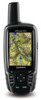
Garmin GPSMAP 62st Owner's Manual - Page 20
Opening the Main Menu, Elevation Plot Setup Options
 |
View all Garmin GPSMAP 62st manuals
Add to My Manuals
Save this manual to your list of manuals |
Page 20 highlights
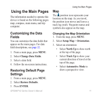
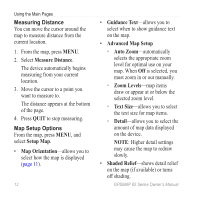
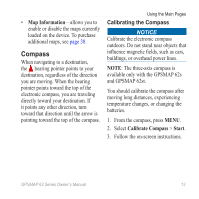
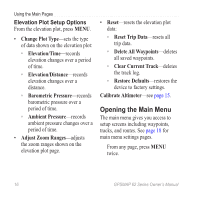
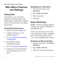
Using the Main Pages Elevation Plot Setup Options From the elevation plot, press menu. • Change Plot Type-sets the type of data shown on the elevation plot: ◦◦ Elevation/Time-records elevation changes over a period of time. ◦◦ Elevation/Distance-records elevation changes over a distance. ◦◦ Barometric Pressure-records barometric pressure over a period of time. ◦◦ Ambient Pressure-records ambient pressure changes over a period of time. • Adjust Zoom Ranges-adjusts the zoom ranges shown on the elevation plot page. • Reset-resets the elevation plot data: ◦◦ Reset Trip Data-resets all trip data. ◦◦ Delete All Waypoints-deletes all saved waypoints. ◦◦ Clear Current Track-deletes the track log. ◦◦ Restore Defaults-restores the device to factory settings. Calibrate Altimeter-see page 15. Opening the Main Menu The main menu gives you access to setup screens including waypoints, tracks, and routes. See page 18 for main menu settings pages. From any page, press MENU twice. 16 GPSMAP 62 Series Owner's Manual
-
 1
1 -
2
-
3
-
4
-
5
-
6
-
7
-
8
-
9
-
10
-
11
-
12
-
13
-
14
-
 15
15 -
 16
16 -
 17
17 -
 18
18 -
 19
19 -
 20
20 -
 21
21 -
 22
22 -
 23
23 -
 24
24 -
 25
25 -
26
-
27
-
28
-
29
-
30
-
31
-
32
-
33
-
34
-
35
-
36
-
37
-
38
-
39
-
40
-
41
-
42
-
43
-
44
-
45
-
46
-
47
-
48
-
49
-
50
-
51
-
52
-
53
-
54
-
55
-
56
 |
 |