Magellan RoadMate 760 Manual - English (for the UK) - Page 29
Map Screen, Changing the Map Zoom Levels - map update
 |
UPC - 763357111163
View all Magellan RoadMate 760 manuals
Add to My Manuals
Save this manual to your list of manuals |
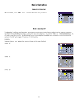
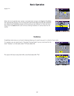
Page 29 highlights
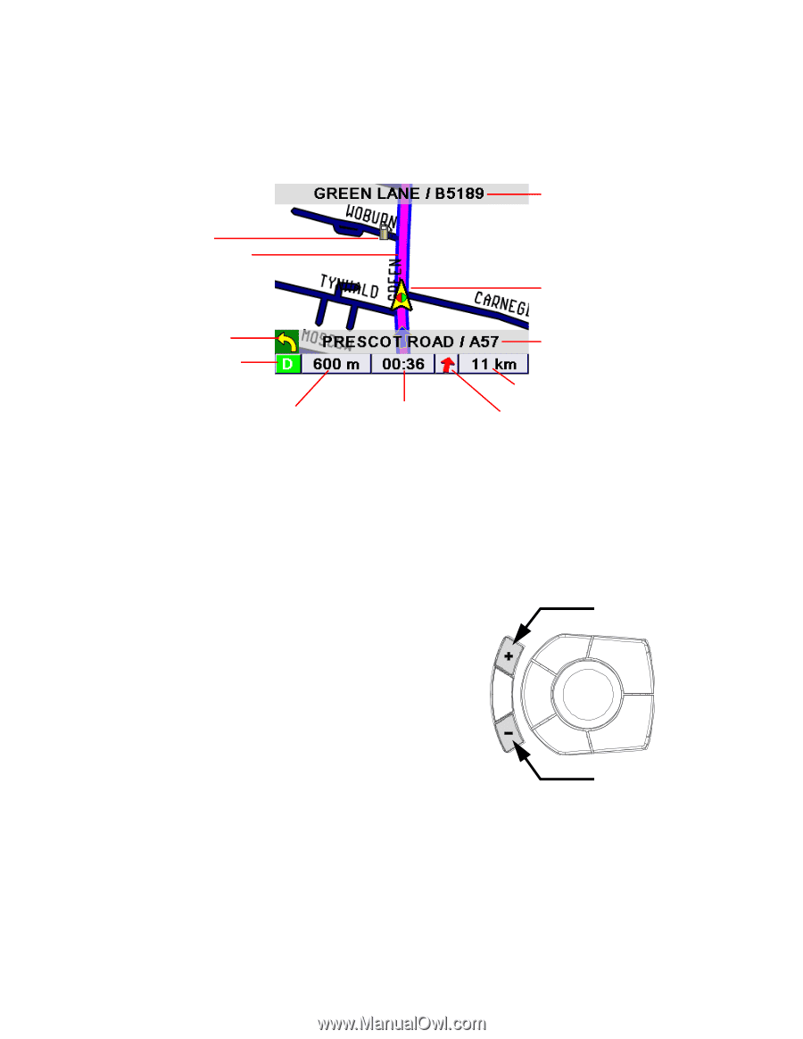
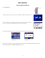
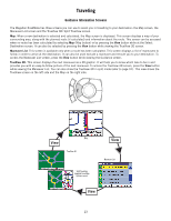
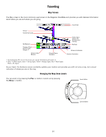
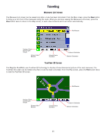
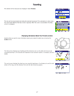
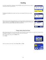
Traveling Map Screen The Map screen is the most commonly used screen in the Magellan RoadMate and provides you with detailed information about where you are and where you are going. Current Road POI Icon † Planned Route (pink) Next Maneuver Direction of Travel and GPS Signal Strength †† Distance to Next Maneuver Estimated Time to Destination Position Cursor (points in the direction you are traveling) Next Road Distance to Destination Direction of Destination † By touching the POI icon on the screen, you can get information and route to it. †† Blue = EGNOS Signal, Green = Strong Signal, Yellow = Average Signal, Red = Weak Signal, Black = No Signal As you travel, the Guidance screen constantly updates your location and provides you with not only a map, but a visual indication of where you are on the map. Changing the Map Zoom Levels You can zoom in by pressing the Plus (+) button or zoom out by pressing the Minus (-) button. Zoom In Button Zoom Out Button 24
-
 1
1 -
2
-
3
-
4
-
5
-
6
-
7
-
8
-
9
-
10
-
11
-
12
-
13
-
14
-
15
-
16
-
17
-
18
-
19
-
20
-
21
-
22
-
23
-
 24
24 -
 25
25 -
 26
26 -
 27
27 -
 28
28 -
 29
29 -
 30
30 -
 31
31 -
 32
32 -
 33
33 -
 34
34 -
35
-
36
-
37
-
38
-
39
-
40
-
41
-
42
-
43
-
44
-
45
-
46
-
47
-
48
-
49
-
50
-
51
-
52
-
53
-
54
-
55
-
56
-
57
-
58
-
59
-
60
-
61
-
62
-
63
-
64
-
65
-
66
-
67
-
68
-
69
-
70
-
71
-
72
-
73
-
74
-
75
-
76
-
77
-
78
-
79
-
80
-
81
-
82
-
83
-
84
-
85
-
86
-
87
-
88
-
89
-
90
-
91
-
92
-
93
-
94
-
95
-
96
-
97
-
98
-
99
-
100
-
101
-
102
-
103
-
104
-
105
-
106
-
107
-
108
-
109
-
110
-
111
-
112
-
113
-
114
-
115
-
116
-
117
-
118
-
119
-
120
-
121
-
122
-
123
-
124
-
125
-
126
-
127
-
128
-
129
-
130
 |
 |