Garmin ECHOMAP UHD 72sv Owners Manual - Page 11
Premium Charts
 |
View all Garmin ECHOMAP UHD 72sv manuals
Add to My Manuals
Save this manual to your list of manuals |
Page 11 highlights
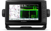
A push pin appears on the screen at your present location. The distance and angle from the pin is listed in the corner. TIP: To reset the pin and measure from the current location of the cursor, select Set Reference. Creating a Waypoint on the Chart 1 From a chart, select a location or object. 2 Select Create Waypoint. Navigating to a Point on the Chart WARNING All route and navigation lines displayed on the chartplotter are only intended to provide general route guidance or to identify proper channels, and are not intended to be precisely followed. Always defer to the navaids and conditions on the water when navigating to avoid groundings or hazards that could result in vessel damage, personal injury, or death. The Auto Guidance feature is based on electronic chart information. That data does not ensure obstacle and bottom clearance. Carefully compare the course to all visual sightings, and avoid any land, shallow water, or other obstacles that may be in your path. When using Go To, a direct course and a corrected course may pass over land or shallow water. Use visual sightings, and steer to avoid land, shallow water, and other dangerous objects. NOTE: The Fishing chart is available with premium charts, in some areas. NOTE: Auto Guidance is available with premium charts, in some areas. 1 From the Navigation chart or Fishing chart, select a location. 2 If necessary, select Navigate To. 3 Select an option: • To navigate directly to the location, select Go To. • To create a route to the location, including turns, select Route To. • To use Auto Guidance, select Auto Guidance. 4 Review the course indicated by the magenta line. NOTE: When using Auto Guidance, a gray segment within any part of the magenta line indicates that Auto Guidance cannot calculate part of the Auto Guidance line. This is due to the settings for minimum safe water depth and minimum safe obstacle height. 5 Follow the magenta line, steering to avoid land, shallow water, and other obstacles. Viewing Location and Object Information on a Chart You can view information, such as tide, current, celestial, chart notes, or local services, about a location or an object on the Navigation chart or the Fishing chart. 1 From the Navigation chart or Fishing chart, select a location or object. A list of options appears along the top of the chart. The options that appear vary based on the location or object you selected. 2 Select Information. Viewing Details about Navaids From the Navigation chart, Fishing chart, Perspective 3D chart view, or Mariner's Eye 3D chart view, you can view details about various types of navigation aids, including beacons, lights, and obstructions. NOTE: The Fishing chart is available with premium charts, in some areas. NOTE: 3D chart views are available with premium charts, in some areas. 1 From a chart or 3D chart view, select a navaid. 2 Select the name of the navaid. Heading Line and Angle Markers The heading line is an extension drawn on the map from the bow of the boat in the direction of travel. Angle markers indicate relative position from the heading or course over ground, which are helpful for casting or finding reference points. Setting the Heading Line and Angle Markers The heading line is an extension drawn on the map from the bow of the boat in the direction of travel. Angle markers indicate relative position from the heading or course over ground, which are helpful for casting or finding reference points. You can show the heading line and the course over ground (COG) line on the chart. COG is your direction of movement. Heading is the direction the bow of the boat is pointed, when a heading sensor is connected. 1 From a chart, select MENU > Layers > My Vessel > Heading Line. 2 Angle Markers 3 If necessary, select Source, and select an option: • To automatically use the available source, select Auto. • To use the GPS antenna heading for COG, select GPS Heading (COG). • To use data from a connected heading sensor, select Heading. • To use data from both a connected heading sensor and the GPS antenna, select COG and Heading. This displays both the heading line and the COG line on the chart. 4 Select Display, and select an option: • Select Distance > Distance, and enter the length of the line shown on the chart. • Select Time > Time, and enter the time used to calculate the distance your boat will travel in the specified time at your present speed. Turning on Angle Markers You can add angle markers to the map along the heading line. Angle markers can be helpful for casting when fishing. 1 Set the heading line (Setting the Heading Line and Angle Markers, page 5). 2 Select Angle Markers. Premium Charts WARNING All route and navigation lines displayed on the chartplotter are only intended to provide general route guidance or to identify proper channels, and are not intended to be precisely followed. Always defer to the navaids and conditions on the water when navigating to avoid groundings or hazards that could result in vessel damage, personal injury, or death. The Auto Guidance feature is based on electronic chart information. That data does not ensure obstacle and bottom clearance. Carefully compare the course to all visual sightings, and avoid any land, shallow water, or other obstacles that may be in your path. NOTE: Not all models support all charts. Optional premium charts, such as BlueChart® g3 Vision, allow you to get the most out of your chartplotter. In addition to detailed marine charting, premium charts may contain these features, which are available in some areas. Mariner's Eye 3D: Provides a view from above and behind the boat for a three-dimensional navigation aid. Charts and 3D Chart Views 5
-
 1
1 -
2
-
3
-
4
-
5
-
 6
6 -
 7
7 -
 8
8 -
 9
9 -
 10
10 -
 11
11 -
 12
12 -
 13
13 -
 14
14 -
 15
15 -
 16
16 -
17
-
18
-
19
-
20
-
21
-
22
-
23
-
24
-
25
-
26
-
27
-
28
-
29
-
30
-
31
-
32
-
33
-
34
-
35
-
36
-
37
-
38
-
39
-
40
-
41
-
42
-
43
-
44
-
45
-
46
-
47
-
48
-
49
-
50
-
51
-
52
 |
 |
