Garmin ECHOMAP UHD 72sv Owners Manual - Page 20
Auto Guidance
 |
View all Garmin ECHOMAP UHD 72sv manuals
Add to My Manuals
Save this manual to your list of manuals |
Page 20 highlights
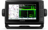
Creating and Saving a Route This procedure saves the route and all the waypoints in it. The starting point can be your present location or another location. You can add up to 250 waypoints, or turns, to one route. 1 Select Nav Info > Routes > New > Routes. 2 Select the starting location of the route. 3 Select Add Turn. 4 Select the location of the next turn on the chart. 5 Select Add Turn. The chartplotter marks the location of the turn with a waypoint. 6 If necessary, repeat steps 4 and 5 to add more turns. 7 Select the final destination. Viewing a List of Routes and Auto Guidance Paths 1 Select Nav Info > Routes. 2 If necessary, select Filter to see routes only or Auto Guidance paths only. Editing a Saved Route You can change the name of a route or change the turns the route contains. 1 Select Nav Info > Routes. 2 Select a route. 3 Select Edit Route. 4 Select an option: • To change the name, select Name, and enter the name. • To select a waypoint from the turn list, select Edit Turns > Use Turn List, and select a waypoint from the list. • To select a turn using the chart, select Edit Turns > Use Chart, and select a location on the chart. Browsing for and Navigating a Saved Route Before you can browse a list of routes and navigate to one of them, you must create and save at least one route. 1 Select Nav Info > Routes. 2 Select a route. 3 Select Navigate To. 4 Select an option: • To navigate the route from the starting point used when the route was created, select Forward. • To navigate the route from the destination point used when the route was created, select Backward. A magenta line appears. In the center of the magenta line is a thinner purple line that represents the corrected course from your present location to the destination. The corrected course is dynamic, and it moves with your boat when you are off course. 5 Review the course indicated by the magenta line. 6 Follow the magenta line along each leg in the route, steering to avoid land, shallow water, and other obstacles. 7 If you are off course, follow the purple line (corrected course) to go to your destination, or steer back to the magenta line (direct course). Browsing for and Navigating Parallel to a Saved Route Before you can browse a list of routes and navigate to one of them, you must create and save at least one route. 1 Select Nav Info > Routes. 2 Select a route. 3 Select Navigate To. 4 Select Offset to navigate parallel to the route, offset from it by a specific distance. 5 Indicate how to navigate the route: • To navigate the route from the starting point used when the route was created, to the left of the original route, select Forward - Port. • To navigate the route from the starting point used when the route was created, to the right of the original route, select Forward - Starboard. • To navigate the route from the destination point used when the route was created, to the left of the original route, select Backward - Port. • To navigate the route from the destination point used when the route was created, to the right of the original route, select Backward - Starboard. 6 If necessary, select Done. A magenta line appears. In the center of the magenta line is a thinner purple line that represents the corrected course from your present location to the destination. The corrected course is dynamic, and it moves with your boat when you are off course. 7 Review the course indicated by the magenta line. 8 Follow the magenta line along each leg in the route, steering to avoid land, shallow water, and other obstacles. 9 If you are off course, follow the purple line (corrected course) to go to your destination, or steer back to the magenta line (direct course). Deleting a Saved Route 1 Select Nav Info > Routes. 2 Select a route. 3 Select Review > Delete. Deleting All Saved Routes Select Nav Info > Manage Data > Clear User Data > Routes. Auto Guidance WARNING The Auto Guidance feature is based on electronic chart information. That data does not ensure obstacle and bottom clearance. Carefully compare the course to all visual sightings, and avoid any land, shallow water, or other obstacles that may be in your path. All route and navigation lines displayed on the chartplotter are only intended to provide general route guidance or to identify proper channels, and are not intended to be precisely followed. Always defer to the navaids and conditions on the water when navigating to avoid groundings or hazards that could result in vessel damage, personal injury, or death. NOTE: Auto Guidance is available with premium charts, in some areas. You can use Auto Guidance to plot the best path to your destination. Auto Guidance uses your chartplotter to scan chart data, such as water depth and known obstacles, to calculate a suggested path. You can adjust the path during navigation. Setting and Following an Auto Guidance Path 1 Select a destination (Destinations, page 12). 2 Select Navigate To > Auto Guidance. 3 Review the path, indicated by the magenta line. 4 Select Start Navigation. 5 Follow the magenta line, steering to avoid land, shallow water, and other obstacles. 14 Navigation with a Chartplotter
-
 1
1 -
2
-
3
-
4
-
5
-
6
-
7
-
8
-
9
-
10
-
11
-
12
-
13
-
14
-
 15
15 -
 16
16 -
 17
17 -
 18
18 -
 19
19 -
 20
20 -
 21
21 -
 22
22 -
 23
23 -
 24
24 -
 25
25 -
26
-
27
-
28
-
29
-
30
-
31
-
32
-
33
-
34
-
35
-
36
-
37
-
38
-
39
-
40
-
41
-
42
-
43
-
44
-
45
-
46
-
47
-
48
-
49
-
50
-
51
-
52
 |
 |
