Garmin ECHOMAP UHD 72sv Owners Manual - Page 28
Creating a Waypoint on the Sonar Screen
 |
View all Garmin ECHOMAP UHD 72sv manuals
Add to My Manuals
Save this manual to your list of manuals |
Page 28 highlights
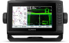
A-scope, zoomed-in view of the right side view A-scope with zoom area outlined1 Depth scale Depth at your present location Angle and span of the transducer cone at the current frequency Flasher Page Shortcuts On touchscreen devices, you can interact with the flasher and ascopes. Drag up and down to move the zoom area. Select to adjust the range. Select to adjust the frequency. Select to adjust the gain. Select to adjust the beam width. Drag the zoom window to move the zoom area on the left A-scope. Spread two fingers apart to zoom in. Pinch two fingers together to zoom out. Selecting the Transducer Type Before you can select the transducer type, you must know what kind of transducer you have. This chartplotter is compatible with a range of accessory transducers, including the Garmin ClearVü™ transducers, which are available at garmin.com/transducers. If you are connecting a transducer that was not included with the chartplotter, you may need to set the transducer type to make the sonar function properly. 1 From a sonar view, select MENU > Sonar Setup > Installation > Transducer Type. 2 Select the transducer to change. 3 Select an option: • If your transducer is listed, select it from the list. • If you have a 200/77 kHz, dual-beam transducer, select Dual Beam (200/77 kHz). • If you have a 200/50 kHz, dual-frequency transducer, select Dual Frequency (200/50 kHz). 1 On the ECHOMAP UHD 60 models, you can press and to move the zoom area up and down. 22 Calibrating the Compass Before you can calibrate the compass, the transducer must be installed on the shaft far enough away from the trolling motor to avoid magnetic interference, and deployed in the water. Calibration must be of sufficient quality to enable the internal compass. NOTE: To use the compass, you must mount the transducer on the transom or the trolling motor shaft. The compass may not work when you mount the transducer on the motor. NOTE: For best results, you should use a heading sensor such as the SteadyCast™ heading sensor. The heading sensor shows the direction the transducer is pointing relative to the boat. NOTE: Compass calibration is available only for transducers with an internal compass, such as the PS21-TR transducer. You can begin turning your boat before calibrating, but you must fully rotate your boat 1.5 times during calibration. 1 From an applicable sonar view, select MENU > Sonar Setup > Installation. 2 If necessary, select Use AHRS to turn on the AHRS sensor. 3 Select Calibrate Compass. 4 Follow the on-screen instructions. Selecting a Sonar Source This feature may not be available with all models. When you are using more than one sonar data source for a particular sonar view, you can select the source to use for that sonar view. For example, if you have two sources for Garmin ClearVü, you can select the source to use from the Garmin ClearVü sonar view. 1 Open the sonar view for which you will change the source. 2 Select MENU > Sonar Setup > Source. 3 Select the source for this sonar view. Renaming a Sonar Source You can rename a sonar source to easily identify that source. For example, you use "Bow" as the name of the transducer on the bow of your boat. To rename a source, you must be in the applicable sonar view for the source. For example, to rename the Garmin ClearVü sonar source, you must open the Garmin ClearVü sonar view. 1 From the sonar view, select MENU > Sonar Setup > Source > Rename Sources. 2 Enter the name. Creating a Waypoint on the Sonar Screen 1 Select a location. 2 If necessary, edit the waypoint information. Pausing the Sonar Display From a sonar view, select MENU > . Measuring Distance on the Sonar Screen You can measure the distance between two points on the SideVü sonar view. 1 From the SideVü sonar view, select . 2 Select a location on the screen. 3 Select . A push pin appears on the screen at the selected location. 4 Select another location. The distance and angle from the pin is listed in the upper-left corner. TIP: To reset the pin and measure from the current location of the pin, select Set Reference. Sonar Fishfinder
-
 1
1 -
2
-
3
-
4
-
5
-
6
-
7
-
8
-
9
-
10
-
11
-
12
-
13
-
14
-
15
-
16
-
17
-
18
-
19
-
20
-
21
-
22
-
 23
23 -
 24
24 -
 25
25 -
 26
26 -
 27
27 -
 28
28 -
 29
29 -
 30
30 -
 31
31 -
 32
32 -
 33
33 -
34
-
35
-
36
-
37
-
38
-
39
-
40
-
41
-
42
-
43
-
44
-
45
-
46
-
47
-
48
-
49
-
50
-
51
-
52
 |
 |
