Garmin GNS 430W Quick Reference Guide - Page 3
Warnings, Cautions, And Notes - weather
 |
View all Garmin GNS 430W manuals
Add to My Manuals
Save this manual to your list of manuals |
Page 3 highlights
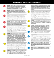
WARNINGS, CAUTIONS, and NOTES WARNING: VNAV is to be used for advisory purposes only. VNAV messages or vertical speed required should not be used to maintain terrain or ATC clearances. Terrain and ATC clearances are the sole responsibility of the pilot. WARNING: The altitude calculated by the 400W-series is geometric height above mean sea level and could vary significantly from altitude displayed by pressure altimeters in aircraft. WARNING: The Jeppesen database incorporated in the 400W-series must be updated regularly in order to ensure that its information is current. Updates are released every 28 days. A database information packet is included in your 400W-series package. Pilots using an out-of-date database do so entirely at their own risk! WARNING: Do not use data link weather information for maneuvering in, near, or around areas of hazardous weather. Information contained within data link weather products may not accurately depict current weather conditions. WARNING: Do not use the indicated data link weather product age to determine the age of the weather information shown by the data link weather product. Due to time delays inherent in gathering and processing weather data for data link transmission, the weather information shown by the data link weather product may be significantly older than the indicated weather product age. CAUTION: GPS receivers operate by receiving and decoding very low power radio signals broadcast by satellites. It is possible that in some situations other radio equipment or electronic equipment used in close proximity to a GPS receiver may create electromagnetic interference (EMI) which may affect the ability of the GPS receiver to receive and decode the satellite signals. In such event, the interference may be reduced or eliminated by switching off the source of interference or moving the GPS receiver away from it. CAUTION: The Global Positioning System is operated by the United States government, which is solely responsible for its accuracy and maintenance. The system is subject to changes which could affect the accuracy and performance of all GPS equipment. Although the Garmin 400W-series are precision electronic NAVigation AIDs (NAVAID), any NAVAID can be misused or misinterpreted and therefore become unsafe. CAUTION: Use the 400W-series at your own risk. To reduce the risk of unsafe operation, carefully review and understand all aspects of this Owner's Manual and the Flight Manual Supplement, and thoroughly practice basic operation prior to actual use. When in actual use, carefully compare indications from the 400W-series to all available navigation sources, including the information from other NAVAIDS, visual sightings, charts, etc. For safety, always resolve any discrepancies before continuing navigation. CAUTION: The electronic chart is an aid to navigation and is designed to facilitate the use of authorized government charts, not replace them. Land and water data is provided only as a general reference to your surroundings. The positional accuracy of the land and water data is not of a precision suitable for use in navigation and it should not be used for navigation. Only official government charts and notices contain all information needed for safe navigation - and, as always, the user is responsible for their prudent use. CAUTION: The Terrain feature is for supplemental awareness only. The pilot/crew is responsible for all terrain and obstacle avoidance using information not provided by the 400W-series Terrain feature. CAUTION: The Garmin 400W-series does not contain any user-serviceable parts. Repairs should only be made by an authorized Garmin service center. Unauthorized repairs or modifications could void your warranty and authority to operate this device under FCC Part 15 regulations. NOTE: The GNS 400W-series units use a different database than in the legacy units. The databases are incompatible between units. The GNS 400W-series units must use a WAAS enabled database. NOTE: This product, its packaging, and its components contain chemicals known to the State of California to cause cancer, birth defects, or reproductive harm. This notice is being provided in accordance with California's Proposition 65. If you have any questions or would like additional information, please refer to our website at www.garmin.com/prop65. NOTE: It is the pilot's responsibility for initial missed approach guidance in accordance with published procedure. The unit may not provide correct guidance until established on a defined leg. NOTE: GPS level of service annunciations (LPV, ENR, etc.) are not applicable to the external CDI (or HSI) when VLOC is active. 190-00356-01 Rev H 1
-
 1
1 -
 2
2 -
 3
3 -
 4
4 -
 5
5 -
 6
6 -
 7
7 -
 8
8 -
 9
9 -
10
-
11
-
12
-
13
-
14
-
15
-
16
-
17
-
18
-
19
-
20
-
21
-
22
-
23
-
24
 |
 |