Garmin GTN 750 Cockpit Reference Guide - Page 31
Waypoint Info
 |
View all Garmin GTN 750 manuals
Add to My Manuals
Save this manual to your list of manuals |
Page 31 highlights
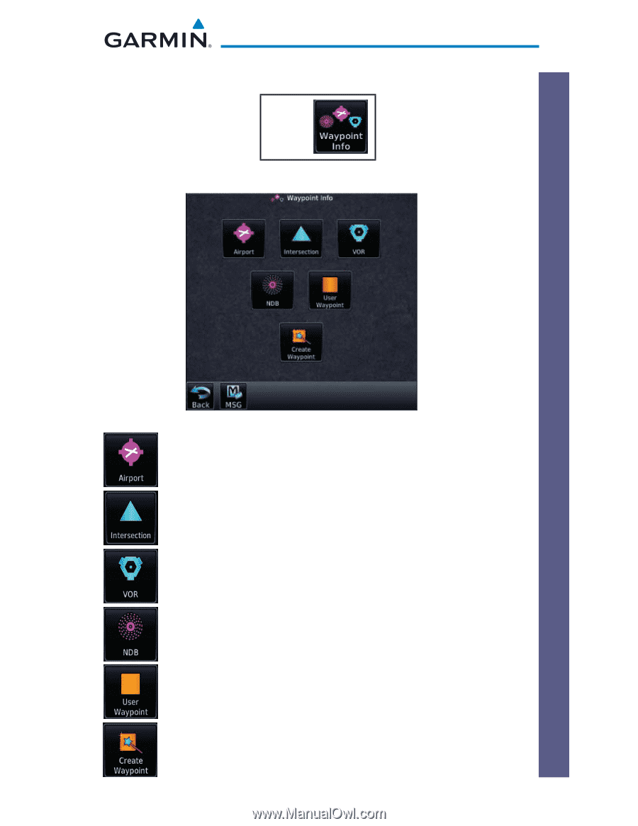
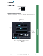
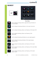
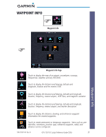
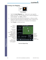
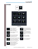
* * WAYPOINT INFO Waypoint Info Waypoint Info Waypoint Info Page Touch to display the map of an airport, procedures, runways, frequencies, weather, and any NOTAMs. Touch to display the distance and bearing, latitude and longitude, location and the nearest VOR. Touch to display the distance and bearing, latitude and longitude, location, frequency, nearest airport, VOR Class, and magnetic variation. Touch to display the distance and bearing, latitude and longitude, location, frequency, nearest airport, and marker description. Touch to display the distance, bearing, and reference waypoint information for created waypoints. Touch to create permanent or temporary waypoints. Items such as user identifier, comments, position type, reference waypoint, radial, and distance can be configured. 190-01007-04 Rev. B GTN 725/750 Cockpit Reference Guide (CRG) 25
-
 1
1 -
2
-
3
-
4
-
5
-
6
-
7
-
8
-
9
-
10
-
11
-
12
-
13
-
14
-
15
-
16
-
17
-
18
-
19
-
20
-
21
-
22
-
23
-
24
-
25
-
 26
26 -
 27
27 -
 28
28 -
 29
29 -
 30
30 -
 31
31 -
 32
32 -
 33
33 -
 34
34 -
 35
35 -
 36
36 -
37
-
38
-
39
-
40
-
41
-
42
-
43
-
44
-
45
-
46
-
47
-
48
-
49
-
50
-
51
-
52
-
53
-
54
-
55
-
56
-
57
-
58
-
59
-
60
 |
 |