Nokia 6210 Navigator Nokia 6210 Navigator User Guide in English - Spanish - Page 37
Browse maps, Tools, Settings, Internet, Network destination, Roaming warning, My position - free software
 |
View all Nokia 6210 Navigator manuals
Add to My Manuals
Save this manual to your list of manuals |
Page 37 highlights
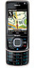
different points of interest, plan routes from one location to another, and save locations as landmarks and send them to compatible devices. You can also purchase extra services, such as travel guides and traffic information. These services are not available in all countries or regions. Some maps may be pre-loaded on the memory card in your device. You can download more maps through the internet using Nokia Map Loader PC software. See "Download maps," p. 38. Maps uses GPS. You can define the positioning methods used with your device. See "Positioning settings," p. 34. For the most accurate location information, use either the internal GPS or a compatible external GPS receiver. Browse maps To start Maps, press the Navigator key. When you use Maps for the first time, you may need to select a cellular access point for downloading map information for your current location. To change the default access point later, select Options > Tools > Settings > Internet > Network destination. To receive a note when your device registers to a network outside your home network, select Options > Tools > Settings > Internet > Roaming warning > On. For details and roaming costs, contact your network service provider. The data transfer indicator shows the internet connection used and the amount of data transferred since the application started. Almost all digital cartography is inaccurate and incomplete to some extent. Never rely solely on the cartography provided for use in this device. When you open Maps, it shows the location that was saved from your last session or the capital of the country you are in. The map of the location is also downloaded, if needed. To establish a GPS connection and zoom in to your last known location, press the Navigator key, or select Options > My position. A GPS indicator ( ) shows the availability and strength of the satellite signal. One bar indicates one satellite. When the device receives enough data from the satellite to establish a GPS connection, the bar turns green. Your device must receive signals from at least four satellites to calculate the coordinates of your location. After the initial calculation, signals from three satellites may be enough. To zoom in or out, press * or #. To move on the map, use the scroll key. A new map is automatically downloaded if you scroll to an area which is not covered by maps already downloaded. See "Download maps," p. 38. The maps are free of charge, but downloading may involve the transmission of large amounts of data through your service provider's network. For more information on data transmission charges, contact your service provider. The maps are automatically saved in the device memory or on a compatible memory card (if inserted). 36
-
 1
1 -
2
-
3
-
4
-
5
-
6
-
7
-
8
-
9
-
10
-
11
-
12
-
13
-
14
-
15
-
16
-
17
-
18
-
19
-
20
-
21
-
22
-
23
-
24
-
25
-
26
-
27
-
28
-
29
-
30
-
31
-
 32
32 -
 33
33 -
 34
34 -
 35
35 -
 36
36 -
 37
37 -
 38
38 -
 39
39 -
 40
40 -
 41
41 -
 42
42 -
43
-
44
-
45
-
46
-
47
-
48
-
49
-
50
-
51
-
52
-
53
-
54
-
55
-
56
-
57
-
58
-
59
-
60
-
61
-
62
-
63
-
64
-
65
-
66
-
67
-
68
-
69
-
70
-
71
-
72
-
73
-
74
-
75
-
76
-
77
-
78
-
79
-
80
-
81
-
82
-
83
-
84
-
85
-
86
-
87
-
88
-
89
-
90
-
91
-
92
-
93
-
94
-
95
-
96
-
97
-
98
-
99
-
100
-
101
-
102
-
103
-
104
-
105
-
106
-
107
-
108
-
109
-
110
-
111
-
112
-
113
-
114
-
115
-
116
-
117
-
118
-
119
-
120
-
121
-
122
-
123
-
124
-
125
-
126
-
127
-
128
-
129
-
130
-
131
-
132
-
133
-
134
-
135
-
136
-
137
-
138
-
139
-
140
-
141
-
142
-
143
-
144
-
145
-
146
-
147
-
148
-
149
-
150
-
151
-
152
-
153
-
154
-
155
-
156
-
157
-
158
-
159
-
160
-
161
-
162
 |
 |
