Pioneer AVIC-D2 Owner's Manual - Page 35
Viewing the information of a specified, location, Finding a destination on the map, appears to
 |
View all Pioneer AVIC-D2 manuals
Add to My Manuals
Save this manual to your list of manuals |
Page 35 highlights
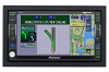
NAVI ❒ When the scale is 0.25 mi (200 m) or lower, the road appears light blue in the vicinity of the scroll cursor. (2) Direction line The direction towards the scroll cursor is indicated with a straight line. (3) Distance from the current location Shows the distance in a straight line between the location indicated by the scroll cursor and your current location. (4) The street name, city name, area name and other information for this location. (The information displayed varies according to the scale.) Touching the on the right displays hidden text. ➲ Displaying information on the specified location ➞ Page 33 (5) Shortcut menu ➲ How to use shortcut menu ➞ Page 28 Viewing the information of a specified location An icon appears at registered places (home location, specific places, address book entries) and places where there is a POI icon or traffic information icon. Place the scroll cursor over the icon to view detailed information. 1 Scroll the map and move the scroll cursor to the icon you want to view. 2 Touch . 3 Touch "Back". You are returned to the previous display. Finding a destination on the map If you search the location you want to visit by scrolling the map, touch in the Shortcut menu to specify your destination on the map. 1 Press the MAP button to access the map screen. 2 Touch the map for at least 2 seconds. The map display changes to Scroll mode. 3 Scroll the map and move the scroll cursor to the place you want to make your destination. ➲ Moving the map to view the part you want to see ➞ Page 32 4 Touch . ❒ If you press the MAP button during route calculation, the calculation is canceled and the map display appears. When appears to the right of the list You can also set a destination by touching to the right of the list. Touch "OK" to confirm. The location indicated by the scroll cursor will be set as a destination. Chapter 2 Menu and Map Display Information for a specified location appears. The information shown varies according to the location. (There may be no information for that location.) ➲ Registering places ➞ Page 47 ➲ Displaying facilities (POI) icon on the map ➞ Page 43 ➲ Icon for traffic information ➞ Page 51 Alternative option: Scroll : The map display changes to with Shortcut menu. If you touch anywhere on the map, the map display changes to Scroll mode. ➲ Shortcut menu ➞ Page 28 33
-
 1
1 -
2
-
3
-
4
-
5
-
6
-
7
-
8
-
9
-
10
-
11
-
12
-
13
-
14
-
15
-
16
-
17
-
18
-
19
-
20
-
21
-
22
-
23
-
24
-
25
-
26
-
27
-
28
-
29
-
 30
30 -
 31
31 -
 32
32 -
 33
33 -
 34
34 -
 35
35 -
 36
36 -
 37
37 -
 38
38 -
 39
39 -
 40
40 -
41
-
42
-
43
-
44
-
45
-
46
-
47
-
48
-
49
-
50
-
51
-
52
-
53
-
54
-
55
-
56
-
57
-
58
-
59
-
60
-
61
-
62
-
63
-
64
-
65
-
66
-
67
-
68
-
69
-
70
-
71
-
72
-
73
-
74
-
75
-
76
-
77
-
78
-
79
-
80
-
81
-
82
-
83
-
84
-
85
-
86
-
87
-
88
-
89
-
90
-
91
-
92
-
93
-
94
-
95
-
96
-
97
-
98
-
99
-
100
-
101
-
102
-
103
-
104
-
105
-
106
-
107
-
108
-
109
-
110
-
111
-
112
-
113
-
114
-
115
-
116
-
117
-
118
-
119
-
120
-
121
-
122
-
123
-
124
-
125
-
126
-
127
-
128
-
129
-
130
-
131
-
132
-
133
-
134
 |
 |
