Garmin GPS 48 Owner's Manual
Garmin GPS 48 Manual
 |
UPC - 753759007553
View all Garmin GPS 48 manuals
Add to My Manuals
Save this manual to your list of manuals |
Garmin GPS 48 manual content summary:
- Garmin GPS 48 | Owner's Manual - Page 1
GPS 48 Personal NavigatorTM Owner's Manual & Reference - Garmin GPS 48 | Owner's Manual - Page 2
without obligation to notify any person or organization of such changes. Visit the GARMIN website (www.garmin.com) for current updates and supplemental information concerning the use and operation of this and other GARMIN products. GARMIN, Personal Navigator, AutoLocate, TracBack, and PhaseTrac12 - Garmin GPS 48 | Owner's Manual - Page 3
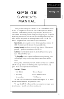
Package: • GPS 48 Unit • Owner's Manual • Wrist Strap • Carrying Case • Quick Reference Guide • 4 AA Batteries See your GARMIN dealer for accessories including our PC kit, swivel mounts, external antennas, and power/data cables. We hope the GPS 48 will meet all of your navigation needs and - Garmin GPS 48 | Owner's Manual - Page 4
the problem. Operation is subject to the following conditions: (1) This device cannot cause harmful interference, and (2) this device must accept any interference received, including interference that may cause undesired operation. The GPS 48 does not contain any user-serviceable parts. Repairs - Garmin GPS 48 | Owner's Manual - Page 5
46 System Setup 46-48 Navigation Setup 49-51 Interface Setup & DGPS Interface 52-53 Alarms Setup 54 Find City 55 Navigation Simulator 56 SECTION FOUR Appendices Appendix A--Specifications & Wiring 57-60 Appendix B-Messages and Time Offsets 61-62 Appendix C-Map Datums 63-64 Appendix - Garmin GPS 48 | Owner's Manual - Page 6
Glossary The GPS 48 is a powerful navigation tool that can guide you anywhere in the world. To better understand its operation and capabilities, it may be helpful to review the basic terms and concepts briefly explained below. Other navigation and GPS definitions used in the manual are defined - Garmin GPS 48 | Owner's Manual - Page 7
INTRODUCTION Glossary Estimated Time Enroute (ETE) The time left to your destination Meridian, an imaginary circle that passes through the north and south poles. Navigation The process of traveling from one place to another and knowing where you are specific location saved in the receiver's memory. 3 - Garmin GPS 48 | Owner's Manual - Page 8
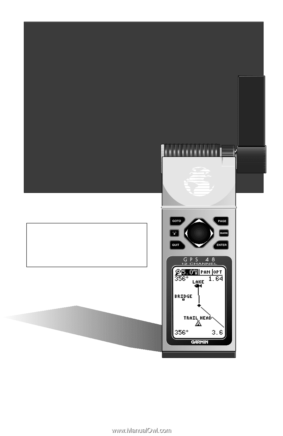
as 180º, and west as 270º. The diagram and compass rose below provide a graphic illustration of the navigation terms used by the GPS 48. More information on basic navigation and GPS are available at your local library or bookstore. "ACTIVE TO" WAYPOINT DISTANCE "ACTIVE LEG" GROUND SPEED NORTH - Garmin GPS 48 | Owner's Manual - Page 9
the field highlight from field to field. L R Moves the selected character field and moves the field highlight from field to field. DATA ENTRY The arrow keypad is used for all data entry. Use the U and D keys to select letters, numbers, and menu options; use the L and R keys to move the cur- sor - Garmin GPS 48 | Owner's Manual - Page 10
, the warning page is replaced by the Satellite Page, with the EZinit prompt ready for you to select one of two initialization methods: •Select Country--allows you to initialize the receiver by selecting your present position from a list of countries in the GPS 48's internal database. This method - Garmin GPS 48 | Owner's Manual - Page 11
/region you're in. 5. Press E to finish. The GPS 48 now begins searching for the appropriate satellites for your location and the top-left corner of the Satellite Page. Initialization Troubleshooting If you have trouble initializing the receiver or acquiring a position, check the following: • Does - Garmin GPS 48 | Owner's Manual - Page 12
we start the tour, let's briefly look at the five primary information pages used for the GPS 48. Switch between pages by pressing either the Q or J keys. J Satellite Page The Satellite in three dimensions: latitude, longitude, and altitude. A trip odometer and 12/24-hour clock are also provided. - Garmin GPS 48 | Owner's Manual - Page 13
position. As you move, you will see a thin line - called a track log - appear along the path you have just covered. The GPS 48 contains a built-in marine database that displays city locations and nautical navaids on the moving map. The database is covered on pages 21-22. The bottom corners of the - Garmin GPS 48 | Owner's Manual - Page 14
(units of measure, selectable fields, etc.) have been changed. If these settings have been changed, the pictures and descriptions you see in this manual may not match what you see on your screen. Turning the GPS 48 On 1. Press B until the receiver turns on. The welcome page will appear while the - Garmin GPS 48 | Owner's Manual - Page 15
& Going to a Waypoint The Map Page displays your present position as a diamond icon and provides a real time graphic "breadcrumb" display of your track right on the screen. The GOTO waypoint page allows you to select a destination from a list of all available waypoints in the GPS 48's memory. 11 - Garmin GPS 48 | Owner's Manual - Page 16
a GOTO The GPS48 will also provide steering guidance with a Graphic Compass display. Once a GOTO is activated, the GPS 48 provides steering guidance until the GOTO is canceled. To cancel a GOTO, highlight the cancel prompt at the bottom of the page and press ENTER. 12 Highway Page Bearing - Garmin GPS 48 | Owner's Manual - Page 17
through the basic operation of your new GPS receiver and probably know a little more than you think about how it works. We encourage you to experiment with the GPS 48 until it becomes an extension of your own navigation skills. If you encounter any problems using the unit or want to take advantage - Garmin GPS 48 | Owner's Manual - Page 18
by a '2D NAV' or '3D NAV' in the status field). You can also set the sky view to a track up configuration by changing the 'orientation' option on the Map Page. (See pg. 24 for setup instructions.) While the receiver is looking for satellites the satellite number will be highlighted in the sky view - Garmin GPS 48 | Owner's Manual - Page 19
- the GPS 48 is initializing and collecting new almanac data. This process can take 5 minutes, depending on the satellites currently in view. Acquiring- the receiver is collecting data from available satellites, but has not collected enough data to calculate a 2D fix. 2D Nav (2D Navigation)- at - Garmin GPS 48 | Owner's Manual - Page 20
. Voltage differences will display ! Ni-Cad and lithium batteries differently. No other receiver functions are affected. The GPS 48 features an internal lithium battery that will maintain the unit's memory when the receiver is not running off batteries or external power. Backlighting Bulb Icon The - Garmin GPS 48 | Owner's Manual - Page 21
page shows your current latitude and longitude in degrees and minutes. The GPS 48 uses this basic information to mark exact positions as waypoints, which help guide you from one place to another. The lower center of the page is a 12- or 24-hour clock. Both the trip odometer and the altitude fields - Garmin GPS 48 | Owner's Manual - Page 22
and set the odometer to 0. You may enter your exact altitude to assist the GPS 48 in GPS 48 is acquiring satellites or navigating in the 2D mode, the last known altitude is used to compute your position. In cases where the GPS 48 has 2D coverage, entering your exact altitude will enable the receiver - Garmin GPS 48 | Owner's Manual - Page 23
estimate distances. You may select which of these features are shown through the map setup submenu page (see pg. 24 for more information). The four corners of the Map Page are used to display various navigation data, including the bearing and distance to a destination waypoint and your current track - Garmin GPS 48 | Owner's Manual - Page 24
OPT, press ENTER and select 'CITY SETUP'. Marine Database The GPS 48 contains an updateable, marine database that displays city locations and nautical navaids on the moving map. Check the Garmin website for possible nautical navaid updates. City locations are depicted by a small square icon - Garmin GPS 48 | Owner's Manual - Page 25
set in navaid setup (see page 27) or by panning the map cursor to the navaid (see page 22). The navaid label contains an abbreviated description of the navaid. Lit Navaids have a description string with two required parts blasts per time. There may display. REFERENCE Marine Database Lit and - Garmin GPS 48 | Owner's Manual - Page 26
displayed waypoints, which allows you to quickly review or go to the selected waypoint right from the Map Page. 22 Zooming, Panning, and Configuring There are three main functions you can perform from the Map Page- zooming, panning, and configuring (changing the map and track setup). Each of these - Garmin GPS 48 | Owner's Manual - Page 27
can also define how each individual waypoint is displayed on the map. The GPS 48 displays waypoints as a name with a corresponding symbol (e.g., "nearest and instantly set a course for a new waypoint called 'MAP'. To go to the target crosshair: 1. Press G, and press E. To save the MAP waypoint, be - Garmin GPS 48 | Owner's Manual - Page 28
map. To GOTO a user waypoint or navaid: 1. Highlight the user waypoint or navaid by panning the map cursor to the point and press E. 2. Press Gthen Eto begin navigation to stay on course). The default setting is track up. To change the map orientation: 1. Highlight the 'map' field, and press E. 2. - Garmin GPS 48 | Owner's Manual - Page 29
INTERVAL', and press E twice. 3. Enter hours, minutes, and seconds, and press E. REFERENCE Map & Track Setup Pages Use the track setup page to control the way the GPS 48 manages your track log. Entering a time interval in to the track recording criteria will plot your position points further apart - Garmin GPS 48 | Owner's Manual - Page 30
Function The Find City function lets you search the internal marine database for a city, by spelling the city map. The cities are divided into three categories; small, medium and large. To set the visible range: 1. Highlight 'CITY SETUP', and press E. 2. Select the city size, and press E. 3. Change - Garmin GPS 48 | Owner's Manual - Page 31
field is user-selectable and determines when the navaid becomes visible on the map. REFERENCE Navaid Setup Navaids become visible on the map at or below the selected zoom setting. To change the zoom setting: 1. Highlight 'NAVAID SETUP', and press E. 2. Select the 'ZOOM' field that corresponds with - Garmin GPS 48 | Owner's Manual - Page 32
Once you have selected a GOTO, Tracback, MOB or route the GPS 48 will provide navigation using one of two user defined navigation pages. To switch the navigation page to the Compass Page, press ENTER twice. To switch the navigation page to the Highway Page, press ENTER twice. Compass Page Highway - Garmin GPS 48 | Owner's Manual - Page 33
to scroll through the possible options. The following data options are available for the Navigation Pages: Estimated Time Enroute (ETE)- the time left to your destination based on your present speed and track. Estimated Time of Arrival (ETA)- the time of day of your arrival at a destination, based - Garmin GPS 48 | Owner's Manual - Page 34
the Highway Page for travel at slower speeds (ex. walking) and for travel with many directional changes. The bearing (BRG) and distance (DST) to the waypoint are displayed at the top of based on your current speed and track over ground), the GPS 48 will alert you with a flashing onscreen message box. - Garmin GPS 48 | Owner's Manual - Page 35
Scale User Selectable Field The GPS 48's Highway Page provides graphic of the highway represents your desired track. As you navigate toward a waypoint, the highway will actually move-indicating off course will be displayed where the CDI scale setting normally appears. If you get too far off course - Garmin GPS 48 | Owner's Manual - Page 36
The Figure of Merit (FOM) field will display the value reflecting estimated accuracy of the averaged position. Note: As the GPS 48 calculates the FOM, it will rapidly change before it stabilizes on one number. 2. The unit will continue averaging until you have high- lighted 'SAVE?' and pressed E. To - Garmin GPS 48 | Owner's Manual - Page 37
page or GOTO a selected waypoint right from the list. To review the waypoint definition page of a selected waypoint: 1. Highlight the provides a complete list of all waypoints currently stored in the GPS 48 and their respective waypoint symbols. The total number of empty and updated continuously. 33 - Garmin GPS 48 | Owner's Manual - Page 38
temporary waypoints created by the TracBack function. Proximity Waypoints The GPS 48's proximity waypoint function warns you when you are getting too 2. Highlight 'REVIEW?' or 'REMOVE?' and press E. If 'REVIEW?' is chosen, the waypoint page will appear, and you may make any changes to the selected - Garmin GPS 48 | Owner's Manual - Page 39
a stored waypoint: REFERENCE Waypoint Definition Page The GPS 48's advanced waypoint planning features allow you to create new waypoints and practice navigation without ever setting foot outside. If you create a new waypoint by entering coordinates from a map, you may want to re-mark the waypoint - Garmin GPS 48 | Owner's Manual - Page 40
. Waypoint Symbols The GPS 48 allows you to select one of 16 symbols for each waypoint for easy recognition on the map display. From the GPS 48 has a user- defined 16-character comment field. The default comment is the UTC (or Greenwich mean time) date and time of the waypoint's creation. To change - Garmin GPS 48 | Owner's Manual - Page 41
part of a route, you'll be given a "Route Waypoint Can't be Deleted" message. Scanning Waypoints As you manually enter a waypoint's name, the GPS 48 You may then rename the waypoint at a later date. Any waypoint may be renamed at any time. Scanning waypoints from the waypoint definition page gives - Garmin GPS 48 | Owner's Manual - Page 42
(MOB) lets you simultaneously mark and set a course to a position for quick response to passing positions. To activate the MOB mode: 1. Press G twice. The GOTO waypoint page will appear with 'MOB' selected. 2 Press E to begin MOB navigation. The GPS 48 will now guide you to the MOB waypoint until - Garmin GPS 48 | Owner's Manual - Page 43
Navigation GARMIN's patented TracBack feature allows you to quickly retrace your path using the track log automatically stored in the receiver. This feature eliminates the need to mark waypoints along the way and manually , the GPS 48 will take the track log currently stored in memory and divide - Garmin GPS 48 | Owner's Manual - Page 44
oldest track log point in memory). • If the 'METHOD' option on the track log setup page is set to a time interval, the TracBack route may not follow your exact path. (Keeping the criteria set to automatic will always provide the most detailed TracBack route.) • If the receiver is turned off or you - Garmin GPS 48 | Owner's Manual - Page 45
The last form of navigating to a destination with the GPS 48 is by creating a user-defined route. The route navigation feature lets you plan and navigate a course from one place to another using a set of predefined waypoints. Routes are often used when it's not practical, safe, or possible - Garmin GPS 48 | Owner's Manual - Page 46
would like to navigate them. If you enter a waypoint not stored in memory, you'll need to define the position on the waypoint definition page. Route Definition Page Comment Field Desired Track of Leg Copy Field Route Number Leg Distance Total Distance Function Prompts The GPS 48 lets you create - Garmin GPS 48 | Owner's Manual - Page 47
as the active leg. As you pass each waypoint in the route, the receiver will automatically sequence and select the next waypoint as the active to waypoint. system allows you to have an active route that you may edit during navigation and save as an entirely new route from the original. You will have - Garmin GPS 48 | Owner's Manual - Page 48
navigating an active route, the active route page will become part of the main page sequence of the unit. The active route page will also allow you to change the 'ETE' field to display desired track (DTK) or estimated time the route. To clear a route from memory: 1. Highlight the 'ROUTE:' field, and - Garmin GPS 48 | Owner's Manual - Page 49
Review?- reviews the waypoint's definition page. • Insert?- adds a new waypoint that precedes the selected waypoint. • Remove?- deletes a selected waypoint. • Change?- replaces reach the on-route GOTO waypoint, the GPS 48 will automatically resume navigating the rest of the route in sequence using - Garmin GPS 48 | Owner's Manual - Page 50
system, navigation, interface and alarms setup pages. System Setup The system setup page is used to select the operating mode, time offset, and screen preferences. The GPS 48 has two operating modes: • Normal Mode operates the unit at maximum performance, and provides battery life of up to 12 hours - Garmin GPS 48 | Owner's Manual - Page 51
the system setup and Position Pages may be set to display the time in a 12or 24-hour format. To select the time format: 1. Highlight the 'HOURS' field, and press E. 2. Select 12- or 24-hour display, and press E. REFERENCE Date and Time Setup The GPS 48's two operating modes are accessed through the - Garmin GPS 48 | Owner's Manual - Page 52
on continuously. However, this will significantly reduce your battery life. The tone setting has three options to customize it to your preference. 48 The GPS 48 has adjustable screen contrast controlled by an on-screen bar scale. To set the screen contrast: 1. Highlight the 'CONTRAST' field, and - Garmin GPS 48 | Owner's Manual - Page 53
Setup The navigation setup submenu page is used to select units of measurement for position formats, map datums, CDI scale, units, and heading, and speed filter information. Position Formats The default position format for the GPS 48 is latitude and longitude in degrees and minutes (hdddºmm - Garmin GPS 48 | Owner's Manual - Page 54
the 'CDI SCALE' field, and press E. 2. Select the desired setting, and press E. Units of Measure The GPS 48 lets you select statute (default), nauti- cal, or metric units of measure for all "speed" and "distance" fields. To change the unit of measure: 1. Highlight the 'UNITS' field, and press - Garmin GPS 48 | Owner's Manual - Page 55
allows you to determine how the GPS48 responds to changes in track or ground speed. Three settings are available: automatic, on, or off. The 'Auto' setting is the default and will monitor changes in your current track and speed and adjust the receiver's response time up to 255 seconds. Selecting - Garmin GPS 48 | Owner's Manual - Page 56
. Two RTCM options are available: RTCM/NONE, which allows connection to a beacon receiver with no output capability; and RTCM/NMEA, which allows DGPS input and NMEA output. Once a RTCM setting has been selected, the GPS 48 will either automatically try to tune the last frequency and bit rate you - Garmin GPS 48 | Owner's Manual - Page 57
received, a 'No Data' message will be displayed. • If a beacon signal cannot be tuned, a 'No Status' message will be displayed. The message page will alert you to any problems relating to DGPS operation. You may also monitor the DGPS status from the status field on the interface page. The GPS 48 - Garmin GPS 48 | Owner's Manual - Page 58
more than the specified distance setting. Alarms Setup The alarms setup page is used to set the three alarms available on the GPS 48: the anchor drag alarm, the off/on/auto field for the desired alarm and press E. 3. Change to the desired setting and press E. Off - No alarm will occur. On - The - Garmin GPS 48 | Owner's Manual - Page 59
Setup The GPS 48 offers nine GPS position or a reference waypoint. To view the city location on the map: 1. Highlight 'SHOW MAP' and press E. After the search is complete the map spelling of the city name. REFERENCE Find City Function Garmin's exclusive Find City function allows the user to search - Garmin GPS 48 | Owner's Manual - Page 60
simulator mode from the operation mode choices and press ENTER. You may return to normal operation by changing the operation mode or by turning the unit off. Navigation Simulator The GPS 48's simulator mode lets you practice all aspects of its operation without active satellite acquisition. You can - Garmin GPS 48 | Owner's Manual - Page 61
. 6.15"H x 2"W x 1.23" D (15.6 x 5.1 x 1.23 cm) Approx 9.5 ounces (269g) w/ batteries 5º to 158ºF (-15º to 70ºC) PERFORMANCE Receiver: Acquisition Time: Update Rate: Position Accuracy: Velocity Accuracy: Dynamics: 12 parallel channel, differential-ready Approx. 15 seconds (warm start) Approx. 45 - Garmin GPS 48 | Owner's Manual - Page 62
12-volt DC cigarette lighter plug. Part No. 010-10085-00. • Data Transfer Cable- Allows data transfer between GARMIN GPS units. The GPS 48 is compatible with the following units: GPS 12/12XL/ 38/40/45/45XL, GPS II/II plus and the GPS error), PGRMM (map datum), PSLIB (beacon receiver control) DGPS - Garmin GPS 48 | Owner's Manual - Page 63
life in colder conditions. The GPS 48 also features an internal 10-year lithium battery which retains your data while changing the AA batteries or when stored with nearly depleted AA batteries ! Note: The on-screen battery level indicator is calibrated for alkaline batteries, and will not be - Garmin GPS 48 | Owner's Manual - Page 64
information will frflect those changes. Since the GPS 48 does not rely on the loran signal for navigation, it can refer- ence a different GRI chain and/or secondary stations and still navigate to the location stored in memory. To change the Setup TD settings: 1. Highlight the 'Position Frmt - Garmin GPS 48 | Owner's Manual - Page 65
exists in the GPS 48's memory. Approaching-You are one minute away from reaching a destination waypoint. Battery Power is Low-The batteries are low and should be replaced. No DGPS Position-Not enough data is available to compute a DGPS position. No RTCM Input-Beacon receiver is improperly connected - Garmin GPS 48 | Owner's Manual - Page 66
signal. Searching the Sky-The GPS 48 is in searching the sky for almanac data or the unit is in AutoLocateTM mode. Stored Data was Lost-All waypoints, routes, time and almanac data has been lost due to battery failure or clearing the receiver's memory. Track Memory is Full-All track log points - Garmin GPS 48 | Owner's Manual - Page 67
APPENDIX C The following list shows the map datums available for the GPS 48. Menu abbreviations are listed first, followed by the corresponding map datum name and area. The default map datum for the GPS 48 is WGS 84. Map Datums Adindan Afgooye AIN EL ABD '70 Anna 1 Ast '65 ARC 1950 ARC 1960 - Garmin GPS 48 | Owner's Manual - Page 68
APPENDIX C Map Datums Mahe 1971 Mahe 1971- Mahe Island Marco Astro Marco Astro- Salvage Island Massawa Massawa- Eritrea (Ethiopia) Merchich Merchich- Morocco Midway Ast '61 Midway Astro ' - Garmin GPS 48 | Owner's Manual - Page 69
the abbreviation. APPENDIX D Navaid Abbreviations Lit Navaid Abbreviations F Fixed - continuous and steady light FL Single Flashing - flash repeated on given time period, not to exceed 30 per minute FL(2) Group Flashing - group of regularly repeating flashes FL(2+1) Composite Group Flashing - Garmin GPS 48 | Owner's Manual - Page 70
Timer . . . . . .48 Battery Level 16 Battery Life 58 Battery Installation . . . . . .59 C CDI 12, 31, 50 Cancelling a GOTO . . . . .12 Cautions ii Cigarette Lighter Adapter .58 City Setup 26 Clearing Routes 44 Clearing the Track Log 13, 26 Compass Page .9, 12, 28, 30 Configuring the Map Page - Garmin GPS 48 | Owner's Manual - Page 71
Page 8, 17 Power and Data Cables . . .57 Primary Pages 8 Proximity Waypoints . . . .34 R Receiver Status 15 Reference Waypoints . . . .35 Renaming Waypoints . . . .37 Repairs 57, 69 Routes Clearing 44 Copying 44 Creating 43 Editing 45 Inverting 43 Navigating Routes . . . . .41 On-Route - Garmin GPS 48 | Owner's Manual - Page 72
56 Speed Filter 51 System Setup 46 T Time Format 47 Time Offset 59 Tone Setting 48 TracBack Navigation . . . . .39 TracBack Tips 40 Track Log Display . . .25, 40 Track Method 40 Track Setup 25 Trip Timer (TTIME) . . . . .17 Troubleshooting 7 Turn (TRN 17 Trip odometer 17 U Units - Garmin GPS 48 | Owner's Manual - Page 73
prepaid and insured to a GARMIN warranty service station. A copy of the original sales receipt is required as the proof of purchase for warranty repairs. GARMIN retains the exclusive right to repair or replace the unit or software or offer a full refund of the purchase price at its sole discretion - Garmin GPS 48 | Owner's Manual - Page 74
® © 1999 GARMIN Corporation 1200 E. 151st Street, Olathe, KS 66062 USA GARMIN (Europe) Ltd. - Unit 5, The Quadrangle, Abbey Park, Romsey, UK SO51 9AQ UK GARMIN (Asia) Corp., No. 68, Jangshu 2nd Rd., Shijr, Taipei County, Taiwan, R.O.C. Part Number 190-00141-00 Rev B - Printed in Taiwan
-
 1
1 -
 2
2 -
 3
3 -
 4
4 -
 5
5 -
 6
6 -
 7
7 -
8
-
9
-
10
-
11
-
12
-
13
-
14
-
15
-
16
-
17
-
18
-
19
-
20
-
21
-
22
-
23
-
24
-
25
-
26
-
27
-
28
-
29
-
30
-
31
-
32
-
33
-
34
-
35
-
36
-
37
-
38
-
39
-
40
-
41
-
42
-
43
-
44
-
45
-
46
-
47
-
48
-
49
-
50
-
51
-
52
-
53
-
54
-
55
-
56
-
57
-
58
-
59
-
60
-
61
-
62
-
63
-
64
-
65
-
66
-
67
-
68
-
69
-
70
-
71
-
72
-
73
-
74
 |
 |
Owner’s
Manual
&Reference
GPS
48
Personal
Navigator
TM