Garmin GPSMAP 740/740s Owner's Manual - Page 4

Table of Contents, Charts and 3D Chart Views - transducer

Page 4 highlights

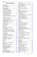
Introduction Table of Contents Introduction i Tips and Shortcuts i Manual Conventions i Getting Started 1 Front and Back Panels 1 Turning On the Chartplotter 1 Turning Off the Chartplotter 1 Initial Chartplotter Settings 2 GPS Satellite Signal Acquisition 2 Adjusting the Backlight 2 Adjusting the Color Mode 2 Inserting and Removing Data and Memory Cards 2 Viewing System Information 3 About the Home Screen 3 Charts and 3D Chart Views 4 Navigation Chart 4 Automatic Identification System 12 Perspective 3D 15 BlueChart g2 Vision 16 Mariner's Eye 3D 17 Fish Eye 3D 18 Fishing Chart 19 Showing Satellite Imagery on the Navigation Chart 19 Viewing Aerial Photos of Landmarks 20 Animated Tide and Current Indicators 21 Detailed Road and Point of Interest Data........21 Auto Guidance 21 Combinations 22 About the Combination Screen 22 Combination Screen Configuration 22 Navigation 25 Basic Navigation Questions 25 Navigation with a Chartplotter 25 Waypoints 26 Routes 28 Tracks 30 Navigating with a Garmin Autopilot 32 Where To 33 Marine Services Destinations 33 Almanac, On-boat, and Environmental Data 36 Almanac Data 36 On-boat Data 38 Environmental Data 41 Device Configuration 44 Basic Device Configuration Questions 44 Simulator Mode 44 Turning the Chartplotter On Automatically.......44 Display Configuration 45 Navigation Preferences 45 Information about Your Boat 50 Alarms 51 Chartplotter Data Management 52 Radar 54 Transmitting Radar Signals 54 Adjusting the Zoom Scale on the Radar Screen 54 Radar Display Modes 55 Waypoints and Routes on the Radar Screen...60 About the Radar Overlay 61 Optimizing the Radar Display 62 Radar Display Appearance 66 Radar Overlay Display Appearance 69 Sonar 71 Sonar Views 71 Depth Log 73 Transducer Temperature Log 73 Waypoints on the Sonar Screen 74 Sonar Display Appearance 74 Sonar Alarms 77 Transducer Configuration 78 Digital Selective Calling 79 Chartplotter and VHF Radio Functionality.......79 Turning On DSC 79 About the DSC List 79 Incoming Distress Calls 80 Man-Overboard Distress Calls Initiated from a VHF Radio 80 Man-Overboard Distress Calls Initiated from the Chartplotter 80 Position Tracking 81 Individual Routine Calls 83 Making an Individual Routine Call to an AIS Target 83 Appendix 84 Specifications 84 Calibrating the Touchscreen 84 Screenshots 85 Viewing GPS Satellite Locations 85 Using WAAS/EGNOS 85 System Information 85 NMEA 0183 and NMEA 2000 86 Registering Your Device 89 Contacting Garmin Product Support 89 Declaration of Conformity 89 Software License Agreement 89 Index 90 ii GPSMAP 700 Series Owner's Manual

  • 1
  • 2
  • 3
  • 4
  • 5
  • 6
  • 7
  • 8
  • 9
  • 10
  • 11
  • 12
  • 13
  • 14
  • 15
  • 16
  • 17
  • 18
  • 19
  • 20
  • 21
  • 22
  • 23
  • 24
  • 25
  • 26
  • 27
  • 28
  • 29
  • 30
  • 31
  • 32
  • 33
  • 34
  • 35
  • 36
  • 37
  • 38
  • 39
  • 40
  • 41
  • 42
  • 43
  • 44
  • 45
  • 46
  • 47
  • 48
  • 49
  • 50
  • 51
  • 52
  • 53
  • 54
  • 55
  • 56
  • 57
  • 58
  • 59
  • 60
  • 61
  • 62
  • 63
  • 64
  • 65
  • 66
  • 67
  • 68
  • 69
  • 70
  • 71
  • 72
  • 73
  • 74
  • 75
  • 76
  • 77
  • 78
  • 79
  • 80
  • 81
  • 82
  • 83
  • 84
  • 85
  • 86
  • 87
  • 88
  • 89
  • 90
  • 91
  • 92
  • 93
  • 94
  • 95
  • 96
  • 97
  • 98
  • 99
  • 100

ii
GPSMAP 700 Series Owner’s Manual
Introduction
Table of Contents
Introduction
................................................
i
Tips and Shortcuts
..............................................
i
Manual Conventions
...........................................
i
Getting Started
..........................................
1
Front and Back Panels
......................................
1
Turning On the Chartplotter
...............................
1
Turning Off the Chartplotter
...............................
1
Initial Chartplotter Settings
................................
2
GPS Satellite Signal Acquisition
........................
2
Adjusting the Backlight
......................................
2
Adjusting the Color Mode
..................................
2
Inserting and Removing Data and Memory
Cards
..............................................................
2
Viewing System Information
..............................
3
About the Home Screen
....................................
3
Charts and 3D Chart Views
......................
4
Navigation Chart
................................................
4
Automatic Identification System
......................
12
Perspective 3D
................................................
15
BlueChart g2 Vision
.........................................
16
Mariner’s Eye 3D
.............................................
17
Fish Eye 3D
.....................................................
18
Fishing Chart
...................................................
19
Showing Satellite Imagery on the
Navigation Chart
...........................................
19
Viewing Aerial Photos of Landmarks
...............
20
Animated Tide and Current Indicators
.............
21
Detailed Road and Point of Interest Data
........
21
Auto Guidance
.................................................
21
Combinations
..........................................
22
About the Combination Screen
........................
22
Combination Screen Configuration
..................
22
Navigation
...............................................
25
Basic Navigation Questions
.............................
25
Navigation with a Chartplotter
.........................
25
Waypoints
........................................................
26
Routes
.............................................................
28
Tracks
..............................................................
30
Navigating with a Garmin Autopilot
..................
32
Where To?
...............................................
33
Marine Services Destinations
..........................
33
Almanac, On-boat, and
Environmental Data
................................
36
Almanac Data
..................................................
36
On-boat Data
...................................................
38
Environmental Data
.........................................
41
Device Configuration
.............................
44
Basic Device Configuration Questions
............
44
Simulator Mode
...............................................
44
Turning the Chartplotter On Automatically
.......
44
Display Configuration
......................................
45
Navigation Preferences
...................................
45
Information about Your Boat
............................
50
Alarms
.............................................................
51
Chartplotter Data Management
.......................
52
Radar
.......................................................
54
Transmitting Radar Signals
.............................
54
Adjusting the Zoom Scale on the
Radar Screen
................................................
54
Radar Display Modes
......................................
55
Waypoints and Routes on the Radar Screen ..
60
About the Radar Overlay
.................................
61
Optimizing the Radar Display
..........................
62
Radar Display Appearance
..............................
66
Radar Overlay Display Appearance
................
69
Sonar
.......................................................
71
Sonar Views
....................................................
71
Depth Log
........................................................
73
Transducer Temperature Log
..........................
73
Waypoints on the Sonar Screen
......................
74
Sonar Display Appearance
..............................
74
Sonar Alarms
...................................................
77
Transducer Configuration
................................
78
Digital Selective Calling
.........................
79
Chartplotter and VHF Radio Functionality
.......
79
Turning On DSC
..............................................
79
About the DSC List
..........................................
79
Incoming Distress Calls
...................................
80
Man-Overboard Distress Calls Initiated
from a VHF Radio
.........................................
80
Man-Overboard Distress Calls Initiated
from the Chartplotter
.....................................
80
Position Tracking
.............................................
81
Individual Routine Calls
...................................
83
Making an Individual Routine Call to an
AIS Target
.....................................................
83
Appendix
.................................................
84
Specifications
..................................................
84
Calibrating the Touchscreen
............................
84
Screenshots
.....................................................
85
Viewing GPS Satellite Locations
.....................
85
Using WAAS/EGNOS
......................................
85
System Information
..........................................
85
NMEA 0183 and NMEA 2000
..........................
86
Registering Your Device
..................................
89
Contacting Garmin Product Support
................
89
Declaration of Conformity
................................
89
Software License Agreement
...........................
89
Index
........................................................
90