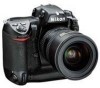
Nikon D2HS D2Hs User's Manual - Page 139
Using a GPS Unit
 |
UPC - 018208252190
View all Nikon D2HS manuals
Add to My Manuals
Save this manual to your list of manuals |
Page 139 highlights
Taking Photographs-Using a GPS Unit Using a GPS Unit Recording GPS Data Garmin and Magellan GPS units that conform to version 2.01 of the National Marine Electronics Association NMEA0183 protocol can be connected to the camera's ten-pin remote terminal using an MC-35 GPS adapter cord (available separately; 239), allowing information on the camera's current position to be recorded when photographs are taken. Operation has been confirmed with the following devices: • Garmin eTrex series • Magellan SporTrak series These devices connect to the MC-35 using the cable provided by the manufacturer of the GPS device. See the MC-35 instruction manual for details. Before turning the camera on, set the GPS device to NMEA mode. When the camera establishes communication with a GPS device, a icon will be displayed in the top control panel. The exposure meters will not turn off while this icon is displayed. Photo information for pictures taken while the icon is displayed will include an additional page ( 130) recording the current latitude, longitude, altitude, and Coordinated Universal Time (UTC). If no data are received from the GPS unit for two seconds, the icon will clear from the display and the camera will stop recording GPS information. Coordinated Universal Time (UTC) UTC data is provided by the GPS device and is independent of the camera clock. GPS Data GPS data are only recorded when the icon is displayed. Confirm that the icon is displayed in the top control panel before shooting. A flashing icon indicates that the GPS device is searching for a signal; pictures taken while the icon is flashing will not include GPS data. 125
-
 1
1 -
2
-
3
-
4
-
5
-
6
-
7
-
8
-
9
-
10
-
11
-
12
-
13
-
14
-
15
-
16
-
17
-
18
-
19
-
20
-
21
-
22
-
23
-
24
-
25
-
26
-
27
-
28
-
29
-
30
-
31
-
32
-
33
-
34
-
35
-
36
-
37
-
38
-
39
-
40
-
41
-
42
-
43
-
44
-
45
-
46
-
47
-
48
-
49
-
50
-
51
-
52
-
53
-
54
-
55
-
56
-
57
-
58
-
59
-
60
-
61
-
62
-
63
-
64
-
65
-
66
-
67
-
68
-
69
-
70
-
71
-
72
-
73
-
74
-
75
-
76
-
77
-
78
-
79
-
80
-
81
-
82
-
83
-
84
-
85
-
86
-
87
-
88
-
89
-
90
-
91
-
92
-
93
-
94
-
95
-
96
-
97
-
98
-
99
-
100
-
101
-
102
-
103
-
104
-
105
-
106
-
107
-
108
-
109
-
110
-
111
-
112
-
113
-
114
-
115
-
116
-
117
-
118
-
119
-
120
-
121
-
122
-
123
-
124
-
125
-
126
-
127
-
128
-
129
-
130
-
131
-
132
-
133
-
 134
134 -
 135
135 -
 136
136 -
 137
137 -
 138
138 -
 139
139 -
 140
140 -
 141
141 -
 142
142 -
 143
143 -
 144
144 -
145
-
146
-
147
-
148
-
149
-
150
-
151
-
152
-
153
-
154
-
155
-
156
-
157
-
158
-
159
-
160
-
161
-
162
-
163
-
164
-
165
-
166
-
167
-
168
-
169
-
170
-
171
-
172
-
173
-
174
-
175
-
176
-
177
-
178
-
179
-
180
-
181
-
182
-
183
-
184
-
185
-
186
-
187
-
188
-
189
-
190
-
191
-
192
-
193
-
194
-
195
-
196
-
197
-
198
-
199
-
200
-
201
-
202
-
203
-
204
-
205
-
206
-
207
-
208
-
209
-
210
-
211
-
212
-
213
-
214
-
215
-
216
-
217
-
218
-
219
-
220
-
221
-
222
-
223
-
224
-
225
-
226
-
227
-
228
-
229
-
230
-
231
-
232
-
233
-
234
-
235
-
236
-
237
-
238
-
239
-
240
-
241
-
242
-
243
-
244
-
245
-
246
-
247
-
248
-
249
-
250
-
251
-
252
-
253
-
254
-
255
-
256
-
257
-
258
-
259
-
260
-
261
-
262
-
263
-
264
-
265
-
266
-
267
-
268
-
269
-
270
-
271
 |
 |
