Uniden TRAX436 Owners Manual - Page 4
Using Track Logs - battery
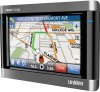 |
View all Uniden TRAX436 manuals
Add to My Manuals
Save this manual to your list of manuals |
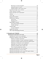
Page 4 highlights
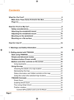
Selecting the destination by entering its coordinate 60 Creating a multi-point route (inserting a via point) 61 Creating a multi-point route (appending a new destination) 62 Editing the route 63 View the whole route on the map (Fit-to-Screen) 64 Watching the simulation of the route 64 Enabling Safety Mode 65 Pausing the active route 65 Deleting the next via point from the route 65 Deleting the active route 66 Using Track Logs 66 Recording the travelled path (creating a Track Log) 66 Simulating a Track Log on the map 67 Changing the colour of a Track Log 67 Saving a route 67 Loading a saved route 68 4: Reference book (Advanced mode) 69 Map screen 69 Icons on the map 73 Battery, GPS position quality and Vehicle type indicator 73 Status indicator strip 75 Next two route events (Turn Preview fields) 76 Objects on the map 78 Streets and roads 78 3D object types 78 Elements of the active route 78 Detour menu 80 Cursor menu 81 Position menu 83 Route information screen 84 Trip information screen 86 Trip computer screen 89 Quick menu 89 GPS data screen 91 Page 4
-
 1
1 -
 2
2 -
 3
3 -
 4
4 -
 5
5 -
 6
6 -
 7
7 -
 8
8 -
 9
9 -
 10
10 -
11
-
12
-
13
-
14
-
15
-
16
-
17
-
18
-
19
-
20
-
21
-
22
-
23
-
24
-
25
-
26
-
27
-
28
-
29
-
30
-
31
-
32
-
33
-
34
-
35
-
36
-
37
-
38
-
39
-
40
-
41
-
42
-
43
-
44
-
45
-
46
-
47
-
48
-
49
-
50
-
51
-
52
-
53
-
54
-
55
-
56
-
57
-
58
-
59
-
60
-
61
-
62
-
63
-
64
-
65
-
66
-
67
-
68
-
69
-
70
-
71
-
72
-
73
-
74
-
75
-
76
-
77
-
78
-
79
-
80
-
81
-
82
-
83
-
84
-
85
-
86
-
87
-
88
-
89
-
90
-
91
-
92
-
93
-
94
-
95
-
96
-
97
-
98
-
99
-
100
-
101
-
102
-
103
-
104
-
105
-
106
-
107
-
108
-
109
-
110
-
111
-
112
-
113
-
114
-
115
-
116
-
117
-
118
-
119
-
120
-
121
-
122
-
123
-
124
-
125
-
126
-
127
-
128
-
129
-
130
-
131
-
132
 |
 |
