Garmin STRIKER 4 Owners Manual - Page 10
Routes, Track, Device Configuration - review
 |
View all Garmin STRIKER 4 manuals
Add to My Manuals
Save this manual to your list of manuals |
Page 10 highlights
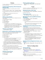
Routes A route is a sequence of waypoints or locations that leads you to your final destination. Deleting All Saved Routes Select User Data > Manage Data > Clear User Data > Routes. Creating and Navigating a Route Using the Waypoint Map The starting point can be your present location or another location. 1 Select User Data > Routes > New > Use Waypoint Map. 2 Pan the waypoint map to select the starting location of the route. 3 Follow the onscreen instructions to add a turns. 4 Select > Navigate To. 5 Select an option. Editing a Saved Route You can change the name of a route or change the turns the route contains. 1 Select User Data > Routes. 2 Select a route. 3 Select Edit Route. 4 Select an option: • To change the name, select Name, and enter the name. • To select a waypoint from the turn list, select Edit Turns > Use Turn List, and select a waypoint from the list. • To select a turn using the chart, select Edit Turns > Use Waypoint Map, and select a location on the chart. Viewing a List of Routes Select User Data > Routes. Browsing for and Navigating a Saved Route Before you can browse a list of routes and navigate to one of them, you must create and save at least one route. 1 Select User Data > Routes. 2 Select a route. 3 Select Navigate To. 4 Select an option: • To navigate the route from the starting point used when the route was created, select Forward. • To navigate the route from the destination point used when the route was created, select Backward. A magenta line appears. In the center of the magenta line is a thinner purple line that represents the corrected course from your present location to the destination. The corrected course is dynamic, and it moves with your boat when you are off course. 5 Review the course indicated by the magenta line. 6 Follow the magenta line along each leg in the route, steering to avoid land, shallow water, and other obstacles. 7 If you are off course, follow the purple line (corrected course) to go to your destination, or steer back to the magenta line (direct course). Deleting a Saved Route 1 Select User Data > Routes. 2 Select a route. 3 Select Delete. Track A track is a recording of the current path of your boat. You can show your current track in waypoint map view. Setting the Color of the Track 1 Select User Data > Track > Track Options > Track Color. 2 Select a track color. Clearing the Track Select User Data > Track > Clear Track > OK. Managing the Track Log Memory During Recording 1 Select User Data > Track > Track Options. 2 Select Record Mode. 3 Select an option: • To record a track log until the track memory is full, select Fill. • To continuously record a track log, replacing the oldest track data with new data, select Wrap. Configuring the Recording Interval of the Track Log You can indicate the frequency at which the track plot is recorded. Recording more frequent plots is more accurate but fills the track log faster. The resolution interval is recommended for the most efficient use of memory. 1 Select User Data > Track > Track Options > Record Intervals > Interval. 2 Select an option: • To record the track based on a distance between points, select Distance > Change, and enter the distance. • To record the track based on a time interval, select Time > Change, and enter the time interval. • To record the track plot based on a variance from your course, select Resolution > Change, and enter the maximum error allowed from the true course before recording a track point. Deleting All Saved Waypoints, Routes, and Tracks Select User Data > Manage Data > Clear User Data > All > OK. Device Configuration System Settings Select Settings > System. Display: Adjusts the backlight brightness (Adjusting the Backlight, page 1) and color scheme (Adjusting the Color Mode, page 1). GPS: Provides information about the GPS satellite settings and fix. Language: Sets the on-screen language. Simulator: Turns on the simulator and allows you to set the speed and simulated location. 6 Routes
-
 1
1 -
2
-
3
-
4
-
 5
5 -
 6
6 -
 7
7 -
 8
8 -
 9
9 -
 10
10 -
 11
11 -
 12
12 -
 13
13 -
 14
14 -
 15
15 -
16
 |
 |
