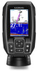
Garmin STRIKER 4 Owners Manual - Page 11
Setting the Water Temperature Offset - battery
 |
View all Garmin STRIKER 4 manuals
Add to My Manuals
Save this manual to your list of manuals |
Page 11 highlights
Beeper: Turns on and off the tone that sounds for alarms and selections (Setting the Beeper, page 1). Auto Power: Turns on the device automatically when power is applied. System Information: Provides information about the device and the software version. System Information Select Settings > Settings > System Information. Event Log: Allows you to view a log of system events. Software Information: Provides information about the device and the software version. Garmin Devices: Provides information about connected Garmin devices. Factory Settings: Restores the device to factory settings. NOTE: This deletes any setting information you have entered. Waypoint Map Settings Select Waypoint Map > . Waypoints: Shows the list of waypoints. Waypoint Display: Sets how to display waypoints on the chart. Routes: Shows the list of routes. Track: Shows the track option menu. Search: Allows you to search for saved routes and waypoints. Map Setup: Sets the perspective of the waypoint map and shows the heading line, which is a line drawn on the waypoint map from the bow of the boat in the direction of travel. Overlay Numbers: Allows you to customize the data shown on the waypoint map. Sonar Alarms Select Settings > Alarms > Sonar. Shallow Water: Sounds when the water depth is shallower than the specified depth. Deep Water: Sounds when the water depth is deeper than the specified depth. Water Temp.: Sounds when the water temperature varies more than ± 2°F (± 1.1°C). Alarm settings are saved when the device is turned off. NOTE: You must connect the device to a temperaturecapable transducer to use this alarm. Fish: Sets an alarm to sound when the device detects a suspended target. • sets the alarm to sound when fish of all sizes are detected. • sets the alarm to sound only when medium or large fish are detected. • sets the alarm to sound only when large fish are detected. System Alarms Alarm Clock: Sets an alarm clock. Device Voltage: Sets an alarm to sound when the battery reaches a specified low voltage. GPS Accuracy: Sets an alarm to sound when the GPS location accuracy falls outside the user-defined value. Navigation Alarms Select Settings > Alarms > Navigation. Arrival: Sets an alarm to sound when you are within a specified distance or time from a turn or a destination. Anchor Drag: Sets an alarm to sound when you exceed a specified drift distance while anchored. Off Course: Sets an alarm to sound when you are off course by a specified distance. Navigation Settings NOTE: Some settings and options require additional hardware. Select Settings > Navigation. Route Labels: Sets the type of labels shown with route turns on the map. Turn Transition Activ.: Sets the turn transition to be calculated based on time or distance. Turn Transition Time: Sets how many minutes before the turn that you transition to it as the next leg, when Time is selected for the Turn Transition Activ. setting. Turn Transition Dist.: Sets how far before the turn that you transition to it as the next leg, when Distance is selected for the Turn Transition Activ. setting. Route Start: Selects a starting point for route navigation. You can select Boat to start navigation from the current vessel location, or Waypoints to start from the first waypoint on the route. My Vessel Settings NOTE: Some settings and options require additional hardware. Select Settings > My Vessel. Transducer Type: Displays the type of transducer connected to the device (Selecting the Transducer Type, page 3). Keel Offset: Offsets the surface reading for the depth of a keel, making it possible to measure depth from the bottom of the keel instead of from the transducer location (Setting the Keel Offset, page 8). Temp. Offset: Compensates for the water temperature reading from a temperature-capable transducer (Setting the Water Temperature Offset, page 7). Unit Settings Select Settings > Units. System Units: Sets the unit format for the device. Variance: Sets the magnetic declination, the angle between magnetic north and true north, for your present location. North Reference: Sets the direction references used in calculating heading information. True sets geographic north as the north reference. Grid sets grid north as the north reference (000º). Magnetic sets the magnetic north as the north reference. Position Format: Sets the position format in which a given location reading appears. Do not change this setting unless you are using a map or chart that specifies a different position format. Map Datum: Sets the coordinate system on which the map is structured. Do not change this setting unless you are using a map or chart that specifies a different map datum. Time Format: Sets a 12-hour, 24-hour, or UTC time format. Time Zone: Sets the time zone. Daylight Savings Time: Sets daylight savings time to Off or On. Setting the Water Temperature Offset You can set the temperature offset to compensate for the temperature reading from a temperature-capable sensor. 1 Measure the water temperature using the temperature- capable transducer that is connected to the device. Device Configuration 7
-
 1
1 -
2
-
3
-
4
-
5
-
 6
6 -
 7
7 -
 8
8 -
 9
9 -
 10
10 -
 11
11 -
 12
12 -
 13
13 -
 14
14 -
 15
15 -
 16
16
 |
 |