Garmin eTrex 22x/32x Owners Manual - Page 5
Introduction, Waypoints, Routes, and Tracks - maps
 |
View all Garmin eTrex 22x/32x manuals
Add to My Manuals
Save this manual to your list of manuals |
Page 5 highlights
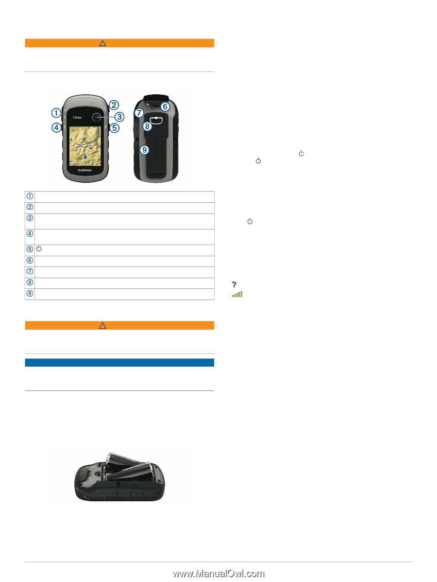
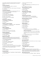
Introduction WARNING See the Important Safety and Product Information guide in the product box for product warnings and other important information. Device Overview Zoom keys. Press to zoom in and out. Back key. Press to return to the previous menu. Thumb Stick™controller. Move directionally to scroll or highlight an item. Press to select an item. Menu key. Press to open the menu for a page. Press twice to return to the main menu. Press to adjust the backlight. Hold to turn the device on or off. Mini-USB port (under weather cap). Battery cover. Battery cover locking ring. Mounting spine. Battery Information WARNING The temperature rating for the device may exceed the usable range of some batteries. Alkaline batteries can rupture at high temperatures. NOTICE Alkaline batteries lose a significant amount of their capacity as the temperature decreases. Use lithium batteries when operating the device in below freezing conditions. Installing AA Batteries The handheld device operates on two AA batteries (not included). Use NiMH or lithium batteries for best results. 1 Turn the D-ring counter-clockwise, and pull up to remove the cover. 2 Insert two AA batteries, observing polarity. 3 Replace the battery cover, and turn the D-ring clockwise. Selecting the Battery Type 1 From the main menu, select Setup > System > Battery Type. 2 Select Alkaline, Lithium, or Rechargeable NiMH. Maximizing Battery Life You can do several things to extend the life of the batteries. • Reduce the backlight brightness (Adjusting the Backlight Brightness, page 6). • Reduce the backlight timeout (Display Settings, page 8). • Use battery save mode (Turning On Battery Save Mode, page 1). • Decrease the map drawing speed (Map Settings, page 4). • Turn off GLONASS (GPS and Other Satellite Systems, page 8). Turning On Battery Save Mode You can use battery save mode to prolong the battery life. Select Setup > Display > Battery Save > On. In battery save mode, the screen shuts off when the backlight times out. You can select to turn on the screen, and you can double tap to view the status page. Long-Term Storage When you do not plan to use the device for several months, remove the batteries. Stored data is not lost when batteries are removed. Turning On the Device Hold . Acquiring Satellite Signals It may take 30 to 60 seconds to acquire satellite signals. 1 Go outdoors to an open area. 2 If necessary, turn on the device. 3 Wait while the device searches for satellites. flashes while the device determines your location. shows the satellite signal strength. Turning On the Backlight Select any key to turn on the backlight. The backlight turns on automatically when alerts and messages are displayed. Opening the Main Menu The main menu gives you access to tools and setup screens for waypoints, activities, routes, and more (Additional Main Menu Tools, page 6). From any page, select menu twice. Waypoints, Routes, and Tracks Where To? Menu You can use the Where To? menu to find a destination to navigate to. Not all Where To? categories are available in all areas and maps. Finding a Location Near Another Location 1 Select Where To? > menu > Search Near. 2 Select an option. 3 Select a location. Waypoints Waypoints are locations you record and store in the device. Waypoints can mark where you are, where you are going, or where you have been. You can add details about the location, such as name, elevation, and depth. Introduction 1
-
 1
1 -
 2
2 -
 3
3 -
 4
4 -
 5
5 -
 6
6 -
 7
7 -
 8
8 -
 9
9 -
 10
10 -
 11
11 -
12
-
13
-
14
-
15
-
16
-
17
-
18
 |
 |