Garmin eTrex 22x/32x Owners Manual - Page 7
Purchasing Additional Maps, Navigating to a Destination, Navigating with Sight 'N Go
 |
View all Garmin eTrex 22x/32x manuals
Add to My Manuals
Save this manual to your list of manuals |
Page 7 highlights
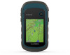
2 Select Record, Do Not Show or Record, Show On Map. If you select Record, Show On Map, a line on the map indicates your track. 3 Select Record Method. 4 Select an option: • To record tracks at a variable rate that creates an optimum representation of your tracks, select Auto. • To record tracks at a specified distance, select Distance. • To record tracks at a specified time, select Time. 5 Select Recording Interval. 6 Complete an action: • If you selected Auto for the Record Method, select an option to record tracks more or less often. NOTE: Using the Most Often interval provides the most track detail, but fills up the device memory quicker. • If you selected Distance or Time for the Record Method, enter a value. As you move with the device turned on, a track log is created. Viewing the Current Track 1 Select Track Manager > Current Track. 2 Select an option: • To show the current track on the map, select View Map. • To show the elevation plot for the current track, select Elevation Plot. Saving the Current Track 1 Select Track Manager > Current Track. 2 Select an option: • Select Save Track to save the entire track. • Select Save Portion, and select a portion. Navigating a Saved Track 1 Select Where To? > Tracks. 2 Select a saved track. 3 Select Go. Clearing the Current Track Select Track Manager > Current Track > Clear Current Track. Deleting a Track 1 Select Track Manager. 2 Select a track. 3 Select Delete. Tracks Settings Select Setup > Tracks. Track Log: Turns track recording on or off. Record Method: Sets a track recording method. Auto records the tracks at a variable rate to create an optimum representation of your tracks. Recording Interval: Sets a track log recording rate. Recording points more frequently creates a more-detailed track, but fills the track log faster. Clear Current Track: Clears the current track memory. Advanced Setup > Auto Archive: Sets an automatic archive method to organize your tracks. Tracks are saved and cleared automatically. Advanced Setup > Color: Changes the color of the track line on the map. Purchasing Additional Maps 1 Go to your device product page at garmin.com. 2 Click the Maps tab. 3 Follow the on-screen instructions. Finding an Address You can use optional City Navigator® maps to search for addresses. 1 Select Where To? > Addresses. 2 Select the country or state, if necessary. 3 Enter the city or postal code. NOTE: Not all map data provides postal code searching. 4 Select the city. 5 Enter the house number. 6 Enter the street. Navigation You can navigate to a route, track, waypoint, geocache, or any saved location in the device. You can use the map or the compass to navigate to your destination. Navigating to a Destination 1 Select Where To?. 2 Select a category. 3 If necessary, select menu > Spell Search and enter the destination name or part of the name. 4 Select a destination. 5 Select Go. Your route appears as a magenta line on the map. 6 Navigate using the map (Navigating with the Map, page 4) or compass (Navigating with the Compass, page 4). Navigating with Sight 'N Go You can point the device at an object in the distance, lock in the direction, and navigate to the object. NOTE: Sight 'N Go is available only with eTrex 32x devices. 1 Select Sight 'N Go. 2 Point the device at an object. 3 Select Lock Direction > Set Course. 4 Navigate using the compass. Heading Settings You can customize the compass settings. Select Setup > Heading. Display: Sets the type of directional heading shown on the compass. North Reference: Sets the north reference used on the compass. Go To Line/Pointer: Sets the behavior of the pointer that appears on the map. Bearing points in the direction of your destination. Course shows your relationship to the course line leading to the destination. Compass: Automatically switches from an electronic compass to a GPS compass when you are traveling at a higher rate of speed for a period of time. Calibrate Compass: See Calibrating the Compass, page 4. Map represents your location on the map. As you travel, moves and leaves a track log (trail). Waypoint names and symbols appear on the map. When you are navigating to a destination, your route is marked with a colored line on the map. Navigation 3
-
 1
1 -
 2
2 -
 3
3 -
 4
4 -
 5
5 -
 6
6 -
 7
7 -
 8
8 -
 9
9 -
 10
10 -
 11
11 -
 12
12 -
13
-
14
-
15
-
16
-
17
-
18
 |
 |
