Garmin Edge 840 Owners Manual - Page 38
Climb Categories, Map Settings, Map Appearance Settings, Changing the Map Orientation
 |
View all Garmin Edge 840 manuals
Add to My Manuals
Save this manual to your list of manuals |
Page 38 highlights
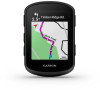
Climb Categories Climb categories are determined by climb score, which is calculated using the grade multiplied by the length of the climb. A climb must have a length of at least 500 meters and an average grade of at least 3 percent, or a climb score of 1,500, to be considered a climb. Category Climb Score Color Hors Category (HC) Greater than 80,000 Category 1 Greater than 64,000 Category 2 Greater than 32,000 Category 3 Greater than 16,000 Category 4 Greater than 8,000 Uncategorized Greater than 1,500 Map Settings Select > Activity Profiles, select a profile, and select Navigation > Map. Orientation: Sets how the map is shown on the page. Auto Zoom: Automatically selects a zoom level for the map. When Off is selected, you must zoom in or out manually. Guide Text: Sets when the turn-by-turn navigation prompts are shown (requires routable maps). Appearance: Customizes the appearance settings on the map (Map Appearance Settings, page 32). Map Information: Enables or disables the maps currently loaded on the device. Map Appearance Settings Select > Activity Profiles, select a profile, and select Navigation > Map > Appearance. Map Theme: Adjusts the appearance of the map for your ride type. (Map Themes, page 33) Popularity Map: Highlights popular roads or trails for your ride type. The darker the road or trail, the more popular. Map Detail: Sets the level of detail shown on the map. History Line Color: Allows you to change the line color of the path you have traveled. Advanced: Allows you to set zoom levels and text size, and enable shaded relief and contours. Reset Map Default: Resets the map appearance to the default settings. Changing the Map Orientation 1 Select > Activity Profiles. 2 Select a profile. 3 Select Navigation > Map > Orientation. 4 Select an option: • Select North Up to show north at the top of the page. • Select Track Up to show your current direction of travel at the top of the page. 32 Navigation
-
 1
1 -
2
-
3
-
4
-
5
-
6
-
7
-
8
-
9
-
10
-
11
-
12
-
13
-
14
-
15
-
16
-
17
-
18
-
19
-
20
-
21
-
22
-
23
-
24
-
25
-
26
-
27
-
28
-
29
-
30
-
31
-
32
-
 33
33 -
 34
34 -
 35
35 -
 36
36 -
 37
37 -
 38
38 -
 39
39 -
 40
40 -
 41
41 -
 42
42 -
 43
43 -
44
-
45
-
46
-
47
-
48
-
49
-
50
-
51
-
52
-
53
-
54
-
55
-
56
-
57
-
58
-
59
-
60
-
61
-
62
-
63
-
64
-
65
-
66
-
67
-
68
-
69
-
70
-
71
-
72
-
73
-
74
-
75
-
76
-
77
-
78
-
79
-
80
-
81
-
82
-
83
-
84
-
85
-
86
-
87
-
88
-
89
-
90
-
91
-
92
 |
 |
