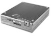
Garmin GDL 88 Series Pilots Guide - Page 23
SURF is in operation within the terminal environment within five NM
 |
View all Garmin GDL 88 Series manuals
Add to My Manuals
Save this manual to your list of manuals |
Page 23 highlights
* Indicates Multiple Targets. Touch the target to show all targets. Then touch Next to get info on each of the targets. Map ADS-B and TCAS Orientation Status and Altitude Filter Selected Traffic Info Traffic Motion Vector (Green) Touch For Next Target Ownship Icon Traffic Display Radius Proximate Non-Directional Traffic Selected Vector Motion and Duration Touch To View Traffic Menu Figure 4-2 AIRB Display on the GTN 7XX SURF is in operation within the terminal environment (within five NM and less than 1,500 feet above field elevation). When SURF is running, and the zoom scale on the traffic display is less than two NM, the airport environment (including taxiways and runways) is displayed in addition to traffic. This is to aid in situational awareness of runway occupancy/availability, etc. ADS-B and TCAS Status and Altitude Filter Map Orientation Traffic Display Radius Ownship Icon Selected Vector Motion and Duration Touch To View Traffic Menu Figure 4-3 SURF Display on the GTN 7XX 190-01122-03 Rev. E Garmin GDL 84/88 ADS-B Transceiver Pilot's Guide 4-3
-
 1
1 -
2
-
3
-
4
-
5
-
6
-
7
-
8
-
9
-
10
-
11
-
12
-
13
-
14
-
15
-
16
-
17
-
 18
18 -
 19
19 -
 20
20 -
 21
21 -
 22
22 -
 23
23 -
 24
24 -
 25
25 -
 26
26 -
 27
27 -
 28
28 -
29
-
30
-
31
-
32
-
33
-
34
-
35
-
36
-
37
-
38
-
39
-
40
-
41
-
42
-
43
-
44
-
45
-
46
-
47
-
48
-
49
-
50
-
51
-
52
 |
 |
