Garmin GDL 88 Series Pilots Guide - Page 24
On Scene Mode Helicopter Installations Only, 2.1.2, Airport Area Alerting, 2.1.3, Rotorcraft
 |
View all Garmin GDL 88 Series manuals
Add to My Manuals
Save this manual to your list of manuals |
Page 24 highlights
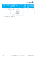
Due to the varying precision of the data received via ADS-B, ADS-R, and TIS-B, all traffic targets may not be depicted on the traffic display. Because higher data precision is required for display in the SURF environment, some targets eligible for AIRB will not be displayed while SURF is active. Individual eligibility for AIRB and SURF is depicted in the selected traffic data on the traffic page of both the GTN 6XX and 7XX. NOTE: Displays not capable of SURF will always run the AIRB application. 4.2.1.1 On Scene Mode (Helicopter Installations Only) On Scene Mode is a pilot selectable mode which changes the traffic alerting volumes for other ADS-B equipped rotorcraft traffic. This allows operation in closer proximity to other helicopters during operations such as Electronic News Gathering without excessive nuisance alerts. Protection is unchanged for fixed wing traffic and non-ADS-B equipped helicopters. The pilot must manually select On Scene Mode on and must select On Scene Mode off after completing operations. Refer to the display Pilot Guide for information about controls and indications. 4.2.1.2 Airport Area Alerting A GDL 88 (only) installed in a helicopter and with an interfaced Garmin navigator or Radar Altimeter offers additional traffic alerting in the airport environment uniquely tailored to helicopter operations. When operating at less than 200 feet AGL and less than 60 kts groundspeed, traffic alerting volumes are tailored to minimize nuisance alerts while conducting operations in the airport environment while still providing alerts from airborne aircraft equipped with ADS-B. When in the airport environment alerting envelope, aural traffic alerts are truncated to "Traffic" and the bearing, distance, and relative altitude information is omitted from the aural alert. No traffic alerts are provided when the GDL 88 equipped helicopter groundspeed is less than 10 kts and within 50 feet of the surface. 4.2.1.3 Rotorcraft Installations with No Source of Heading Data The following limitations are applicable to helicopters with a GDL 88 installed but no source of heading data provided to the GDL 88. Because ground track may not correspond to heading at low speeds due to the ability of the helicopter to fly backward or sideways the following limitations apply: 4-4 Garmin GDL 84/88 ADS-B Transceiver Pilot's Guide 190-01122-03 Rev. E
-
 1
1 -
2
-
3
-
4
-
5
-
6
-
7
-
8
-
9
-
10
-
11
-
12
-
13
-
14
-
15
-
16
-
17
-
18
-
 19
19 -
 20
20 -
 21
21 -
 22
22 -
 23
23 -
 24
24 -
 25
25 -
 26
26 -
 27
27 -
 28
28 -
 29
29 -
30
-
31
-
32
-
33
-
34
-
35
-
36
-
37
-
38
-
39
-
40
-
41
-
42
-
43
-
44
-
45
-
46
-
47
-
48
-
49
-
50
-
51
-
52
 |
 |
