Garmin GPSMAP 527 Weather Supplement - Page 12
Viewing Fishing Information, Viewing Forecast Sea Conditions Information for Another, Time Period
 |
View all Garmin GPSMAP 527 manuals
Add to My Manuals
Save this manual to your list of manuals |
Page 12 highlights
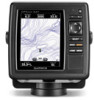
XM WX Satellite Weather and Cellular Weather Viewing Forecast Sea Conditions Information for Another Time Period NOTE: This feature is available only if you are receiving XM WX Satellite Weather data. It is not available if you are receiving only cellular weather data. 1. From the Home screen, select Information > Weather > Sea Conditions. 2. Complete an action: • To view forecasted sea conditions for the next 12 hours, select right on the Rocker, and to view forecasts up to 48 hours, in 12-hour increments, select right on the Rocker again. • To view the forecasted sea conditions for the previous 12 hours, select left on the Rocker, and to view previous forecasts, up to 48 hours ago, in 12-hour increments, select left on the Rocker again. Viewing Fishing Information The weather Fishing chart shows present water temperature, present surface pressure conditions, and fishing forecasts. From the Home screen, select Information > Weather > Fishing. Surface Pressure and Water Temperature Data Surface-pressure information appears as pressure isobars and pressure centers. Isobars ➊ connect points of equal pressure. Pressure readings can help to determine weather and wind conditions. High-pressure areas are generally associated with fair weather. Low-pressure areas are generally associated with clouds and the chance of precipitation. Isobars packed closely together show a strong pressure gradient. Strong pressure gradients are associated with areas of stronger winds. ➋ ➊ Pressure units are shown in millibars (mb), inches of Mercury (inHg), or hectopascals (hPa). Colored shading, as defined by the legend ➋ in the upper-left corner of the display, indicates the surface temperature of the water. 8 GPSMAP 400/500 Series Weather Supplement
-
 1
1 -
2
-
3
-
4
-
5
-
6
-
 7
7 -
 8
8 -
 9
9 -
 10
10 -
 11
11 -
 12
12 -
 13
13 -
 14
14 -
 15
15 -
 16
16 -
 17
17 -
18
-
19
-
20
-
21
-
22
-
23
-
24
-
25
-
26
-
27
-
28
 |
 |
