Garmin StreetPilot 2610 Owners Manual - Page 46
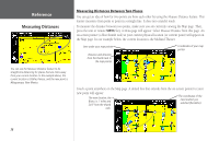
Measuring Distances Between Two Places
 |
UPC - 753759042141
View all Garmin StreetPilot 2610 manuals
Add to My Manuals
Save this manual to your list of manuals |
Page 46 highlights
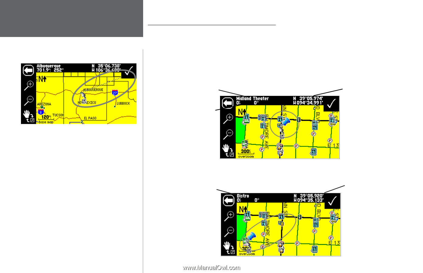
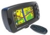
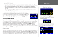
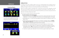
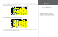
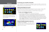
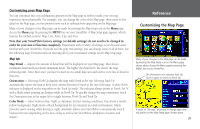
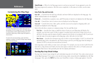
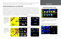
Reference Measuring Distances You can use the Measure Distance feature to do straight-line distancing for places that are miles away from your current location. In the example above, the current location is Olathe, Kansas, and the new point is Albuquerque, New Mexico. Measuring Distances Between Two Places You can get an idea of how far two points are from each other by using the Measure Distance feature. This feature measures from point to point in a straight line. It does not consider roads. To measure the distance between two points, make sure you are currently viewing the Map page. Then, press the unit or remote MENU key. A Menu page will appear. Select Measure Distance from this page. An on-screen pointer (a blue thumb tack) at your current physical location (or current point) will appear on the Map page. In our example below, the current location is the Midland Theater. Item under your map pointer Distance and direction from the thumb tack to the map pointer . Coordinates of your map pointer Touch a point anywhere on the Map page. A dotted line that extends from the on-screen pointer to your new point will appear: The new location, the Bistro, is .1 miles and 244° from the thumb The coordinates of the new location you selected (the Bistro). tack. 36
-
 1
1 -
2
-
3
-
4
-
5
-
6
-
7
-
8
-
9
-
10
-
11
-
12
-
13
-
14
-
15
-
16
-
17
-
18
-
19
-
20
-
21
-
22
-
23
-
24
-
25
-
26
-
27
-
28
-
29
-
30
-
31
-
32
-
33
-
34
-
35
-
36
-
37
-
38
-
39
-
40
-
 41
41 -
 42
42 -
 43
43 -
 44
44 -
 45
45 -
 46
46 -
 47
47 -
 48
48 -
 49
49 -
 50
50 -
 51
51 -
52
-
53
-
54
-
55
-
56
-
57
-
58
-
59
-
60
-
61
-
62
-
63
-
64
-
65
-
66
-
67
-
68
-
69
-
70
-
71
-
72
-
73
-
74
-
75
-
76
-
77
-
78
-
79
-
80
-
81
-
82
-
83
-
84
-
85
-
86
-
87
-
88
-
89
-
90
-
91
-
92
-
93
-
94
-
95
 |
 |