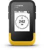
Garmin eTrex SE Owners Manual - Page 21
Map Settings, Phone Settings, System Settings
 |
View all Garmin eTrex SE manuals
Add to My Manuals
Save this manual to your list of manuals |
Page 21 highlights
Map Settings From the main menu, press or to scroll through the apps on the navigator. Select Settings > Map. Orientation: Adjusts how the map is shown on the page. The North Up option shows north at the top of the page. The Track Up option shows your current direction of travel toward the top of the page. Auto Zoom: Automatically selects the zoom level for optimal use of your map. When disabled, you must zoom in or out manually. Waypoints: Shows or hides waypoints on the map. Geocaches: Shows or hides geocaches on the map. Cities: Shows or hides cities on the map. Grid Lines: Shows or hides grid lines on the map. Recording: Shows or hides recordings on the map. Dashboard: Sets a dashboard to display on the map. Each dashboard shows different information about your course or your location. Phone Settings From the main menu, press or to scroll through the apps on the navigator. Select Settings > Phone. Status: Enables Bluetooth technology, and shows the current connection status. Notifications: Shows or hides smartphone notifications. Forget Phone: Removes the connected smartphone. This option is available only after a smartphone is paired. System Settings From the main menu, press or to scroll through the apps on the navigator. Select Settings > System. Expedition Mode: Allows you to customize settings for expedition mode. The Auto option automatically turns on expedition mode after two minutes of inactivity. The Manual option allows you to turn on expedition mode using the power menu (Turning On Expedition Mode, page 3). The Interval option determines how often GPS track points are recorded. Satellite: Allows you to change the satellite system. The GPS Only option enables the GPS satellite system. The Multi-GNSS option enables multiple Global Navigation Satellite Systems (GNSS). The Demo Mode option turns GPS off. NOTE: Using multiple GNSS systems offers increased performance in challenging environments and faster position acquisition than using GPS only. However, using multiple GNSS systems can reduce battery life more quickly than using GPS only. Display: Sets the backlight brightness and the length of time before the backlight turns off. Language: Sets the text language on the navigator. NOTE: Changing the text language does not change the language of user-entered data or map data. Waypoints: Allows you to change the automatic name type for waypoints, and enter a custom prefix for automatically named waypoints. Menus: Allows you to customize the main menu (Customizing the Main Menu, page 16) and glance loop (Customizing the Glance Loop, page 4). Battery Type: Allows you to change the type of AA battery you are using (Selecting the Battery Type, page 3). Units: Sets the units of measure for the navigator. Time: Sets the time format and time zone (Time Settings, page 18). Compass: Allows you to customize the compass heading settings (Compass Settings, page 18). Position Format: Sets the geographical position format and datum options (Position Format Settings, page 18). Course Trans.: Sets how the navigator routes you from one point in the course to the next. The Auto option automatically routes you to the next point in the course, the Distance option routes you to the next point in the course when you are within a specified distance of your current point, and the Manual option allows you to select the next point in the course (Changing the Active Course Point, page 12). Customizing the Device 17
-
 1
1 -
2
-
3
-
4
-
5
-
6
-
7
-
8
-
9
-
10
-
11
-
12
-
13
-
14
-
15
-
 16
16 -
 17
17 -
 18
18 -
 19
19 -
 20
20 -
 21
21 -
 22
22 -
 23
23 -
 24
24 -
 25
25 -
 26
26 -
27
-
28
-
29
-
30
 |
 |