Magellan Mapsend Direct Route Manual - English, French, German and Spanish - Page 15
Panning Mode, Zooming Mode, Uploading a Detailed Map to the GPS Receiver, Window. The Zoom Out tool - installation
 |
UPC - 763357108514
View all Magellan Mapsend Direct Route manuals
Add to My Manuals
Save this manual to your list of manuals |
Page 15 highlights
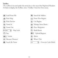
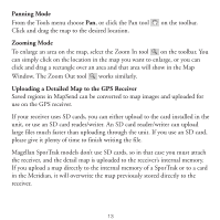
Panning Mode From the Tools menu choose Pan, or click the Pan tool Click and drag the map to the desired location. on the toolbar. Zooming Mode To enlarge an area on the map, select the Zoom In tool on the toolbar. You can simply click on the location in the map you want to enlarge, or you can click and drag a rectangle over an area and that area will show in the Map Window. The Zoom Out tool works similarly. Uploading a Detailed Map to the GPS Receiver Saved regions in MapSend can be converted to map images and uploaded for use on the GPS receiver. If your receiver uses SD cards, you can either upload to the card installed in the unit, or use an SD card reader/writer. An SD card reader/writer can upload large files much faster than uploading through the unit. If you use an SD card, please give it plenty of time to finish writing the file. Magellan SporTrak models don't use SD cards, so in that case you must attach the receiver, and the detail map is uploaded to the receiver's internal memory. If you upload a map directly to the internal memory of a SporTrak or to a card in the Meridian, it will overwrite the map previously stored directly to the receiver. 13
-
 1
1 -
2
-
3
-
4
-
5
-
6
-
7
-
8
-
9
-
 10
10 -
 11
11 -
 12
12 -
 13
13 -
 14
14 -
 15
15 -
 16
16 -
 17
17 -
 18
18 -
 19
19 -
 20
20 -
21
-
22
-
23
-
24
-
25
-
26
-
27
-
28
-
29
-
30
-
31
-
32
-
33
-
34
-
35
-
36
-
37
-
38
-
39
-
40
-
41
-
42
-
43
-
44
-
45
-
46
-
47
-
48
-
49
-
50
-
51
-
52
-
53
-
54
-
55
-
56
-
57
-
58
-
59
-
60
-
61
-
62
-
63
-
64
-
65
-
66
-
67
-
68
-
69
-
70
-
71
-
72
-
73
-
74
-
75
-
76
-
77
-
78
-
79
-
80
-
81
-
82
-
83
-
84
-
85
-
86
-
87
-
88
-
89
-
90
-
91
-
92
-
93
-
94
-
95
-
96
-
97
-
98
-
99
-
100
-
101
-
102
-
103
-
104
-
105
-
106
-
107
-
108
 |
 |