Magellan Mapsend Direct Route Manual - English, French, German and Spanish - Page 18
Defining a Street Route on the PC, Using MapSend DirectRoute on the, GPS Receiver
 |
UPC - 763357108514
View all Magellan Mapsend Direct Route manuals
Add to My Manuals
Save this manual to your list of manuals |
Page 18 highlights
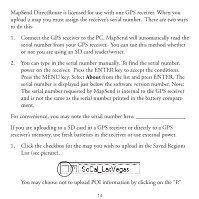
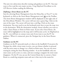
The next two subsections describe routing and guidance on the PC. You may want to first read the next major section, Using MapSend DirectRoute on the GPS Receiver, before reading the following. Defining a Street Route on the PC Start by selecting Route Management from the Menu Bar, or Press F7 on the keyboard, or click on the Street Route Management tool on the Toolbar. The Street Route Management window will be displayed on the right side of the DirectRoute Window. The cursor will turn into a green flag. Click on the start of the route. The cursor will turn into a red flag. Click on the route destination. You may need to use the keyboard arrow keys to pan the map view to the destination. With the destination marked, choose whether you want to make a Street Route or Point-to-Point route. If you select Street Route, the route will be highlighted on the map and it will become active. In MapSend on the PC, you will have to connect your unit if you want to use the PC for guidance. When it's connected, press the Navigate key in the Street Routes Sidebar. Guidance on the PC Guidance on the PC proceeds much as it does on the handheld. If you press the Navigate key while a street route is active, you can choose whether to proceed with the street route or change it to a Point-to-Point route. You can exit street routing by exiting the Street Routing window. As on the handheld, only one street route can be active at a time, and once routing is stopped, the street route disappears. On the PC you can use the Convert Route key to convert a Street Route to a multi-leg waypoint route and save it that way in the routes list. 16
-
 1
1 -
2
-
3
-
4
-
5
-
6
-
7
-
8
-
9
-
10
-
11
-
12
-
 13
13 -
 14
14 -
 15
15 -
 16
16 -
 17
17 -
 18
18 -
 19
19 -
 20
20 -
 21
21 -
 22
22 -
 23
23 -
24
-
25
-
26
-
27
-
28
-
29
-
30
-
31
-
32
-
33
-
34
-
35
-
36
-
37
-
38
-
39
-
40
-
41
-
42
-
43
-
44
-
45
-
46
-
47
-
48
-
49
-
50
-
51
-
52
-
53
-
54
-
55
-
56
-
57
-
58
-
59
-
60
-
61
-
62
-
63
-
64
-
65
-
66
-
67
-
68
-
69
-
70
-
71
-
72
-
73
-
74
-
75
-
76
-
77
-
78
-
79
-
80
-
81
-
82
-
83
-
84
-
85
-
86
-
87
-
88
-
89
-
90
-
91
-
92
-
93
-
94
-
95
-
96
-
97
-
98
-
99
-
100
-
101
-
102
-
103
-
104
-
105
-
106
-
107
-
108
 |
 |