Magellan SporTrak Color User Manual - Page 34
Globally Turn Map Items On/Off, Mark All, Clear All, Setting Up Map Data Fields, Turning Data Fields
 |
UPC - 763357105629
View all Magellan SporTrak Color manuals
Add to My Manuals
Save this manual to your list of manuals |
Page 34 highlights
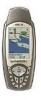
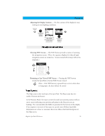
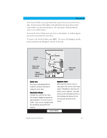
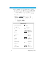
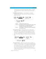
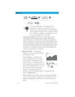
Reference Globally Turn Map Items On/Off - If you have uploaded map data from a MapSend product, you will notice that the list of POIs can be extremely lengthy. To aide you in the customization of the display you can turn everything on or off globally. To turn off all map items, follow these instructions. From the MAP Screen Highlight Map Setup Use L/R arrows to select "Display" tab Use U/D arrows to select Clear All After you have turned off all of the map items, you can go back and just select the POIs that you want to view. Please note that this function will also turn off waypoints, track lines and, if applicable, topo lines. Be sure to turn these back on if you want to see them. Inversely, to globally turn on all of the map items, follow the above steps but select "Mark All" instead of "Clear All". Setting Up Map Data Fields - The following options are available ONLY if you are in the Position Mode of the Map screen. If you are in the cursor mode, press the ESC key and the display will snap back to the Position Mode with the arrow icon displaying your present postion. (If you are not clear on which mode you are in, the simpliest way to determine it is to see what cursor is displayed; an arrow indicates Position and a crosshair indicates Cursor. If you press the ESC key and the display changes to another Nav Screen you were in the Position Mode and you can press NAV to return to the map. Turning Data Fields On/Off - This option allows you to turn on or off the two information fields that are displayed on the Map screen. Turning these off allows for more of the map to be displayed. Default is SHOW. From the MAP Screen Highlight Hide Map Info or Show Map Info When Map Info is hidden and the map is in the cursor mode, the bearing (BRG) and distance (DIS) to the cursor is shown in the bottom left corner of the map replacing the scale. (Note: if you have uploaded topographic information from Magellan's MapSend Topo for the United States CD-ROM, the elevation at the cursor's location is displayed, not the bearing and distance.) If the cursor happens to be on a map object, the name of the object is displayed. 24 Magellan SporTrak GPS Receiver
-
 1
1 -
2
-
3
-
4
-
5
-
6
-
7
-
8
-
9
-
10
-
11
-
12
-
13
-
14
-
15
-
16
-
17
-
18
-
19
-
20
-
21
-
22
-
23
-
24
-
25
-
26
-
27
-
28
-
 29
29 -
 30
30 -
 31
31 -
 32
32 -
 33
33 -
 34
34 -
 35
35 -
 36
36 -
 37
37 -
 38
38 -
 39
39 -
40
-
41
-
42
-
43
-
44
-
45
-
46
-
47
-
48
-
49
-
50
-
51
-
52
-
53
-
54
-
55
-
56
-
57
-
58
-
59
-
60
-
61
-
62
-
63
-
64
-
65
-
66
-
67
-
68
-
69
-
70
-
71
-
72
-
73
-
74
-
75
-
76
-
77
-
78
-
79
-
80
-
81
-
82
-
83
-
84
-
85
-
86
 |
 |