Nextar S3 S3 Software Manual - v2 - Page 4
Main Map, Main Map Icons - gps system
 |
UPC - 714129921541
View all Nextar S3 manuals
Add to My Manuals
Save this manual to your list of manuals |
Page 4 highlights
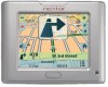
Main Map You can use the icons displayed on this screen to plan and view your route. 1 6 7 2 8 3 4 5 Figure 2 - Map Screen Main Map Icons 1, 6 2 3 9 10 Zoom in or out of the map to view a larger less detailed area or a smaller area in greater detail Tap the compass to change the map view display as follows: 2D map view with the forward direction at the top. 3D map view with the forward direction at the top. 2d map view with North at the top. Tap this icon to adjust or mute the volume. 4 When you have calculated a route, the Directions bar displays information about your next turn. Tap this bar for a complete list of turn-by-turn directions. 5 The GPS bar is a toggle button that displays the remaining travel distance and travel time, estimated time of arrival, street name and address number, speed and altitude. 7 The red GPS receiver means that a reliable GPS signal is not yet located. The green GPS receiver means that a reliable GPS signal is located and that you are ready to navigate. 8 These icons display your power source. 9 Tap this icon to set your QuickNav location. When set, you can tap this button to automatically calculate a route to this location. 10 Tap this icon to display the main menu. 3
-
 1
1 -
 2
2 -
 3
3 -
 4
4 -
 5
5 -
 6
6 -
 7
7 -
 8
8 -
 9
9 -
 10
10 -
11
-
12
-
13
-
14
-
15
-
16
-
17
-
18
-
19
-
20
-
21
-
22
-
23
-
24
-
25
-
26
-
27
-
28
-
29
 |
 |
