Nextar X3-09 X3-09 Software Manual - Page 45
Description, 1.2 Objects on the map
 |
View all Nextar X3-09 manuals
Add to My Manuals
Save this manual to your list of manuals |
Page 45 highlights
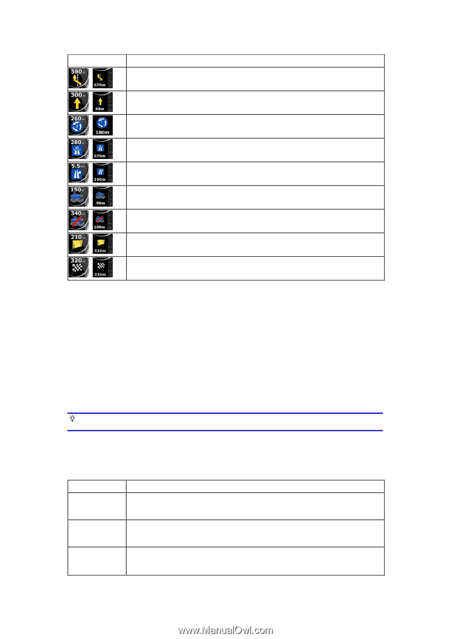
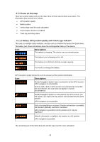
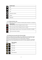
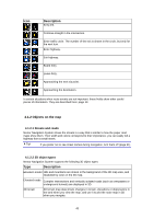
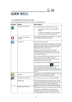
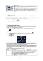
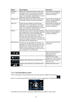
Icon Description Keep left. , Continue straight in the intersection. , Enter traffic circle. The number of the exit is shown in the circle, but only for , the next turn. Enter highway. , Exit highway. , Board ferry. , Leave ferry. , Approaching the next via point. , Approaching the destination. , In certain situations when route events are not important, these fields show other useful pieces of information. They are described here: page 13. 4.1.2 Objects on the map 4.1.2.1 Streets and roads Nextar Navigation System shows the streets in a way that is similar to how the paper road maps show them. Their width and colors correspond to their importance: you can easily tell a highway from a small street. Tip! If you prefer not to see street names during navigation, turn them off (page 61). 4.1.2.2 3D object types Nextar Navigation System supports the following 3D object types: Type Description Elevation model Hills and mountains are shown in the background of the 3D map view, and illustrated by color on the 2D map. Elevated roads Complex intersections and vertically isolated roads (such as overpasses or underground tunnels) are displayed in 3D. 3D terrain 3D terrain map data shows changes in terrain, elevations or depressions in the land when you view the map, and use it to plot the route map in 3D when you navigate. 45
-
 1
1 -
2
-
3
-
4
-
5
-
6
-
7
-
8
-
9
-
10
-
11
-
12
-
13
-
14
-
15
-
16
-
17
-
18
-
19
-
20
-
21
-
22
-
23
-
24
-
25
-
26
-
27
-
28
-
29
-
30
-
31
-
32
-
33
-
34
-
35
-
36
-
37
-
38
-
39
-
 40
40 -
 41
41 -
 42
42 -
 43
43 -
 44
44 -
 45
45 -
 46
46 -
 47
47 -
 48
48 -
 49
49 -
 50
50 -
51
-
52
-
53
-
54
-
55
-
56
-
57
-
58
-
59
-
60
-
61
-
62
-
63
-
64
-
65
-
66
-
67
-
68
-
69
-
70
-
71
-
72
-
73
-
74
 |
 |