Garmin zumo Owners Manual - Page 21
Creating a Round-Trip Route, photoLive Traffic Cameras, Viewing Previous Routes and Destinations,
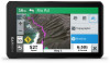 |
View all Garmin zumo manuals
Add to My Manuals
Save this manual to your list of manuals |
Page 21 highlights
2 Select a day. The detailed forecast for that day appears. Viewing Weather Near a Different City 1 Select Apps > Weather > Current Location. 2 Select an option: • To view weather for a favorite city, select a city in the list. • To add a favorite city, select Add City, and enter a city name. Viewing the Weather Radar Before you can use this feature, your device must be connected to a supported phone running the Garmin Drive app (Pairing Your Phone and Headset, page 13). 1 Select Apps > Weather Radar. 2 Select to animate the radar map. Viewing Weather Alerts Before you can use this feature, your device must be connected to a supported phone running the Garmin Drive app (Pairing Your Phone and Headset, page 13). NOTE: This feature is not available in all areas. While you are traveling with your device, weather alerts may appear on the map. You can also view a map of weather alerts near your current location or near a selected city. 1 Select Apps > Weather. 2 If necessary, select a city. 3 Select > Weather Alerts. Checking Road Conditions Before you can use this feature, your device must be connected to a supported phone running the Garmin Drive app (Pairing Your Phone and Headset, page 13). You can view weather-related road conditions for the roads in your area, on your route, or in another city. 1 Select Apps > Weather. 2 If necessary, select a city. 3 Select > Road Conditions. Creating a Round-Trip Route The device can create a round-trip route using a specified starting location and a distance, duration, or destination. 1 From the home screen, select Apps > Round Trip. 2 Select Start Location. 3 Select a location, and select Select. 4 Select Trip Attributes. 5 Select an option: • Select Choose a Distance to plan your route by distance. • Select Choose a Duration to plan your route based on time. • Select Choose a Destination to plan your route based on a specified location. 6 Enter a distance, duration, or destination. 7 Select an option: • If you entered a distance or duration, select Done > Calculate. • If you selected a destination, select Select. 8 Select a route, and select Go!. photoLive Traffic Cameras Before you can use this feature, your device must be connected to the Garmin Drive app (Pairing Your Phone and Headset, page 13). photoLive traffic cameras provide live images of traffic conditions on major roadways and intersections. The photoLive service is not available in all areas. Viewing and Saving photoLive Traffic Cameras You can view live images from nearby traffic cameras. You can also save traffic cameras for areas you travel frequently. 1 Select Apps > photoLive. 2 Select Touch to Add 3 Select a road. 4 Select a traffic camera location. A preview of the live image from the camera appears next to a map of the camera's location. You can select the image preview to view the full-sized image. 5 Select Save to save the camera (optional). A thumbnail image preview of the camera is added to the main screen of the photoLive app. Viewing photoLive Traffic Cameras on the Map The photoLive map tool shows traffic cameras from the road ahead of you. 1 From the map, select > photoLive. The device shows the live image from the nearest traffic camera on the road ahead, along with the distance to the camera. When you pass the camera, the device loads the live image of the next camera on the road. 2 If no cameras are found for the road, select Find Cameras to view or save nearby traffic cameras (optional). Viewing Previous Routes and Destinations Before you can use this feature, you must enable the travel history feature (Device and Privacy Settings, page 19). You can view your previous routes and places you have stopped on the map. Select Apps > Where I've Been. zūmo Settings Map and Vehicle Settings Select Settings > Map & Vehicle. Vehicle: Sets the vehicle icon that represents your position on the map. Driving Map View: Sets the perspective on the map. Map Detail: Sets the level of detail on the map. More detail may cause the map to draw slower. Map Theme: Changes the color of the map data. Map Layers: Sets the data that appears on the map page (Customizing the Map Layers, page 13). Auto Zoom: Automatically selects the zoom level for optimal use of your map. When disabled, you must zoom in or out manually. Skip Next Stop Confirmation: Sets a confirmation message to appear when skipping a location on your route. myMaps: Sets which installed maps the device uses. Enabling Maps You can enable map products installed on your device. TIP: To purchase additional map products, go to http://buy.garmin.com. 1 Select Settings > Map & Vehicle > myMaps. 2 Select a map. zūmo Settings 17
-
 1
1 -
2
-
3
-
4
-
5
-
6
-
7
-
8
-
9
-
10
-
11
-
12
-
13
-
14
-
15
-
 16
16 -
 17
17 -
 18
18 -
 19
19 -
 20
20 -
 21
21 -
 22
22 -
 23
23 -
 24
24 -
 25
25 -
 26
26 -
27
-
28
-
29
-
30
 |
 |
