Garmin Foretrex 101 Owner's Manual - Page 53
Setup Menu: Set Units, Position Format - gps navigator
 |
UPC - 753759046101
View all Garmin Foretrex 101 manuals
Add to My Manuals
Save this manual to your list of manuals |
Page 53 highlights
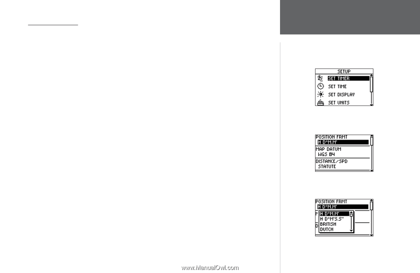
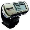
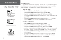
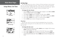
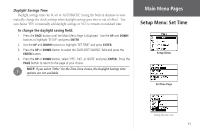
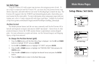
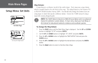
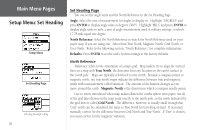
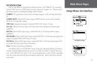
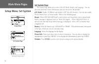
Set Units Page Using the Foretrex 101 with a paper map increases the navigation power of each. To use a map in conjunction with the Foretrex 101, you must select the position format, map datum, map units, and north reference (set in the Set Heading Page) to match the map. The Foretrex 101 supports both the UTM/UPS and latitude/longitude grids, which define position location for the entire globe. For more information about using paper maps with your Garmin unit, refer to "Using a Garmin GPS with Paper Land Maps", available for download at http://www.garmin.com/manuals/UsingaGarmtinGPSwithPaperLandMaps_Manual.pdf. Position Format The default position format (and the one most commonly used) for the Foretrex 101 is latitude and longitude in degrees and minutes (hdddº mm.mmm'). Choose from 11 other position formats or choose the 'USER' position format to approximate custom-designed grids. For more information on grids and datum, visit the National Imagery and Mapping Agency at http://www.nima.mil. To change the Position Format (grid): 1. Press the PAGE button until the Main Menu Page is displayed. Use the UP and DOWN buttons to highlight 'SETUP' and press ENTER. 2. Use the UP and DOWN buttons to highlight 'SET UNITS' and press ENTER. 3. Press the UP or DOWN buttons to highlight the 'POSITION FRMT' field and press the ENTER button. 4. Press the UP or DOWN button to highlight the desired format and press the ENTER button. 5. Press the PAGE button to return to the Main Menu page. Main Menu Pages Setup Menu: Set Units Setup Menu Set Units Page Selecting the Position Format 47
-
 1
1 -
2
-
3
-
4
-
5
-
6
-
7
-
8
-
9
-
10
-
11
-
12
-
13
-
14
-
15
-
16
-
17
-
18
-
19
-
20
-
21
-
22
-
23
-
24
-
25
-
26
-
27
-
28
-
29
-
30
-
31
-
32
-
33
-
34
-
35
-
36
-
37
-
38
-
39
-
40
-
41
-
42
-
43
-
44
-
45
-
46
-
47
-
 48
48 -
 49
49 -
 50
50 -
 51
51 -
 52
52 -
 53
53 -
 54
54 -
 55
55 -
 56
56 -
 57
57 -
 58
58 -
59
-
60
-
61
-
62
-
63
-
64
-
65
-
66
-
67
-
68
-
69
-
70
-
71
-
72
 |
 |