Garmin Foretrex 101 Owner's Manual - Page 54
Map Datums, To change the Map Datum
 |
UPC - 753759046101
View all Garmin Foretrex 101 manuals
Add to My Manuals
Save this manual to your list of manuals |
Page 54 highlights
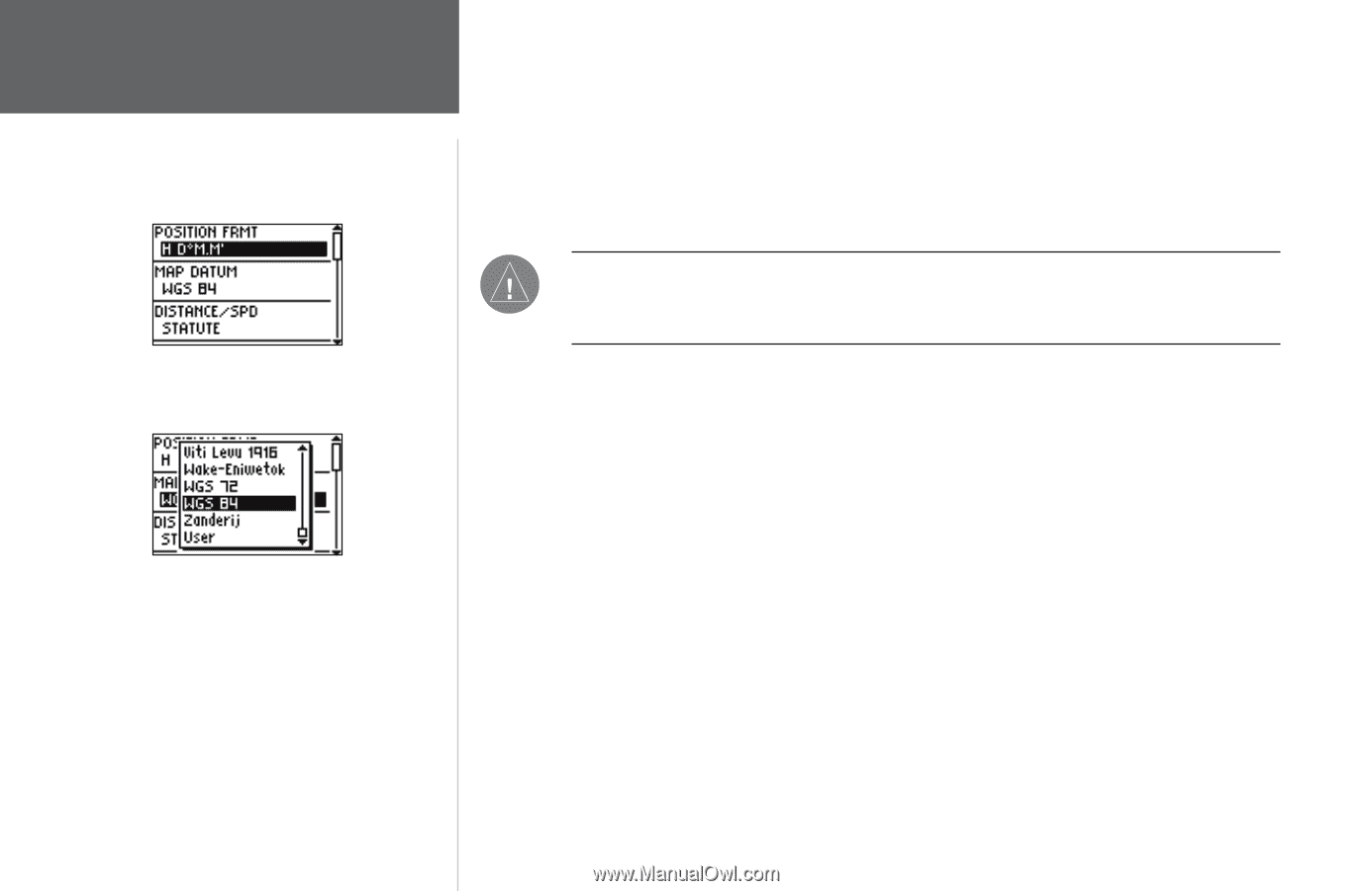
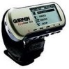
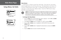
Main Menu Pages Setup Menu: Set Units Set Units Page Selecting the Map Datum Map Datums A map datum is a reference model of the earth's shape. Every map uses a map datum which is usually listed in the title block of the map. The default datum in the Foretrex 101 is WGS 84 (World Geodetic Survey, 1984). You should only change the datum if you are using maps or charts that specify a different datum. Choose the 'USER' datum if using a map with custom-designed grids. NOTE: The 'USER' datum is based on a WGS-84-Local datum and is an advanced feature for unlisted or custom datums. To learn more, check your local library or the Internet for educational materials on datums and coordinate systems. To change the Map Datum: 1. Press the PAGE button until the Main Menu Page is displayed. Use the UP and DOWN buttons to highlight 'SETUP' and press ENTER. 2. Use the UP and DOWN buttons to highlight 'SET UNITS' and press ENTER. 3. Press the UP or DOWN button to highlight the 'MAP DATUM' field and press the ENTER button. 4. Press the UP or DOWN button to highlight the desired datum and press the ENTER button. 5. Press the PAGE button to return to the Main Menu Page. 48
-
 1
1 -
2
-
3
-
4
-
5
-
6
-
7
-
8
-
9
-
10
-
11
-
12
-
13
-
14
-
15
-
16
-
17
-
18
-
19
-
20
-
21
-
22
-
23
-
24
-
25
-
26
-
27
-
28
-
29
-
30
-
31
-
32
-
33
-
34
-
35
-
36
-
37
-
38
-
39
-
40
-
41
-
42
-
43
-
44
-
45
-
46
-
47
-
48
-
 49
49 -
 50
50 -
 51
51 -
 52
52 -
 53
53 -
 54
54 -
 55
55 -
 56
56 -
 57
57 -
 58
58 -
 59
59 -
60
-
61
-
62
-
63
-
64
-
65
-
66
-
67
-
68
-
69
-
70
-
71
-
72
 |
 |