Garmin GPSMAP 496 Owner's Manual (for North America) - Page 182
Data Field Options, XM Antenna Not Responding
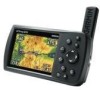 |
View all Garmin GPSMAP 496 manuals
Add to My Manuals
Save this manual to your list of manuals |
Page 182 highlights
Appendix > Data Field Options Waypoint Already Exists-a waypoint with the same name already exists. Waypoint Memory Full-the unit has stored the maximum number of waypoints. XM Antenna Not Responding-the unit is unable to communicate with the GXM 30A. XM Connected-the GXM 30A antenna was recently plugged in. Data Field Options The following list provides a brief description of each data field option. Some of these options are supported only by devices interfaced to your GPSMAP 496. Accuracy-the current accuracy of your GPS determined location. Battery Timer-the time remaining on the battery before it is fully discharged. Bearing-the compass direction from your current location to a destination. Course-the your path of travel from your starting location to a destination. Course to Steer-the recommended direction to steer in order to reduce cross-track error and return to the course line. Showed as 174 Steer. Cross Track-the distance you are off your course in either direction, left or right. Depth (Marine Only)-the depth of water from sonar NMEA input. Dest Wpt-see Waypoint (Destination). Distance (Destination)-the entire distance, from beginning to end, of a route. Distance (Next)-the distance to the next point on a route. ETA (Destination)-Estimated Time of Arrival. The estimated time you will reach your destination. ETA (Next)-Estimated Time of Arrival. The estimated time you will reach the next point on your route. ETE (Destination)-Estimated Time Enroute. The estimated time required to reach your destination. ETE (Next)-Estimated Time Enroute. The estimated time required to reach the next point on your route. Elevation-the altitude (height) above or below mean sea level (MSL). GPS Status-the current status of the GPS receiver, such as "3D GPSMAP 496 Owner's Manual
-
 1
1 -
2
-
3
-
4
-
5
-
6
-
7
-
8
-
9
-
10
-
11
-
12
-
13
-
14
-
15
-
16
-
17
-
18
-
19
-
20
-
21
-
22
-
23
-
24
-
25
-
26
-
27
-
28
-
29
-
30
-
31
-
32
-
33
-
34
-
35
-
36
-
37
-
38
-
39
-
40
-
41
-
42
-
43
-
44
-
45
-
46
-
47
-
48
-
49
-
50
-
51
-
52
-
53
-
54
-
55
-
56
-
57
-
58
-
59
-
60
-
61
-
62
-
63
-
64
-
65
-
66
-
67
-
68
-
69
-
70
-
71
-
72
-
73
-
74
-
75
-
76
-
77
-
78
-
79
-
80
-
81
-
82
-
83
-
84
-
85
-
86
-
87
-
88
-
89
-
90
-
91
-
92
-
93
-
94
-
95
-
96
-
97
-
98
-
99
-
100
-
101
-
102
-
103
-
104
-
105
-
106
-
107
-
108
-
109
-
110
-
111
-
112
-
113
-
114
-
115
-
116
-
117
-
118
-
119
-
120
-
121
-
122
-
123
-
124
-
125
-
126
-
127
-
128
-
129
-
130
-
131
-
132
-
133
-
134
-
135
-
136
-
137
-
138
-
139
-
140
-
141
-
142
-
143
-
144
-
145
-
146
-
147
-
148
-
149
-
150
-
151
-
152
-
153
-
154
-
155
-
156
-
157
-
158
-
159
-
160
-
161
-
162
-
163
-
164
-
165
-
166
-
167
-
168
-
169
-
170
-
171
-
172
-
173
-
174
-
175
-
176
-
 177
177 -
 178
178 -
 179
179 -
 180
180 -
 181
181 -
 182
182 -
 183
183 -
 184
184 -
 185
185 -
 186
186 -
 187
187 -
188
-
189
-
190
-
191
-
192
-
193
-
194
 |
 |
