Lowrance HDS-7 Gen2 Touch Operation Manual - Page 133
Waas/msas/egnos
 |
View all Lowrance HDS-7 Gen2 Touch manuals
Add to My Manuals
Save this manual to your list of manuals |
Page 133 highlights
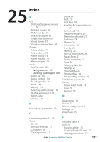
Measuring distance 59 Networking 59 Noise Rejection 57 Palette 58 Pausing sonar 59 Preset range levels 57 Range 57 Stop sonar 59 Surface clarity 57 View Downscan 58 Sidescan 58 Viewing history 56 System settings 77 Advanced 78 Coordinate system 78 Datum 77 Key beeps 77 Language 77 Magnetic variation 78 Restore defaults 78 Satellites 78 Time 77 Units 78 T Tides 74 Touchscreen calibration 123 Trails Creating 36 Logging type 39 Settings 36 Troubleshooting 124 U Units 78 Using the touchscreen 9 Utilities Alarms 73 Files Copying files 75 Find 73 PDF reader 76 Satellites 74 Sun/moon 73 Tides 74 Trip Calculator 73 Vessels 72 Waypoints/routes/trails 73 V Vessels 72 Message listing 72 Status listing 72 Video W WAAS/MSAS/EGNOS 107 Waypoints Alarms 34 Creating 33 Editing 33 Exporting 34 Waypoints, routes and trails Exporting data 125 Export region 126 Weather Adjusting color shading 114 Alarms 115 Animating weather graphics 117 Overlay transparency 115 Precipitation 113 SIRIUS status 112 Symbology 113 Transparency 115 Wave indication 114 Weather reports 116 Index | Lowrance HDS Gen2 Touch | 131
-
 1
1 -
2
-
3
-
4
-
5
-
6
-
7
-
8
-
9
-
10
-
11
-
12
-
13
-
14
-
15
-
16
-
17
-
18
-
19
-
20
-
21
-
22
-
23
-
24
-
25
-
26
-
27
-
28
-
29
-
30
-
31
-
32
-
33
-
34
-
35
-
36
-
37
-
38
-
39
-
40
-
41
-
42
-
43
-
44
-
45
-
46
-
47
-
48
-
49
-
50
-
51
-
52
-
53
-
54
-
55
-
56
-
57
-
58
-
59
-
60
-
61
-
62
-
63
-
64
-
65
-
66
-
67
-
68
-
69
-
70
-
71
-
72
-
73
-
74
-
75
-
76
-
77
-
78
-
79
-
80
-
81
-
82
-
83
-
84
-
85
-
86
-
87
-
88
-
89
-
90
-
91
-
92
-
93
-
94
-
95
-
96
-
97
-
98
-
99
-
100
-
101
-
102
-
103
-
104
-
105
-
106
-
107
-
108
-
109
-
110
-
111
-
112
-
113
-
114
-
115
-
116
-
117
-
118
-
119
-
120
-
121
-
122
-
123
-
124
-
125
-
126
-
127
-
 128
128 -
 129
129 -
 130
130 -
 131
131 -
 132
132 -
 133
133 -
 134
134 -
 135
135 -
 136
136 -
 137
137
 |
 |
