Garmin inReach Mini 2 Owners Manual - Page 23
System Settings, Time Settings, Position Format Settings
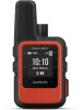 |
View all Garmin inReach Mini 2 manuals
Add to My Manuals
Save this manual to your list of manuals |
Page 23 highlights
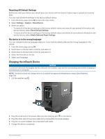
System Settings From the home page, press OK to open the main menu. Select Settings > System. Display: Sets the backlight brightness and the length of time before the backlight turns off. Compass Cal.: Allows you to calibrate the compass (Calibrating the Compass, page 13). Time: Sets the time format and time zone (Time Settings, page 19). Units: Sets the position format and units of measure for the device (Units Settings, page 19). GPS: Allows you to change the GPS setting. The GPS Only option enables the GPS satellite system. The Multi-GNSS option enables multiple Global Navigation Satellite Systems (GNSS). NOTE: Using multiple GNSS systems offers increased performance in challenging environments and faster position acquisition than using GPS only. However, using multiple GNSS systems can reduce battery life more quickly than using GPS only. Language: Sets the text language on the device. NOTE: Changing the text language does not change the language of user-entered data or map data. Keyboard Language: Sets the keyboard language on the device. Owner Info: Allows you to add owner information, such as your name. The information appears on the home page. USB Mode: Sets the device to use mass storage mode or Garmin mode when connected to a computer. Screenshots: Allows you to take a picture of the device screen. Export to GPX: Allows you to export saved waypoints, activities, and courses as GPX files. Reset Device: Allows you to reset user data and settings (Resetting All Default Settings, page 23) Software Update: Allows you to install software updates downloaded to your device. About: Displays the IMEI number, authorization code, software, license, and regulatory information. Time Settings From the home page, press OK to open the main menu. Select Settings > System > Time. Time Format: Sets the device to show time in a 12-hour or 24-hour format. Time Zone: Sets the time zone for the device. Daylight Saving: Sets the device to use daylight saving time. This option is not available when Time Zone is set to Automatic. Units Settings From the home page, press OK to open the main menu. Select Settings > System > Units. Position Format: Sets the format used for geographical position coordinates and the coordinate system used by the map (Position Format Settings, page 19). Speed/Distance: Sets the unit of measure for distance. Wind Speed: Sets the unit of measure for wind speed. Temperature: Sets the temperature unit of measure to Fahrenheit (°F) or Celsius (°C). Pressure: Sets the unit of measure for pressure. Bearing: Sets the north reference used on the compass to true or magnetic north. Position Format Settings NOTE: You should not change the position format or the map datum coordinate system unless you are using a map or chart that specifies a different position format. From the home page, press OK to open the main menu. Select Settings > System > Units > Position Format. Format: Sets the position format in which a location reading appears. Datum: Sets the coordinate system on which the map is structured. Spheroid: Shows the coordinate system the device is using. The default coordinate system is WGS 84. Customizing the Device 19
-
 1
1 -
2
-
3
-
4
-
5
-
6
-
7
-
8
-
9
-
10
-
11
-
12
-
13
-
14
-
15
-
16
-
17
-
 18
18 -
 19
19 -
 20
20 -
 21
21 -
 22
22 -
 23
23 -
 24
24 -
 25
25 -
 26
26 -
 27
27 -
 28
28 -
29
-
30
 |
 |