Magellan SporTrak User Manual - Page 38
Mark]
 |
UPC - 763357103717
View all Magellan SporTrak manuals
Add to My Manuals
Save this manual to your list of manuals |
Page 38 highlights
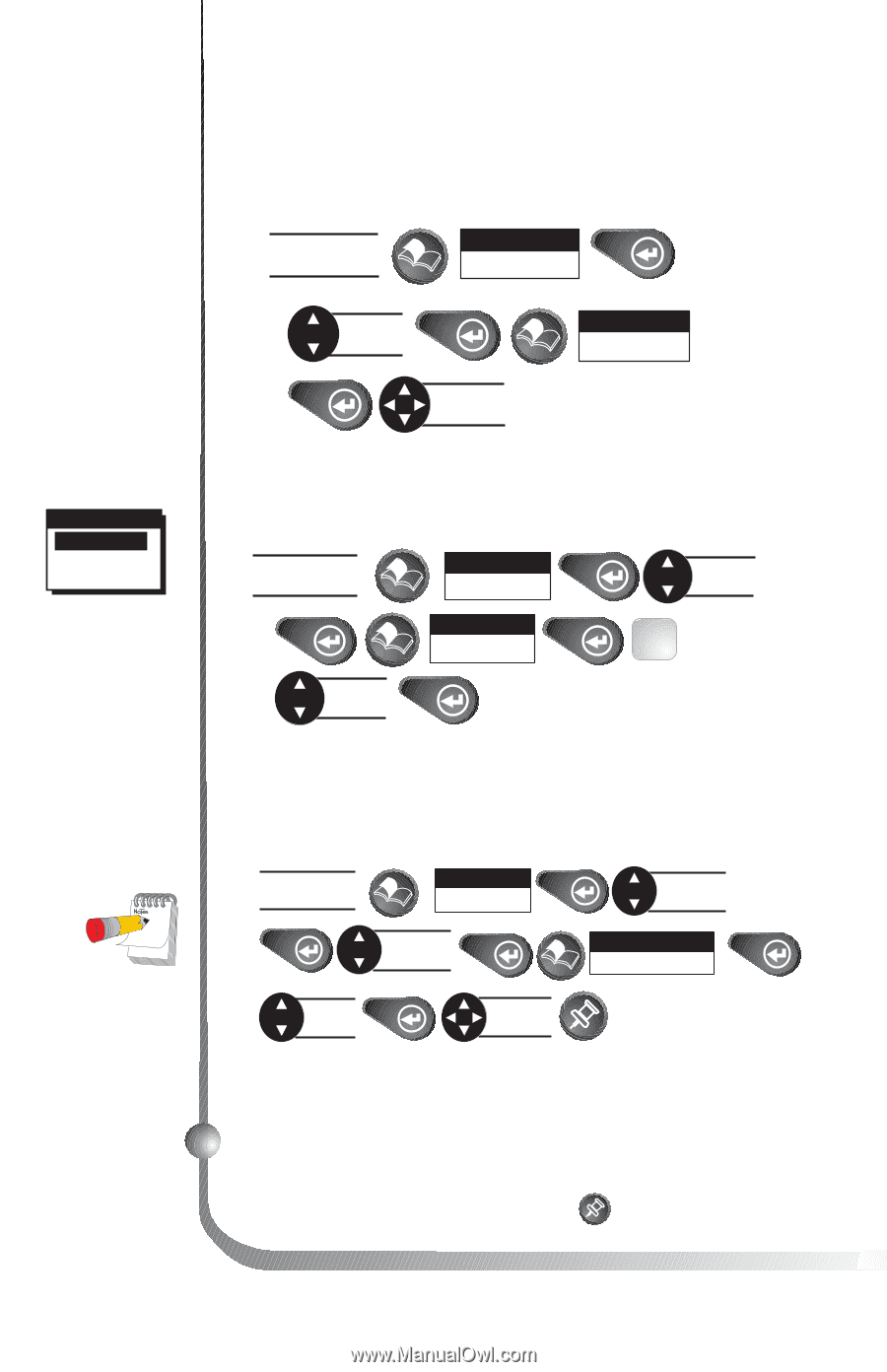
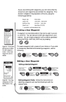
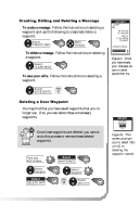
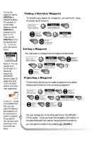
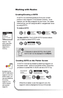
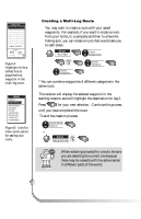
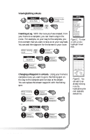
To find the waypoint use the ARROWs to change the letters. For example, to find Dodger Stadium, use the ARROWs to change the first letter to "D". Then use the ARROWs to find the second letter, "O". Continue until the name is found. WPT SORT ALPHABETIC NEAREST ICON/NAME Figure A. You can choose from ALPHABETIC (shows all waypoints), NEAREST (shows closest 20 waypoints) and ICON/NAME (cannot sort NonUser waypoints). In the G.C. (Great Circle) BRG/DST field, you can input the bearing and distance into the data fields in order to compute the projection. You can also input information into the coordinate fields. 30 Finding a Non-User Waypoint To simplify your search for a waypoint, you can find it using the smart scroll function. From any NAV screen Select WAYPOINTS Select category Find waypoint Select FIND Sorting a Waypoint You may want to change how the waypoints are sorted. From any NAV screen Select WAYPOINTS Select category Select FIG. SORT WPT A Select Projecting a Waypoint This function allows you to create a waypoint at a certain distance and direction from an existing waypoint. From any NAV screen Select WAYPOINTS Select waypoint Select category Select PROJECTION Select field Make changes You can change any of the three sections in the PROJECTION screen. Once you have the necessary information in the data fields and the receiver has projected the position, you can save the position by pressing [MARK]. Magellan SporTrak
-
 1
1 -
2
-
3
-
4
-
5
-
6
-
7
-
8
-
9
-
10
-
11
-
12
-
13
-
14
-
15
-
16
-
17
-
18
-
19
-
20
-
21
-
22
-
23
-
24
-
25
-
26
-
27
-
28
-
29
-
30
-
31
-
32
-
 33
33 -
 34
34 -
 35
35 -
 36
36 -
 37
37 -
 38
38 -
 39
39 -
 40
40 -
 41
41 -
 42
42 -
 43
43 -
44
-
45
-
46
-
47
-
48
-
49
-
50
-
51
-
52
-
53
-
54
-
55
-
56
-
57
-
58
-
59
-
60
-
61
-
62
-
63
-
64
-
65
-
66
-
67
-
68
-
69
-
70
-
71
-
72
-
73
-
74
 |
 |