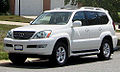
2003 Lexus GX 470 Navigation Manual - Page 1
2003 Lexus GX 470 Manual
Page 1 highlights
Introduction Thank you for your purchase of the Navigation System. Please read this manual carefully to ensure proper use. Keep this manual stored in your vehicle at all times. The Lexus Navigation System is one of the most technologically advanced vehicle accessories ever developed. The system receives satellite signals from the Global Positioning System (GPS) operated by the U. S. Department of Defense. Using these signals and other vehicle sensors, the system can show you where you are and assist you in locating a desired destination. The navigation system is designed to select efficient routes from your present starting location to your destination. The system is designed to direct you to a destination that is unfamiliar to you in an efficient manner. The system uses the maps of DENSO based on NAVTECH maps, GDT maps and infoUSA POIs. The calculated routes are neither the shortest routes nor routes without traffic congestion. Your own personal local knowledge or "short cut" may at times be faster than the calculated routes. The navigation system's database includes about 50 point of interest categories to allow you to easily select destinations such as restaurants and banks. If a destination is not in the database, you can enter the street address or a major intersection close to it and i the system will route you there. The system will provide both a visual map and audio instructions. The audio instructions will announce the distance and direction to go when you are approaching a fork or intersection. These voice instructions will help you keep your eyes on the road and are timed to provide enough time to allow you to maneuver, change lanes or slow down. Please be aware that all current vehicle navigation systems have certain limitations that may affect their ability to perform properly. The accuracy of the vehicle's position depends on the satellite condition, road configuration, vehicle condition or other circumstances. For more information on the limitations of the system, refer to page 53 through 55.
-
 1
1 -
 2
2 -
 3
3 -
 4
4 -
 5
5 -
 6
6 -
 7
7 -
8
-
9
-
10
-
11
-
12
-
13
-
14
-
15
-
16
-
17
-
18
-
19
-
20
-
21
-
22
-
23
-
24
-
25
-
26
-
27
-
28
-
29
-
30
-
31
-
32
-
33
-
34
-
35
-
36
-
37
-
38
-
39
-
40
-
41
-
42
-
43
-
44
-
45
-
46
-
47
-
48
-
49
-
50
-
51
-
52
-
53
-
54
-
55
-
56
-
57
-
58
-
59
-
60
-
61
-
62
-
63
-
64
-
65
-
66
-
67
-
68
-
69
-
70
-
71
-
72
-
73
-
74
-
75
-
76
-
77
-
78
-
79
-
80
-
81
-
82
-
83
-
84
-
85
-
86
-
87
-
88
-
89
-
90
-
91
-
92
-
93
-
94
-
95
-
96
-
97
-
98
-
99
-
100
-
101
-
102
-
103
-
104
-
105
-
106
-
107
-
108
-
109
-
110
-
111
-
112
-
113
-
114
-
115
-
116
-
117
-
118
-
119
-
120
-
121
-
122
-
123
-
124
-
125
-
126
-
127
-
128
-
129
-
130
-
131
-
132
-
133
-
134
-
135
-
136
-
137
-
138
-
139
-
140
-
141
-
142
-
143
-
144
-
145
-
146
-
147
-
148
-
149
-
150
-
151
-
152
-
153
-
154
-
155
-
156
-
157
-
158
-
159
-
160
-
161
-
162
-
163
-
164
-
165
-
166
-
167
-
168
-
169
-
170
-
171
-
172
-
173
-
174
-
175
-
176
-
177
-
178
-
179
-
180
-
181
-
182
-
183
-
184
-
185
 |
 |