Campbell Scientific CSAT3 CSAT3 3-D Sonic Anemometer - Page 53
Appendix A. CSAT3 Orientation
 |
View all Campbell Scientific CSAT3 manuals
Add to My Manuals
Save this manual to your list of manuals |
Page 53 highlights
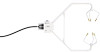
Appendix A. CSAT3 Orientation A.1 Determining True North and Sensor Orientation The orientation of the CSAT3 negative x-axis is found by reading a magnetic compass and applying the site-specific correction for magnetic declination; where the magnetic declination is the number of degrees between True North and Magnetic North. Magnetic declination for a specific site can be obtained from a USGS map, local airport, or through a NOAA web calculator (Section A.2). A general map showing magnetic declination for the Conterminous United States in 2004 is shown in FIGURE A-1. FIGURE A-1. Magnetic declination for the conterminous United States (2004) A-1
-
 1
1 -
2
-
3
-
4
-
5
-
6
-
7
-
8
-
9
-
10
-
11
-
12
-
13
-
14
-
15
-
16
-
17
-
18
-
19
-
20
-
21
-
22
-
23
-
24
-
25
-
26
-
27
-
28
-
29
-
30
-
31
-
32
-
33
-
34
-
35
-
36
-
37
-
38
-
39
-
40
-
41
-
42
-
43
-
44
-
45
-
46
-
47
-
 48
48 -
 49
49 -
 50
50 -
 51
51 -
 52
52 -
 53
53 -
 54
54 -
 55
55 -
 56
56 -
 57
57 -
 58
58 -
59
-
60
-
61
-
62
-
63
-
64
-
65
-
66
-
67
-
68
-
69
-
70
-
71
-
72
 |
 |

Appendix A. CSAT3 Orientation
A.1 Determining True North and Sensor Orientation
The orientation of the CSAT3 negative x-axis is found by reading a magnetic
compass and applying the site-specific correction for magnetic declination;
where the magnetic declination is the number of degrees between True North
and Magnetic North. Magnetic declination for a specific site can be obtained
from a USGS map, local airport, or through a NOAA web calculator (Section
A.2). A general map showing magnetic declination for the Conterminous
United States in 2004 is shown in FIGURE A-1.
FIGURE A-1.
Magnetic declination for the conterminous United States
(2004)
A-1